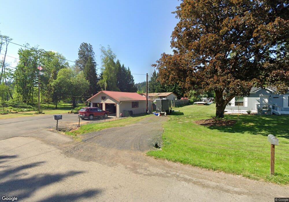
32149 Branch Rd Scappoose, OR 97056
Estimated Value: $354,000 - $686,000
3
Beds
2
Baths
1,782
Sq Ft
$288/Sq Ft
Est. Value
About This Home
This home is located at 32149 Branch Rd, Scappoose, OR 97056 and is currently estimated at $513,572, approximately $288 per square foot. 32149 Branch Rd is a home located in Columbia County with nearby schools including Scappoose High School.
Ownership History
Date
Name
Owned For
Owner Type
Purchase Details
Closed on
Nov 1, 2023
Sold by
Durie Jan Marie and Durk Bret John
Bought by
Dune Bret John
Current Estimated Value
Purchase Details
Closed on
Jun 24, 2013
Sold by
Miners Kathy L and Miners David Lee
Bought by
Durie Bret J and Durie Jan M
Home Financials for this Owner
Home Financials are based on the most recent Mortgage that was taken out on this home.
Original Mortgage
$206,000
Interest Rate
3.38%
Mortgage Type
New Conventional
Create a Home Valuation Report for This Property
The Home Valuation Report is an in-depth analysis detailing your home's value as well as a comparison with similar homes in the area
Home Values in the Area
Average Home Value in this Area
Purchase History
| Date | Buyer | Sale Price | Title Company |
|---|---|---|---|
| Dune Bret John | -- | None Listed On Document | |
| Durie Bret J | $250,000 | Ticor Title |
Source: Public Records
Mortgage History
| Date | Status | Borrower | Loan Amount |
|---|---|---|---|
| Previous Owner | Durie Bret J | $206,000 |
Source: Public Records
Tax History Compared to Growth
Tax History
| Year | Tax Paid | Tax Assessment Tax Assessment Total Assessment is a certain percentage of the fair market value that is determined by local assessors to be the total taxable value of land and additions on the property. | Land | Improvement |
|---|---|---|---|---|
| 2025 | $4,138 | $312,540 | $148,560 | $163,980 |
| 2024 | $4,024 | $303,440 | $144,240 | $159,200 |
| 2023 | $4,006 | $294,610 | $150,930 | $143,680 |
| 2022 | $3,825 | $286,030 | $146,380 | $139,650 |
| 2021 | $3,716 | $277,700 | $138,650 | $139,050 |
| 2020 | $3,408 | $269,620 | $134,440 | $135,180 |
| 2019 | $3,321 | $261,770 | $123,928 | $137,842 |
| 2018 | $3,231 | $254,150 | $119,560 | $134,590 |
| 2017 | $3,183 | $246,750 | $116,080 | $130,670 |
| 2016 | $3,155 | $239,570 | $112,700 | $126,870 |
| 2015 | $2,978 | $232,600 | $100,760 | $131,840 |
| 2014 | $2,092 | $167,670 | $115,110 | $52,560 |
Source: Public Records
Map
Nearby Homes
- 0 Hemlock Ave Unit 120247766
- 51557 SW Em Watts Rd
- Hillsdale Plan at Dutch Canyon
- Aubrey Plan at Dutch Canyon
- Carmichael Plan at Dutch Canyon
- Carlton Plan at Dutch Canyon
- 32922 Coal Creek Rd
- 0 Hawthorne Unit 8 23537227
- 0 Hawthorne Unit 10 23372609
- 0 Hawthorne Unit 9 23026376
- 0 Callahan Unit 28 23508167
- 0 Callahan Unit 26 23220367
- 0 Callahan Unit 27
- 32839 SW Crystal Springs Ct
- 51350 SW Randstad St
- 33279 SW Havlik Dr
- 24 Callahan
- 33298 SW Meadowbrook Dr
- 33362 SW Rokin Way
- 32373 Jp West Rd
- 32185 Branch Rd
- 32122 Meadow Ln
- 0 Branch Rd
- 32106 Meadow Ln
- 32213 Branch Rd
- 32088 Meadow Ln
- 32071 Branch Rd
- 32121 Meadow Ln
- 32153 Meadow Ln
- 51361 Branch Rd
- 51387 Branch Rd
- 32197 Meadow Ln
- 32232 Branch Rd
- 32095 Meadow Ln
- 32140 Raymond Creek Rd
- 32110 Raymond Creek Rd
- 32158 Raymond Creek Rd
- 32045 Meadow Ln
- 32084 Raymond Creek Rd
- 32062 Raymond Creek Rd