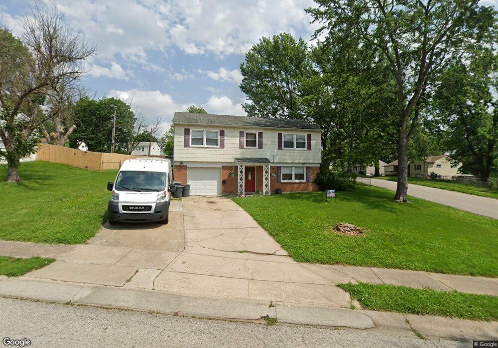
3215 Reynolds Rd Independence, MO 64055
Glendale NeighborhoodEstimated Value: $183,000 - $228,000
3
Beds
2
Baths
1,299
Sq Ft
$158/Sq Ft
Est. Value
About This Home
This home is located at 3215 Reynolds Rd, Independence, MO 64055 and is currently estimated at $205,209, approximately $157 per square foot. 3215 Reynolds Rd is a home located in Jackson County with nearby schools including Glendale Elementary School, Bridger Middle School, and Pioneer Ridge Middle School.
Ownership History
Date
Name
Owned For
Owner Type
Purchase Details
Closed on
Sep 22, 2000
Sold by
Winship Myron W and Winship Sharon F
Bought by
Argo Kerry and Argo Freda
Current Estimated Value
Home Financials for this Owner
Home Financials are based on the most recent Mortgage that was taken out on this home.
Original Mortgage
$68,250
Interest Rate
7.97%
Mortgage Type
Balloon
Create a Home Valuation Report for This Property
The Home Valuation Report is an in-depth analysis detailing your home's value as well as a comparison with similar homes in the area
Home Values in the Area
Average Home Value in this Area
Purchase History
| Date | Buyer | Sale Price | Title Company |
|---|---|---|---|
| Argo Kerry | -- | First American Title Ins |
Source: Public Records
Mortgage History
| Date | Status | Borrower | Loan Amount |
|---|---|---|---|
| Closed | Argo Kerry | $68,250 |
Source: Public Records
Tax History
| Year | Tax Paid | Tax Assessment Tax Assessment Total Assessment is a certain percentage of the fair market value that is determined by local assessors to be the total taxable value of land and additions on the property. | Land | Improvement |
|---|---|---|---|---|
| 2025 | $2,188 | $25,880 | $5,634 | $20,246 |
| 2024 | $2,138 | $31,578 | $6,150 | $25,428 |
| 2023 | $2,138 | $31,578 | $6,150 | $25,428 |
| 2022 | $1,446 | $19,570 | $5,292 | $14,278 |
| 2021 | $1,445 | $19,570 | $5,292 | $14,278 |
| 2020 | $1,484 | $19,528 | $5,292 | $14,236 |
| 2019 | $1,460 | $19,528 | $5,292 | $14,236 |
| 2018 | $1,415 | $18,066 | $3,523 | $14,543 |
| 2017 | $1,415 | $18,066 | $3,523 | $14,543 |
| 2016 | $1,393 | $17,613 | $3,327 | $14,286 |
Source: Public Records
Map
Nearby Homes
- 16400 E Crackerneck Rd
- 3219 Vest St
- 16409 E 31st St S
- 3416 S Marshall Ct
- 16424 E George Franklyn Dr
- 16501 E 28th Place
- 0 Multi Address N A Unit HMS2588688
- 17201 E 32nd St S Unit 3
- 17201 E 32nd St S Unit 6
- 3415 S Davidson Ct
- 3507 S Haden Dr
- 3506 S Haden Dr
- 2724 Queen Ridge Dr
- 2900 S M 291 Hwy
- 3824 S Milton Dr
- 3813 Queen Ridge Dr
- 2800 S Woodbury Dr
- 2705 S Breckenridge Dr
- 3700 S Bolger Ct
- 3609 S Bolger Ct
- 3211 Reynolds Rd
- 16312 E 33rd St S
- 3212 Reynolds Rd
- 3223 Reynolds Rd
- 3216 Reynolds Rd
- 3209 Reynolds Rd
- 3208 Reynolds Rd
- 3220 Reynolds Rd
- 16313 E 33rd St S
- 3204 Reynolds Rd
- 16318 E 33rd St S
- 3227 Reynolds Rd
- 3212 S Mark Cir
- 3224 Reynolds Rd
- 3208 S Mark Cir
- 3205 Reynolds Rd
- 16317 E 33rd St S
- 3209 Queen Ridge Dr
- 3213 Queen Ridge Dr
- 3217 Queen Ridge Dr
Your Personal Tour Guide
Ask me questions while you tour the home.