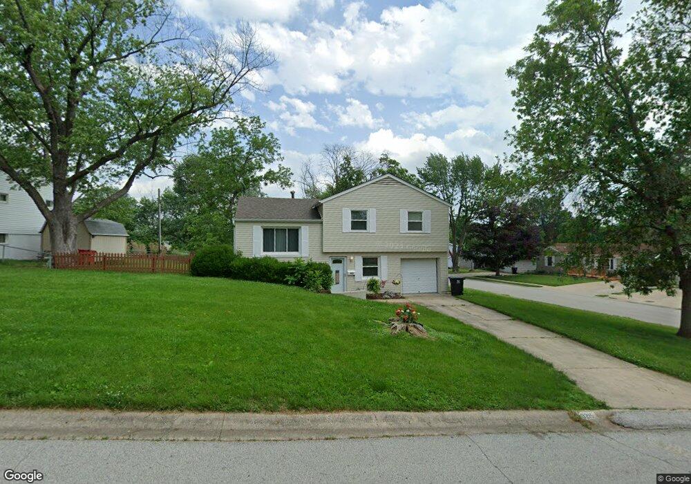
3215 S Mark Cir Independence, MO 64055
Glendale NeighborhoodEstimated Value: $205,000 - $229,000
3
Beds
2
Baths
958
Sq Ft
$227/Sq Ft
Est. Value
About This Home
This home is located at 3215 S Mark Cir, Independence, MO 64055 and is currently estimated at $217,247, approximately $226 per square foot. 3215 S Mark Cir is a home located in Jackson County with nearby schools including Glendale Elementary School, Bridger Middle School, and Pioneer Ridge Middle School.
Ownership History
Date
Name
Owned For
Owner Type
Purchase Details
Closed on
Sep 11, 2009
Sold by
James Dennis P and James Donna L
Bought by
Snow Heather
Current Estimated Value
Create a Home Valuation Report for This Property
The Home Valuation Report is an in-depth analysis detailing your home's value as well as a comparison with similar homes in the area
Home Values in the Area
Average Home Value in this Area
Purchase History
| Date | Buyer | Sale Price | Title Company |
|---|---|---|---|
| Snow Heather | -- | Chicago |
Source: Public Records
Tax History
| Year | Tax Paid | Tax Assessment Tax Assessment Total Assessment is a certain percentage of the fair market value that is determined by local assessors to be the total taxable value of land and additions on the property. | Land | Improvement |
|---|---|---|---|---|
| 2025 | $2,439 | $32,915 | $5,658 | $27,257 |
| 2024 | $2,383 | $35,198 | $6,128 | $29,070 |
| 2023 | $2,383 | $35,198 | $5,858 | $29,340 |
| 2022 | $1,839 | $24,890 | $4,542 | $20,348 |
| 2021 | $1,838 | $24,890 | $4,542 | $20,348 |
| 2020 | $1,770 | $23,294 | $4,542 | $18,752 |
| 2019 | $1,742 | $23,294 | $4,542 | $18,752 |
| 2018 | $774,024 | $20,274 | $3,953 | $16,321 |
| 2017 | $1,588 | $20,274 | $3,953 | $16,321 |
| 2016 | $1,564 | $19,766 | $3,327 | $16,439 |
Source: Public Records
Map
Nearby Homes
- 16400 E Crackerneck Rd
- 3219 Vest St
- 16409 E 31st St S
- 16403 E Ellison Way
- 3416 S Marshall Ct
- 16424 E George Franklyn Dr
- 0 Multi Address N A Unit HMS2588688
- 17201 E 32nd St S Unit 3
- 17201 E 32nd St S Unit 6
- 3415 S Davidson Ct
- 16017 E 37th St S
- 3507 S Haden Dr
- 2900 S M 291 Hwy
- 2724 Queen Ridge Dr
- 3506 S Haden Dr
- 3524 S Maybrook Ave
- 3824 S Milton Dr
- 3813 Queen Ridge Dr
- 2705 S Breckenridge Dr
- 2800 S Woodbury Dr
- 3213 S Mark Cir
- 16408 E 33rd St S
- 16318 E 33rd St S
- 3212 S Mark Cir
- 16412 E 33rd St S
- 16401 E 33rd St S
- 16412 E 33 St S
- 3208 S Mark Cir
- 16405 E 33rd St S
- 16312 E 33rd St S
- 16321 E 33rd St S
- 16409 E 33rd St S
- 3205 S Mark Cir
- 16317 E 33rd St S
- 16500 E 33rd St S
- 16413 E 33rd St S
- 3204 S Mark Cir
- 16501 E 33rd St S
- 3212 S Jeffrey Cir
- 3201 S Mark Cir
Your Personal Tour Guide
Ask me questions while you tour the home.