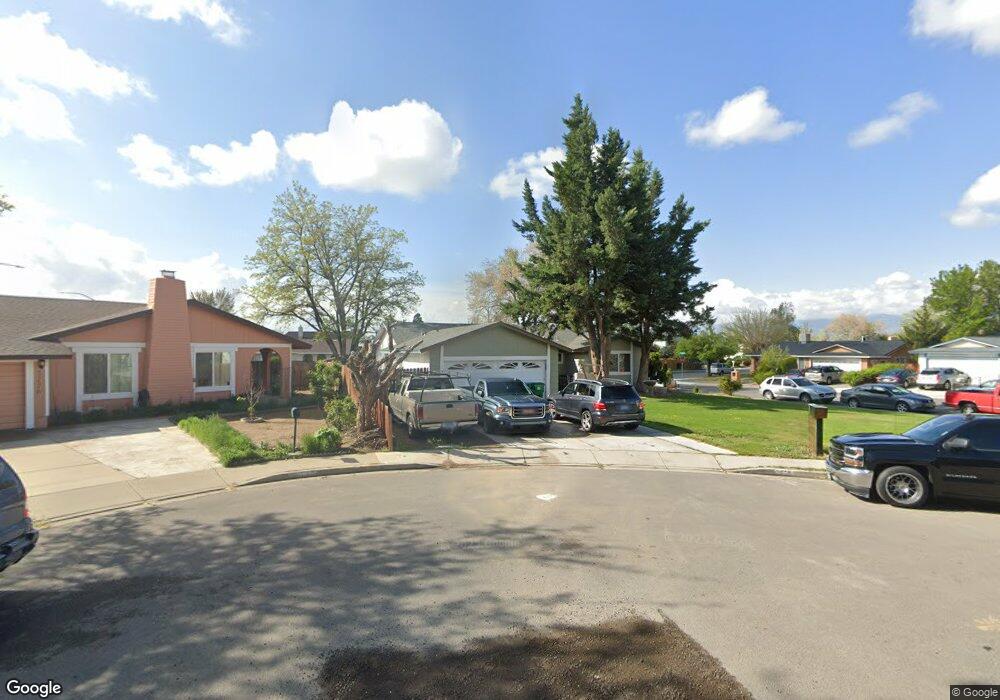
3218 Jamestown Ct Sparks, NV 89431
North Rock NeighborhoodEstimated Value: $469,641 - $480,000
3
Beds
2
Baths
1,635
Sq Ft
$289/Sq Ft
Est. Value
About This Home
This home is located at 3218 Jamestown Ct, Sparks, NV 89431 and is currently estimated at $473,160, approximately $289 per square foot. 3218 Jamestown Ct is a home located in Washoe County with nearby schools including Alice Maxwell Elementary School, Sparks Middle School, and Sparks High School.
Ownership History
Date
Name
Owned For
Owner Type
Purchase Details
Closed on
Aug 22, 2005
Sold by
Barry Geraldine M
Bought by
Bravo Ricardo J and Lagunas Elisa Ruiz
Current Estimated Value
Home Financials for this Owner
Home Financials are based on the most recent Mortgage that was taken out on this home.
Original Mortgage
$228,000
Outstanding Balance
$170,774
Interest Rate
5.56%
Mortgage Type
Credit Line Revolving
Estimated Equity
$302,386
Purchase Details
Closed on
Feb 6, 2001
Sold by
Barry Catherine M and Barry Geraldine M
Bought by
Barry Geraldine M
Create a Home Valuation Report for This Property
The Home Valuation Report is an in-depth analysis detailing your home's value as well as a comparison with similar homes in the area
Home Values in the Area
Average Home Value in this Area
Purchase History
| Date | Buyer | Sale Price | Title Company |
|---|---|---|---|
| Bravo Ricardo J | $285,000 | Ticor Title Of Nevada Inc | |
| Barry Geraldine M | -- | -- |
Source: Public Records
Mortgage History
| Date | Status | Borrower | Loan Amount |
|---|---|---|---|
| Open | Bravo Ricardo J | $228,000 |
Source: Public Records
Tax History Compared to Growth
Tax History
| Year | Tax Paid | Tax Assessment Tax Assessment Total Assessment is a certain percentage of the fair market value that is determined by local assessors to be the total taxable value of land and additions on the property. | Land | Improvement |
|---|---|---|---|---|
| 2025 | $1,707 | $66,494 | $35,875 | $30,619 |
| 2024 | $1,707 | $67,576 | $35,875 | $31,701 |
| 2023 | $1,702 | $67,315 | $36,540 | $30,775 |
| 2022 | $1,661 | $55,114 | $28,980 | $26,135 |
| 2021 | $1,649 | $48,770 | $22,225 | $26,545 |
| 2020 | $1,516 | $49,390 | $22,225 | $27,165 |
| 2019 | $1,471 | $47,979 | $21,280 | $26,699 |
| 2018 | $1,429 | $42,222 | $15,610 | $26,612 |
| 2017 | $1,388 | $40,539 | $13,440 | $27,099 |
| 2016 | $1,354 | $40,717 | $12,600 | $28,117 |
| 2015 | $1,352 | $40,331 | $11,725 | $28,606 |
| 2014 | $1,272 | $34,655 | $7,770 | $26,885 |
| 2013 | -- | $33,977 | $7,140 | $26,837 |
Source: Public Records
Map
Nearby Homes
- 780 Emerson Way
- 3252 Holman Way
- 465 Lenwood Dr
- 3269 Valley Forge Way
- 1125 Dodson Way
- 5530 High Rock Way
- 3465 Dawn Cir
- 1160 York Way
- 0 N Mccarran Blvd Unit 250052909
- 119 Devere Way
- 1110 Xman Way
- 1345 Plymouth Way
- 3245 Elaine Way
- 1023 Tyler Way
- 3607 Keogh Dr
- 3545 4th St
- 1945 4th St Unit 32
- 1945 4th St Unit 33
- 1945 4th St Unit 10
- 1940 4th St Unit 20
- 3226 Jamestown Ct
- 3211 Lagomarsino Dr
- 3232 Jamestown Ct
- 3221 Lagomarsino Dr
- 3190 Lagomarsino Dr
- 3248 Jamestown Ct
- 3231 Lagomarsino Dr
- 3238 Jamestown Ct
- 3185 Lagomarsino Dr
- 3241 Lagomarsino Dr
- 3180 Lagomarsino Dr
- 3220 Wilma Dr
- 3210 Wilma Dr
- 3230 Wilma Dr
- 3200 Wilma Dr
- 3175 Lagomarsino Dr
- 3240 Wilma Dr
- 3215 Sprout Way
- 3251 Lagomarsino Dr
- 3170 Lagomarsino Dr