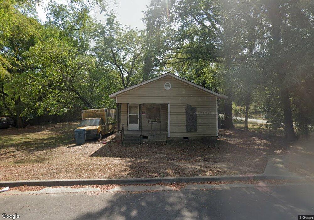
3219 W 17th St Little Rock, AR 72204
Capitol View NeighborhoodEstimated Value: $70,447 - $124,000
--
Bed
1
Bath
1,275
Sq Ft
$75/Sq Ft
Est. Value
About This Home
This home is located at 3219 W 17th St, Little Rock, AR 72204 and is currently estimated at $96,112, approximately $75 per square foot. 3219 W 17th St is a home located in Pulaski County with nearby schools including Stephens Elementary School, Dunbar Magnet Middle School, and Central High School.
Ownership History
Date
Name
Owned For
Owner Type
Purchase Details
Closed on
Mar 11, 2022
Sold by
Commissioner Of State Lands
Bought by
Brown Bennie and Brown Chalanda Lafay
Current Estimated Value
Purchase Details
Closed on
Dec 10, 2021
Sold by
Chung Anna
Bought by
Brown Bennie and Brown Chalanda Lafay
Purchase Details
Closed on
Jun 21, 2018
Sold by
Commissioner Of State Lands
Bought by
Chung Anna
Purchase Details
Closed on
Mar 30, 2012
Sold by
Hampton John A
Bought by
Brown Bennie Chaland
Purchase Details
Closed on
Mar 16, 2004
Sold by
Hampton Willie E
Bought by
Hampton John
Purchase Details
Closed on
Sep 29, 1997
Sold by
Hampton Judy Mae
Bought by
Hampton Samuel and Mckee Lee Ethel
Create a Home Valuation Report for This Property
The Home Valuation Report is an in-depth analysis detailing your home's value as well as a comparison with similar homes in the area
Home Values in the Area
Average Home Value in this Area
Purchase History
| Date | Buyer | Sale Price | Title Company |
|---|---|---|---|
| Brown Bennie | $698 | None Listed On Document | |
| Brown Bennie | -- | None Available | |
| Chung Anna | $2,944 | None Available | |
| Brown Bennie Chaland | -- | None Available | |
| Hampton John | -- | -- | |
| Hampton Samuel | -- | -- |
Source: Public Records
Tax History Compared to Growth
Tax History
| Year | Tax Paid | Tax Assessment Tax Assessment Total Assessment is a certain percentage of the fair market value that is determined by local assessors to be the total taxable value of land and additions on the property. | Land | Improvement |
|---|---|---|---|---|
| 2024 | $518 | $7,396 | $800 | $6,596 |
| 2023 | $518 | $7,396 | $800 | $6,596 |
| 2022 | $300 | $7,396 | $800 | $6,596 |
| 2021 | $275 | $3,900 | $400 | $3,500 |
| 2020 | $273 | $3,900 | $400 | $3,500 |
| 2019 | $273 | $3,900 | $400 | $3,500 |
| 2018 | $273 | $3,900 | $400 | $3,500 |
| 2017 | $273 | $3,900 | $400 | $3,500 |
| 2016 | $514 | $7,340 | $700 | $6,640 |
| 2015 | $515 | $7,340 | $700 | $6,640 |
| 2014 | $515 | $7,340 | $700 | $6,640 |
Source: Public Records
Map
Nearby Homes
- 3401 W 17th St
- 3403 W 17th St
- 3112 W 16th St
- 3123 W 15th St
- 1823 Johnson St
- 1418 S Martin St
- 1900 & 1904 Valmar St
- 1617 S Valentine St
- 1609 S Woodrow St
- 3105 W 13th St
- 2109 Brown St
- 520 S Martin St Unit S. Martin St. north
- 2205 S Martin St
- 3700 W Charles Bussey Ave
- 1519 S Oak St
- 3401 W 12th St
- 2200 Valmar St
- 1520 S Oak St
- 2600 S Pine St
- 3224 W 11th St
- 3215 W 17th St
- 3209 W 17th St
- 1712 Brown St
- 3222 W 18th St
- 3210 W 18th St
- 1624 and 1626 Brown
- 1624 Brown St Unit A
- 3220 W 17th St
- 3208 W 18th St
- 3222 W 17th St
- 3201 W 17th St
- 3212 W 17th St
- 1718 Brown St
- 3210 W 17th St
- 3210 W 17th St Unit 3210 W 17TH ST LITTL
- 3200 W 17th St
- 1801 Brown St
- 3302 W 18th St
- 1610 Brown St
- 3123 W 17th St