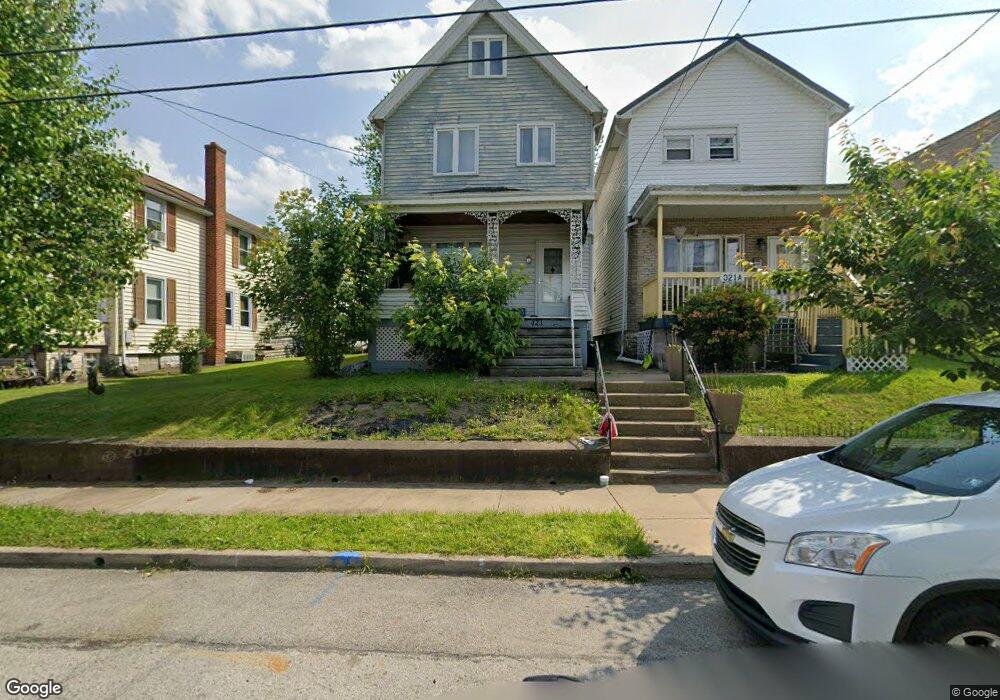
321A Emerson St Vandergrift, PA 15690
Estimated Value: $73,000 - $130,311
3
Beds
2
Baths
1,100
Sq Ft
$86/Sq Ft
Est. Value
About This Home
This home is located at 321A Emerson St, Vandergrift, PA 15690 and is currently estimated at $95,078, approximately $86 per square foot. 321A Emerson St is a home located in Westmoreland County with nearby schools including Kiski Area High School.
Ownership History
Date
Name
Owned For
Owner Type
Purchase Details
Closed on
Jan 28, 2020
Sold by
Cornman Ryan M and Cornman Megan A
Bought by
Snt Homes Llc
Current Estimated Value
Purchase Details
Closed on
Mar 26, 2010
Sold by
Beck Gina Lynn and Beck Gary L
Bought by
Cornman Ryan M and Shotts Megan A
Home Financials for this Owner
Home Financials are based on the most recent Mortgage that was taken out on this home.
Original Mortgage
$34,267
Interest Rate
5.5%
Mortgage Type
FHA
Purchase Details
Closed on
Oct 6, 2008
Sold by
Jaskiewicz Carol J and Jaskiewicz Gina Lynn
Bought by
Jaskiewicz Gina Lynn
Create a Home Valuation Report for This Property
The Home Valuation Report is an in-depth analysis detailing your home's value as well as a comparison with similar homes in the area
Home Values in the Area
Average Home Value in this Area
Purchase History
| Date | Buyer | Sale Price | Title Company |
|---|---|---|---|
| Snt Homes Llc | $50,000 | Penn Bridge Land Abstract Co | |
| Cornman Ryan M | $34,900 | None Available | |
| Jaskiewicz Gina Lynn | -- | None Available |
Source: Public Records
Mortgage History
| Date | Status | Borrower | Loan Amount |
|---|---|---|---|
| Previous Owner | Cornman Ryan M | $34,267 |
Source: Public Records
Tax History
| Year | Tax Paid | Tax Assessment Tax Assessment Total Assessment is a certain percentage of the fair market value that is determined by local assessors to be the total taxable value of land and additions on the property. | Land | Improvement |
|---|---|---|---|---|
| 2026 | $890 | $5,320 | $790 | $4,530 |
| 2025 | $868 | $5,320 | $790 | $4,530 |
| 2024 | $827 | $5,320 | $790 | $4,530 |
| 2023 | $761 | $5,320 | $790 | $4,530 |
| 2022 | $745 | $5,320 | $790 | $4,530 |
| 2021 | $745 | $5,320 | $790 | $4,530 |
| 2020 | $744 | $5,320 | $790 | $4,530 |
| 2019 | $741 | $5,320 | $790 | $4,530 |
| 2018 | $730 | $5,320 | $790 | $4,530 |
| 2017 | $714 | $5,320 | $790 | $4,530 |
| 2016 | $705 | $5,320 | $790 | $4,530 |
| 2015 | $705 | $5,320 | $790 | $4,530 |
| 2014 | $701 | $5,320 | $790 | $4,530 |
Source: Public Records
Map
Nearby Homes
- 314 Lowell St Unit 1/2
- 303 Lowell St
- 327 Lowell St
- 924 Wallace St
- 221 Holmes St
- 300 Longfellow St
- 410 Longfellow St
- 231 Whittier St
- 325 Walnut St
- 208 Whittier St
- 439 Longfellow St
- 512 Watson St
- 512 Longfellow St
- 528 Longfellow St
- 1020 Poe St
- 517 Sycamore St
- 802 Mckinley Ave
- 539 Walnut St
- 324 Beech St
- 510 Franklin Ave
- 321 Emerson St
- 321 Emerson St Unit A
- 323 Emerson St
- 319 Emerson St
- 325 Emerson St
- 317 Emerson St
- 327 Emerson St
- 329 Emerson St
- 315 Emerson St
- 313 Emerson St
- 320 1/2 Emerson St
- 811 Hawthorne St
- 333 Emerson St
- 314 Lowell St
- 320 Lowell St
- 318 Lowell St
- 311 Emerson St
- 316 Lowell St
- 312 1/2 Lowell St
- 320 Emerson St Unit A
Your Personal Tour Guide
Ask me questions while you tour the home.