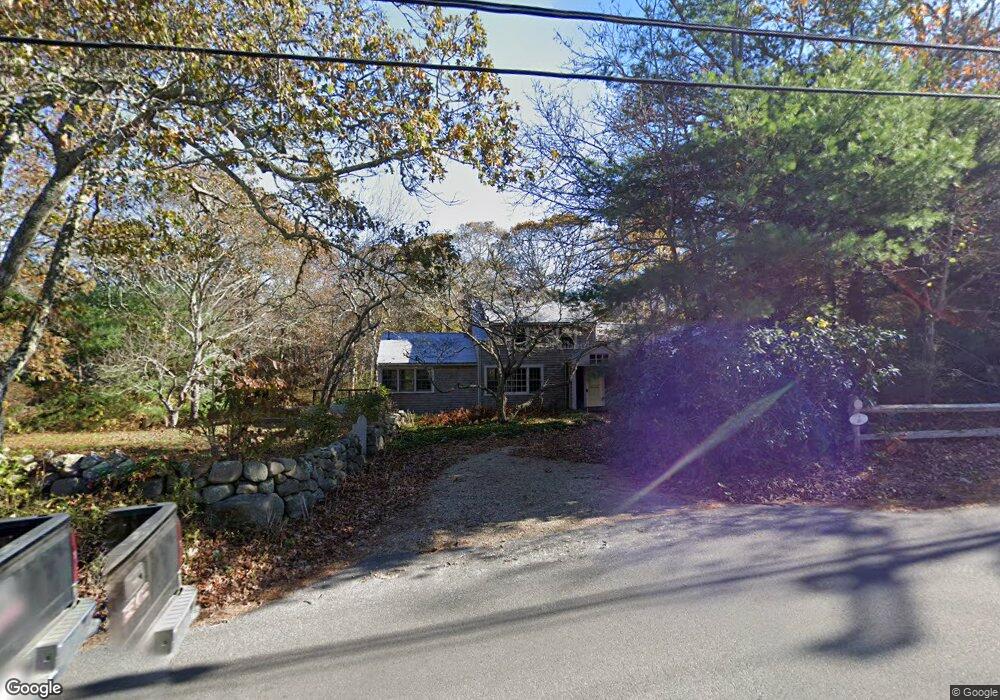
322 Lamberts Cove Rd Vineyard Haven, MA 02568
West Tisbury NeighborhoodEstimated Value: $1,344,000 - $2,111,000
3
Beds
3
Baths
1,468
Sq Ft
$1,214/Sq Ft
Est. Value
About This Home
This home is located at 322 Lamberts Cove Rd, Vineyard Haven, MA 02568 and is currently estimated at $1,782,128, approximately $1,213 per square foot. 322 Lamberts Cove Rd is a home located in Dukes County with nearby schools including Martha's Vineyard Regional High School and Martha's Vineyard Charter School.
Ownership History
Date
Name
Owned For
Owner Type
Purchase Details
Closed on
Jul 29, 2003
Sold by
Dille Ann C and Bushe Dennis M
Bought by
Dille Ann C and Bushe Dennis M
Current Estimated Value
Purchase Details
Closed on
Mar 31, 2003
Sold by
Woodburn Marie C
Bought by
Dille Ann C and Bushe Dennis M
Purchase Details
Closed on
Oct 4, 1995
Sold by
Lee B Herbert and Lee Margaret P
Bought by
Woodburn Marie C
Create a Home Valuation Report for This Property
The Home Valuation Report is an in-depth analysis detailing your home's value as well as a comparison with similar homes in the area
Home Values in the Area
Average Home Value in this Area
Purchase History
| Date | Buyer | Sale Price | Title Company |
|---|---|---|---|
| Dille Ann C | -- | -- | |
| Dille Ann C | $645,000 | -- | |
| Woodburn Marie C | $318,944 | -- |
Source: Public Records
Tax History Compared to Growth
Tax History
| Year | Tax Paid | Tax Assessment Tax Assessment Total Assessment is a certain percentage of the fair market value that is determined by local assessors to be the total taxable value of land and additions on the property. | Land | Improvement |
|---|---|---|---|---|
| 2025 | $6,332 | $1,397,800 | $759,000 | $638,800 |
| 2024 | $5,704 | $1,326,400 | $737,000 | $589,400 |
| 2023 | $5,488 | $1,258,800 | $702,000 | $556,800 |
| 2022 | $5,173 | $888,800 | $405,000 | $483,800 |
| 2021 | $5,744 | $770,300 | $356,400 | $413,900 |
| 2020 | $3,938 | $760,700 | $346,400 | $414,300 |
| 2019 | $4,502 | $728,400 | $346,400 | $382,000 |
| 2018 | $3,284 | $709,900 | $327,500 | $382,400 |
| 2017 | $4,253 | $712,400 | $343,300 | $369,100 |
| 2016 | $4,084 | $673,900 | $323,400 | $350,500 |
| 2015 | $3,841 | $672,700 | $323,400 | $349,300 |
| 2014 | $3,801 | $702,500 | $401,600 | $300,900 |
Source: Public Records
Map
Nearby Homes
- 55 Old House Way
- 97 Longview Rd
- 20 Brook Hollow Rd
- 104 & 111 Old Herring Creek Rd
- 60 Bartimus Luce Rd
- 157 Ben Chase Rd
- 38 Fire Tower Rd Unit 40.2
- 14 Rebekahs Way
- 42 Hidden Village Rd
- 16 Red Coat Hill Rd
- 31 Josiah Sachem Way
- 11 Beach Pebble Rd Unit 48.3
- 11 Beach Pebble Rd
- 9 Beach Pebble Rd
- 34 Pine Ln
- 52 Old Coach Rd
- 53 Stoney Hill Rd
- 10 Trotters Ln
- 180 Pilot Hill Farm Rd
- 4 Rock Pond Rd
- 323 Lamberts Cove Rd
- 318 Lamberts Cove Rd
- 8 Manaquayak Rd
- 90 Manaquayak Rd
- 335 Lamberts Cove Rd
- 314 Lamberts Cove Rd
- 14 Manaquayak Rd
- 330 Lamberts Cove Rd
- 334 Lamberts Cove Rd
- 17 Log Cabin Rd
- 16 Log Cabin Rd
- 20 Manaquayak Rd
- 15 Log Cabin Rd
- 25 Manaquayak Rd
- 329 Lamberts Cove Rd
- 345 Lamberts Cove Rd
- 36 Black Brook Crossing
- 36 Black Brook Crossing Rd
- 4 Log Cabin Rd
- 3 Log Cabin Rd