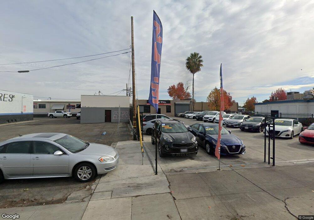
322 N Wilson Way Stockton, CA 95205
Downtown Stockton NeighborhoodEstimated Value: $240,821
--
Bed
--
Bath
--
Sq Ft
9,757
Sq Ft Lot
About This Home
This home is located at 322 N Wilson Way, Stockton, CA 95205 and is currently estimated at $240,821. 322 N Wilson Way is a home located in San Joaquin County with nearby schools including John C. Fremont Elementary School, Fillmore Elementary School, and King Elementary School.
Ownership History
Date
Name
Owned For
Owner Type
Purchase Details
Closed on
Dec 28, 2017
Sold by
Montijo Rhode
Bought by
Rodriguez Manuel
Current Estimated Value
Purchase Details
Closed on
May 21, 2003
Sold by
King Properties
Bought by
Montijo Rhonde
Home Financials for this Owner
Home Financials are based on the most recent Mortgage that was taken out on this home.
Original Mortgage
$80,000
Interest Rate
5.61%
Mortgage Type
Commercial
Create a Home Valuation Report for This Property
The Home Valuation Report is an in-depth analysis detailing your home's value as well as a comparison with similar homes in the area
Home Values in the Area
Average Home Value in this Area
Purchase History
| Date | Buyer | Sale Price | Title Company |
|---|---|---|---|
| Rodriguez Manuel | $150,000 | Chicago Title Company Stockt | |
| Montijo Rhonde | -- | Alliance Title Company |
Source: Public Records
Mortgage History
| Date | Status | Borrower | Loan Amount |
|---|---|---|---|
| Previous Owner | Montijo Rhonde | $80,000 |
Source: Public Records
Tax History Compared to Growth
Tax History
| Year | Tax Paid | Tax Assessment Tax Assessment Total Assessment is a certain percentage of the fair market value that is determined by local assessors to be the total taxable value of land and additions on the property. | Land | Improvement |
|---|---|---|---|---|
| 2025 | $2,170 | $170,668 | $65,991 | $104,677 |
| 2024 | $2,135 | $167,323 | $64,698 | $102,625 |
| 2023 | $2,087 | $164,043 | $63,430 | $100,613 |
| 2022 | $2,033 | $160,828 | $62,187 | $98,641 |
| 2021 | $1,953 | $157,675 | $60,968 | $96,707 |
| 2020 | $1,989 | $156,059 | $60,343 | $95,716 |
| 2019 | $1,981 | $153,000 | $59,160 | $93,840 |
| 2018 | $2,060 | $159,103 | $89,098 | $70,005 |
| 2017 | $1,952 | $155,984 | $87,351 | $68,633 |
| 2016 | $1,987 | $152,927 | $85,639 | $67,288 |
| 2014 | $1,891 | $147,680 | $82,701 | $64,979 |
Source: Public Records
Map
Nearby Homes
- 312 Florence St
- 328 Florence St
- 1200 E Miner Ave
- 1211 E Main St
- 644 N Airport Way
- 1143 E Park St
- 1916 Vicki Ln
- 1123 E Park St
- 1804 E Flora St
- 1224 E Lafayette St
- 336 S Airport Way
- 1816 E Sonora St
- 1845 E Poplar St
- 144 N Grant St
- 2125 E Myrtle St
- 1037 N Airport Way
- 1813 E Anita St
- 1926 E Roosevelt St
- 28 S American St
- 1135 N Pilgrim St
- 340 N Wilson Way
- 1025 E Lindsay St
- 1 E Off Center
- 0 1850 Country Club Unit 11037486
- 1510 E Miner Ave
- 1520 E Miner Ave
- 221 Eugenia Ave
- 235 Eugenia Ave
- 225 Eugenia Ave
- 1420 E Lindsay St
- 1540 E Miner Ave
- 324 N Sierra Nevada St
- 326 N Sierra Nevada St
- 348 N Sierra Nevada St
- 1626 E Lindsay St
- 1405 E Miner Ave
- 1604 E Miner Ave
- 1634 E Lindsay St
- 1624 E Miner Ave
- 1414 E Miner Ave
