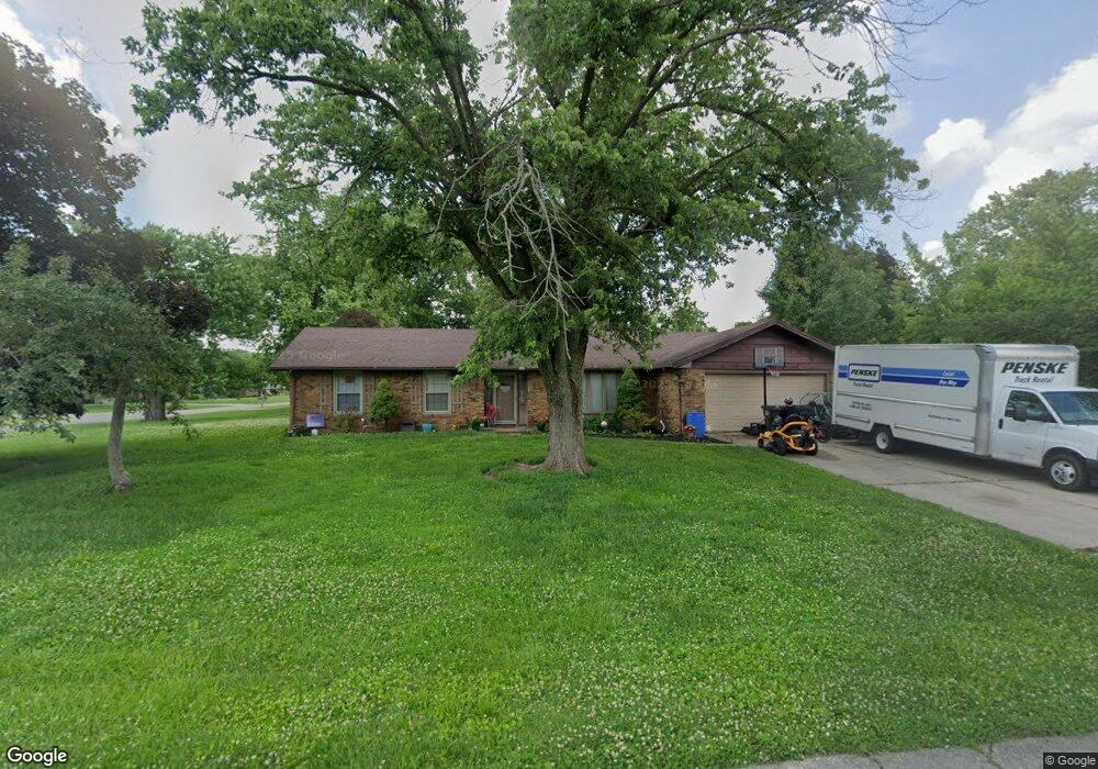
3220 Arthur Blvd Anderson, IN 46012
Estimated Value: $239,000 - $268,000
3
Beds
3
Baths
1,824
Sq Ft
$137/Sq Ft
Est. Value
About This Home
This home is located at 3220 Arthur Blvd, Anderson, IN 46012 and is currently estimated at $249,678, approximately $136 per square foot. 3220 Arthur Blvd is a home located in Madison County with nearby schools including Eastside Elementary School, Highland Middle School, and Anderson High School.
Ownership History
Date
Name
Owned For
Owner Type
Purchase Details
Closed on
Nov 2, 2009
Sold by
Fannie Mae
Bought by
Brenneke Stacey D
Current Estimated Value
Home Financials for this Owner
Home Financials are based on the most recent Mortgage that was taken out on this home.
Original Mortgage
$88,271
Outstanding Balance
$56,636
Interest Rate
4.9%
Mortgage Type
FHA
Estimated Equity
$193,042
Purchase Details
Closed on
Jun 19, 2009
Sold by
Gossage Bret J and Metlife Bank Na
Bought by
Fannie Mae and Federal Natinal Mortgage Assn
Purchase Details
Closed on
Apr 30, 2007
Sold by
Hilgeman Jason and Hilgeman Pamela
Bought by
Gossage Bret J
Home Financials for this Owner
Home Financials are based on the most recent Mortgage that was taken out on this home.
Original Mortgage
$119,900
Interest Rate
6.21%
Mortgage Type
New Conventional
Create a Home Valuation Report for This Property
The Home Valuation Report is an in-depth analysis detailing your home's value as well as a comparison with similar homes in the area
Home Values in the Area
Average Home Value in this Area
Purchase History
| Date | Buyer | Sale Price | Title Company |
|---|---|---|---|
| Brenneke Stacey D | $89,900 | -- | |
| Fannie Mae | $117,027 | -- | |
| Gossage Bret J | -- | -- |
Source: Public Records
Mortgage History
| Date | Status | Borrower | Loan Amount |
|---|---|---|---|
| Open | Brenneke Stacey D | $88,271 | |
| Previous Owner | Gossage Bret J | $119,900 |
Source: Public Records
Tax History Compared to Growth
Tax History
| Year | Tax Paid | Tax Assessment Tax Assessment Total Assessment is a certain percentage of the fair market value that is determined by local assessors to be the total taxable value of land and additions on the property. | Land | Improvement |
|---|---|---|---|---|
| 2025 | $1,166 | $121,200 | $18,900 | $102,300 |
| 2024 | $1,166 | $121,200 | $18,900 | $102,300 |
| 2023 | $1,115 | $111,100 | $18,000 | $93,100 |
| 2022 | $1,184 | $109,900 | $16,800 | $93,100 |
| 2021 | $1,078 | $101,200 | $16,600 | $84,600 |
| 2020 | $801 | $94,800 | $15,500 | $79,300 |
| 2019 | $787 | $92,500 | $15,500 | $77,000 |
| 2018 | $810 | $92,800 | $15,500 | $77,300 |
| 2017 | $638 | $92,000 | $15,500 | $76,500 |
| 2016 | $647 | $92,000 | $15,500 | $76,500 |
| 2014 | $574 | $90,600 | $15,500 | $75,100 |
| 2013 | $574 | $96,400 | $15,500 | $80,900 |
Source: Public Records
Map
Nearby Homes
- 4504 Winter Dr
- 1411 Whisperwood Way
- 2794 E 450 N
- 241 N Scatterfield Rd
- 720 E 400 N
- 3533 Alexandria Pike
- 1226 E 600 N
- 3215 Alexandria Pike
- 1002 E 600 N
- 0 Janet Ct
- 105 Magnolia Dr
- 2334 Impala Dr
- 5016 N Sr 9
- 3054 E 250 N
- 2227 Tartan Rd
- 121 Darin Ct
- 2409 Melody Ln
- 5939 N Olivia Dr
- 2316 Lake Dr
- 2976 N Scatterfield Rd