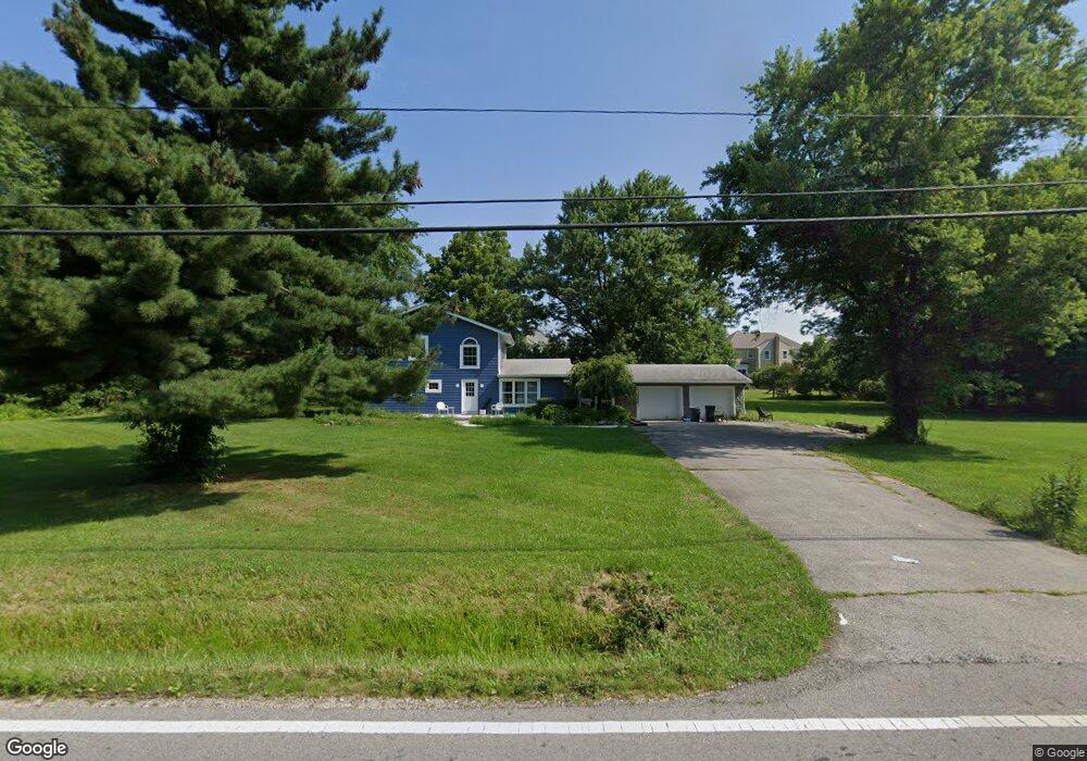
3220 Rutherford Rd Powell, OH 43065
Estimated Value: $443,655 - $565,000
3
Beds
2
Baths
1,612
Sq Ft
$301/Sq Ft
Est. Value
About This Home
This home is located at 3220 Rutherford Rd, Powell, OH 43065 and is currently estimated at $485,414, approximately $301 per square foot. 3220 Rutherford Rd is a home located in Delaware County with nearby schools including Wyandot Run Elementary School, Olentangy Liberty Middle School, and Olentangy Liberty High School.
Ownership History
Date
Name
Owned For
Owner Type
Purchase Details
Closed on
Feb 17, 1998
Sold by
Froehlich David E
Bought by
Moreno Anthony M
Current Estimated Value
Home Financials for this Owner
Home Financials are based on the most recent Mortgage that was taken out on this home.
Original Mortgage
$96,000
Outstanding Balance
$17,176
Interest Rate
7.12%
Mortgage Type
New Conventional
Estimated Equity
$468,238
Purchase Details
Closed on
Oct 30, 1996
Sold by
Trst Jerry Neeley
Bought by
Froehlich Carol A and Froehlich David E
Create a Home Valuation Report for This Property
The Home Valuation Report is an in-depth analysis detailing your home's value as well as a comparison with similar homes in the area
Home Values in the Area
Average Home Value in this Area
Purchase History
| Date | Buyer | Sale Price | Title Company |
|---|---|---|---|
| Moreno Anthony M | $120,000 | -- | |
| Froehlich Carol A | $93,000 | -- |
Source: Public Records
Mortgage History
| Date | Status | Borrower | Loan Amount |
|---|---|---|---|
| Open | Moreno Anthony M | $96,000 |
Source: Public Records
Tax History
| Year | Tax Paid | Tax Assessment Tax Assessment Total Assessment is a certain percentage of the fair market value that is determined by local assessors to be the total taxable value of land and additions on the property. | Land | Improvement |
|---|---|---|---|---|
| 2024 | $5,585 | $106,370 | $46,760 | $59,610 |
| 2023 | $5,607 | $106,370 | $46,760 | $59,610 |
| 2022 | $6,017 | $90,480 | $41,930 | $48,550 |
| 2021 | $6,054 | $90,480 | $41,930 | $48,550 |
| 2020 | $6,083 | $90,480 | $41,930 | $48,550 |
| 2019 | $4,976 | $77,140 | $34,930 | $42,210 |
| 2018 | $4,999 | $77,140 | $34,930 | $42,210 |
| 2017 | $4,690 | $71,050 | $26,600 | $44,450 |
| 2016 | $4,900 | $71,050 | $26,600 | $44,450 |
| 2015 | $4,433 | $71,050 | $26,600 | $44,450 |
| 2014 | $4,494 | $71,050 | $26,600 | $44,450 |
| 2013 | $4,598 | $71,050 | $26,600 | $44,450 |
Source: Public Records
Map
Nearby Homes
- 1063 Mendolin Ct
- 3160 Rutherford Rd
- 0 Liberty Rd Unit Tract 3
- 0 Liberty Rd Unit Tract 4
- 0 Liberty Rd Unit Tract 10
- 0 Liberty Rd Unit Tract 2
- 0 Liberty Rd Unit Tract 1
- 0 Liberty Rd Unit Tract 11
- 901 Bovee Ln
- 3154 Mapex Ct
- 0 Liberty Rd N Unit Lot 4
- 0 Liberty Rd N Unit Lot 6
- 2575 Hackney Ct
- 3443 Village Club Dr
- 3603 Stoneway Point
- 8778 Linksway Dr
- 3623 Stoneway Point Unit 33623
- 2710 Silverleaf Dr
- 3697 Stoneway Point Unit 83697
- 3717 Stoneway Point Unit 3717
- 251 Balsamine Dr
- 247 Balsamine Dr
- 247 Balsamine Dr Unit 3400
- 243 Balsamine Dr
- 243 Balsamine Dr Unit 3401
- 255 Balsamine Dr
- 3164 Rutherford Rd
- 239 Balsamine Dr
- 235 Balsamine Dr
- 3150 Rutherford Rd Unit 38373497
- 280 Halverston Rd
- 274 Halverston Rd
- 252 Balsamine Dr Unit 3412
- 244 Balsamine Dr
- 286 Halverston Rd
- 268 Halverston Rd
- 268 Halverston Rd Unit 3213
- 240 Balsamine Dr
- 231 Balsamine Dr
- 263 Balsamine Dr