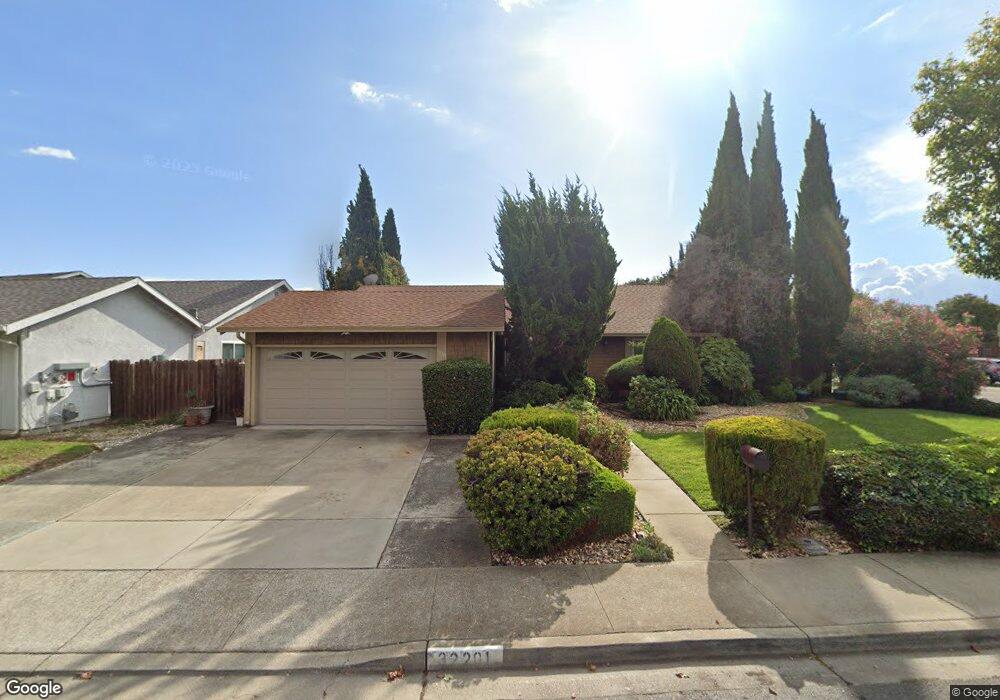
32201 Sloccum Ct Union City, CA 94587
Estimated Value: $1,260,000 - $1,474,000
4
Beds
2
Baths
1,708
Sq Ft
$800/Sq Ft
Est. Value
About This Home
This home is located at 32201 Sloccum Ct, Union City, CA 94587 and is currently estimated at $1,366,112, approximately $799 per square foot. 32201 Sloccum Ct is a home located in Alameda County with nearby schools including Tom Kitayama Elementary School, Cesar Chavez Middle School, and James Logan High School.
Ownership History
Date
Name
Owned For
Owner Type
Purchase Details
Closed on
Sep 25, 2025
Sold by
Houser Patricia A
Bought by
Patricia A Houser Living Trust and Houser
Current Estimated Value
Purchase Details
Closed on
Apr 10, 1998
Sold by
Houser Lonnie and Houser Patricia
Bought by
Houser Lonnie and Houser Patricia
Home Financials for this Owner
Home Financials are based on the most recent Mortgage that was taken out on this home.
Original Mortgage
$203,000
Interest Rate
7.18%
Purchase Details
Closed on
Oct 11, 1994
Sold by
Pates Beverly J
Bought by
Houser Lonnie and Houser Patricia
Home Financials for this Owner
Home Financials are based on the most recent Mortgage that was taken out on this home.
Original Mortgage
$203,000
Interest Rate
8.54%
Create a Home Valuation Report for This Property
The Home Valuation Report is an in-depth analysis detailing your home's value as well as a comparison with similar homes in the area
Home Values in the Area
Average Home Value in this Area
Purchase History
| Date | Buyer | Sale Price | Title Company |
|---|---|---|---|
| Patricia A Houser Living Trust | -- | None Listed On Document | |
| Houser Lonnie | -- | Old Republic Title Company | |
| Houser Lonnie | $215,000 | North American Title Company |
Source: Public Records
Mortgage History
| Date | Status | Borrower | Loan Amount |
|---|---|---|---|
| Previous Owner | Houser Lonnie | $203,000 | |
| Previous Owner | Houser Lonnie | $203,000 |
Source: Public Records
Tax History Compared to Growth
Tax History
| Year | Tax Paid | Tax Assessment Tax Assessment Total Assessment is a certain percentage of the fair market value that is determined by local assessors to be the total taxable value of land and additions on the property. | Land | Improvement |
|---|---|---|---|---|
| 2025 | $5,992 | $361,115 | $108,334 | $252,781 |
| 2024 | $5,992 | $354,035 | $106,210 | $247,825 |
| 2023 | $5,764 | $347,095 | $104,128 | $242,967 |
| 2022 | $5,643 | $340,290 | $102,087 | $238,203 |
| 2021 | $5,517 | $333,618 | $100,085 | $233,533 |
| 2020 | $5,436 | $330,198 | $99,059 | $231,139 |
| 2019 | $5,476 | $323,724 | $97,117 | $226,607 |
| 2018 | $5,347 | $317,378 | $95,213 | $222,165 |
| 2017 | $5,218 | $311,155 | $93,346 | $217,809 |
| 2016 | $5,032 | $305,056 | $91,517 | $213,539 |
| 2015 | $4,932 | $300,474 | $90,142 | $210,332 |
| 2014 | $4,748 | $294,590 | $88,377 | $206,213 |
Source: Public Records
Map
Nearby Homes
- 32625 Brenda Way Unit 1
- 2672 Great Arbor Way Unit 46
- 2469 Ascot Way
- 31274 Santa Maria Dr
- 3501 Lake Ontario Dr
- 167 Kona Cir
- 33010 Lake Mead Dr
- 3142 San Angelo Way
- 3178 Santa Marta Ct
- 192 Hawaii Cir
- 328 Waikiki Cir
- 259 Molokai Cir Unit 259
- 2716 Killdeer Ct
- 23 Palm Dr
- 32333 Crest Ln
- 2544 Franklin Ave Unit 172
- 2572 Parkside Dr
- 30 Palm Dr Unit 30
- 32226 Crest Ln
- 5375 Singh Cir
- 32207 Sloccum Ct
- 32203 Almaden Blvd
- 32213 Sloccum Ct
- 32161 Trefry Ct
- 32205 Almaden Blvd
- 32200 Sloccum Ct
- 32206 Sloccum Ct
- 32219 Sloccum Ct
- 32212 Sloccum Ct
- 32155 Trefry Ct
- 32172 Trefry Ct
- 32218 Sloccum Ct
- 32207 Almaden Blvd
- 32225 Sloccum Ct
- 32166 Trefry Ct
- 32220 Minturn Ct
- 32224 Sloccum Ct
- 32149 Trefry Ct
- 32209 Almaden Blvd
- 32160 Trefry Ct