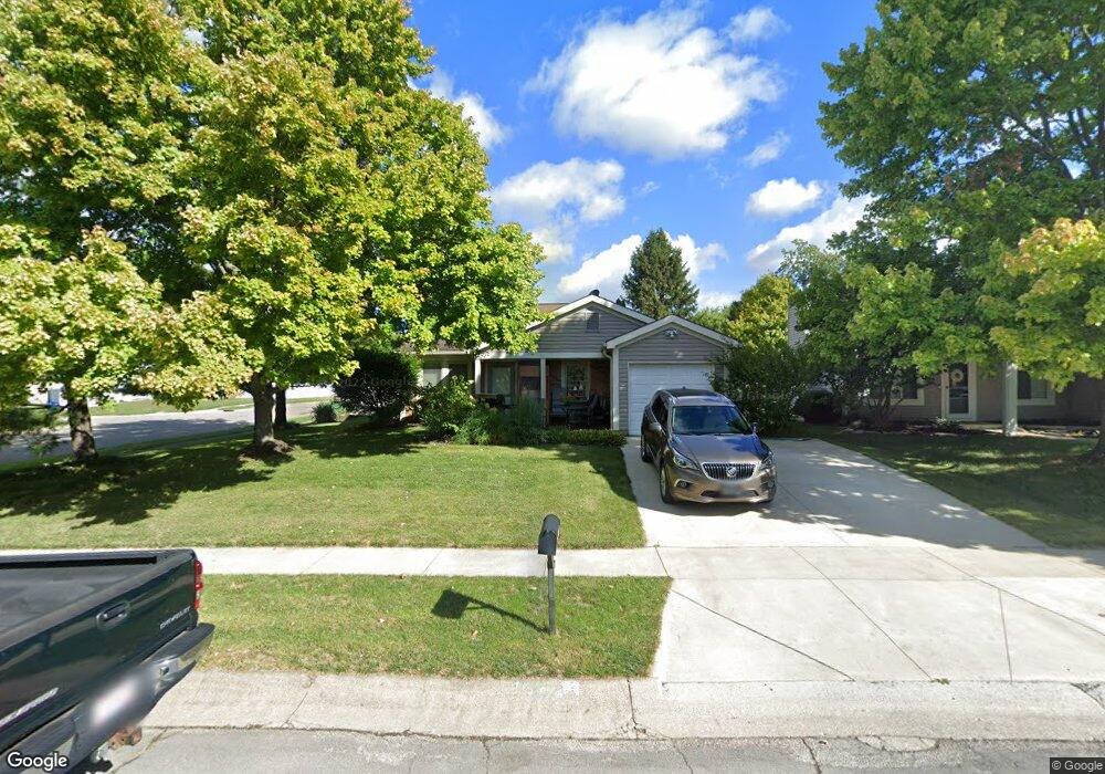
3224 Heatherside Dr Dublin, OH 43017
Riverside NeighborhoodEstimated Value: $320,000 - $345,000
3
Beds
1
Bath
1,244
Sq Ft
$267/Sq Ft
Est. Value
About This Home
This home is located at 3224 Heatherside Dr, Dublin, OH 43017 and is currently estimated at $331,876, approximately $266 per square foot. 3224 Heatherside Dr is a home located in Franklin County with nearby schools including Thomas Elementary School, John Sells Middle School, and Dublin Coffman High School.
Ownership History
Date
Name
Owned For
Owner Type
Purchase Details
Closed on
Jun 1, 2000
Sold by
Bushong Joyce Ann
Bought by
Quinn Richard
Current Estimated Value
Home Financials for this Owner
Home Financials are based on the most recent Mortgage that was taken out on this home.
Original Mortgage
$50,000
Outstanding Balance
$17,841
Interest Rate
9.25%
Estimated Equity
$314,035
Purchase Details
Closed on
Jul 7, 1988
Bought by
Bushong Joyce A
Purchase Details
Closed on
Mar 1, 1987
Purchase Details
Closed on
Dec 1, 1984
Create a Home Valuation Report for This Property
The Home Valuation Report is an in-depth analysis detailing your home's value as well as a comparison with similar homes in the area
Home Values in the Area
Average Home Value in this Area
Purchase History
| Date | Buyer | Sale Price | Title Company |
|---|---|---|---|
| Quinn Richard | $81,000 | Peterson Title Agency | |
| Bushong Joyce A | $71,700 | -- | |
| -- | $64,500 | -- | |
| -- | $64,400 | -- |
Source: Public Records
Mortgage History
| Date | Status | Borrower | Loan Amount |
|---|---|---|---|
| Open | Quinn Richard | $50,000 |
Source: Public Records
Tax History
| Year | Tax Paid | Tax Assessment Tax Assessment Total Assessment is a certain percentage of the fair market value that is determined by local assessors to be the total taxable value of land and additions on the property. | Land | Improvement |
|---|---|---|---|---|
| 2025 | $4,816 | $89,430 | $35,000 | $54,430 |
| 2024 | $4,816 | $89,430 | $35,000 | $54,430 |
| 2023 | $4,786 | $89,425 | $35,000 | $54,425 |
| 2022 | $3,578 | $64,510 | $28,670 | $35,840 |
| 2021 | $3,636 | $64,510 | $28,670 | $35,840 |
| 2020 | $3,614 | $64,510 | $28,670 | $35,840 |
| 2019 | $2,993 | $49,630 | $22,050 | $27,580 |
| 2018 | $2,800 | $49,630 | $22,050 | $27,580 |
| 2017 | $2,671 | $49,630 | $22,050 | $27,580 |
| 2016 | $2,579 | $44,590 | $11,970 | $32,620 |
| 2015 | $2,595 | $44,590 | $11,970 | $32,620 |
| 2014 | $2,598 | $44,590 | $11,970 | $32,620 |
| 2013 | $1,319 | $44,590 | $11,970 | $32,620 |
Source: Public Records
Map
Nearby Homes
- 6171 Water Bank St
- 5790 Newgate Rd Unit 5790
- 3282 Welsh Abbey Rd Unit 3282
- 3166 Kingstree Ct
- 3263 Scioto Ridge Rd
- 5935 Abbey Church Rd
- 6220 Emberwood Rd
- 3185 Middleboro Way
- 5735 Newbank Cir Unit 303
- 5734 Kingstree Dr
- 5622 Riverside Dr
- 5657 Barry Trace
- 3107 Hamden Ct
- 2947 Talbrock Cir
- 3223 Banting St
- 2960 Sawdust Ln Unit 2960
- 2946 Sawdust Ln
- 4385 Hayden Falls Dr
- 5570 Coogan Place
- 6628 Brock St
- 3216 Heatherside Dr
- 3208 Heatherside Dr
- 6000 Thatcher Dr
- 6004 Renfield Dr
- 3241 Rothschild Ct
- 3200 Heatherside Dr
- 6008 Renfield Dr
- 3221 Heatherside Dr
- 3240 Rothschild Ct
- 3215 Heatherside Dr
- 3209 Heatherside Dr
- 6012 Renfield Dr
- 3249 Rothschild Ct
- 3194 Heatherside Dr
- 3242 Iveswood Ct
- 3203 Heatherside Dr
- 3248 Rothschild Ct
- 3250 Iveswood Ct
- 6016 Renfield Dr
- 6010 Thatcher Dr
Your Personal Tour Guide
Ask me questions while you tour the home.