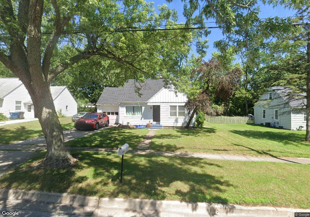
3228 Random Rd Kalamazoo, MI 49004
Burke Acres NeighborhoodEstimated Value: $110,000 - $132,000
2
Beds
1
Bath
725
Sq Ft
$167/Sq Ft
Est. Value
About This Home
This home is located at 3228 Random Rd, Kalamazoo, MI 49004 and is currently estimated at $121,337, approximately $167 per square foot. 3228 Random Rd is a home located in Kalamazoo County with nearby schools including Spring Valley Center for Exploration, Hillside Middle School, and Kalamazoo Central High School.
Ownership History
Date
Name
Owned For
Owner Type
Purchase Details
Closed on
Feb 23, 2016
Sold by
Boyd Scott A and Boyd Louann
Bought by
Bellinger James and Bellinger Mary
Current Estimated Value
Home Financials for this Owner
Home Financials are based on the most recent Mortgage that was taken out on this home.
Original Mortgage
$39,200
Interest Rate
3.79%
Mortgage Type
New Conventional
Purchase Details
Closed on
Nov 23, 2011
Sold by
Pontus Investment Portfolio I Llc
Bought by
Boyd Scott A and Boyd Lou Ann
Purchase Details
Closed on
Sep 13, 2010
Sold by
Sulka Susan Eileen
Bought by
Pontus Investment Portfolio I Llc
Create a Home Valuation Report for This Property
The Home Valuation Report is an in-depth analysis detailing your home's value as well as a comparison with similar homes in the area
Home Values in the Area
Average Home Value in this Area
Purchase History
| Date | Buyer | Sale Price | Title Company |
|---|---|---|---|
| Bellinger James | $49,000 | Nations Title Agency | |
| Boyd Scott A | $23,000 | Devon Title | |
| Pontus Investment Portfolio I Llc | -- | None Available |
Source: Public Records
Mortgage History
| Date | Status | Borrower | Loan Amount |
|---|---|---|---|
| Closed | Bellinger James | $39,200 |
Source: Public Records
Tax History
| Year | Tax Paid | Tax Assessment Tax Assessment Total Assessment is a certain percentage of the fair market value that is determined by local assessors to be the total taxable value of land and additions on the property. | Land | Improvement |
|---|---|---|---|---|
| 2025 | $898 | $49,500 | $0 | $0 |
| 2024 | $871 | $46,300 | $0 | $0 |
| 2023 | $831 | $41,800 | $0 | $0 |
| 2022 | $1,907 | $36,800 | $0 | $0 |
| 2021 | $1,845 | $34,100 | $0 | $0 |
| 2020 | $1,810 | $32,200 | $0 | $0 |
| 2019 | $1,743 | $28,400 | $0 | $0 |
| 2018 | $1,703 | $25,500 | $0 | $0 |
| 2017 | $1,566 | $24,700 | $0 | $0 |
| 2016 | $1,566 | $22,600 | $0 | $0 |
| 2015 | $1,566 | $21,300 | $0 | $0 |
| 2014 | $1,566 | $21,900 | $0 | $0 |
Source: Public Records
Map
Nearby Homes
- 3115 Michael Ave
- 2428 Glendale Blvd
- 3104 Courtlandt Ave
- 1223 Parchmount Ave
- 2415 Parchmount Ave
- 2421 Parchmount Ave
- 818 Parchmount Ave
- 2842 Virginia Ave
- 125 Haymac Dr
- 603 Park Ave
- 2910 Parchmount Ave
- 405 Park Ave
- 4123 Mount Olivet Rd
- 2511 Monterey Dr
- 332 Espanola Ave
- 2516 Fairfield Ave
- 2407 Fairfield Ave
- 309 E Oak Grove Ave
- 267 Parchmount Ave
- 2117 Lakewood Dr
Your Personal Tour Guide
Ask me questions while you tour the home.