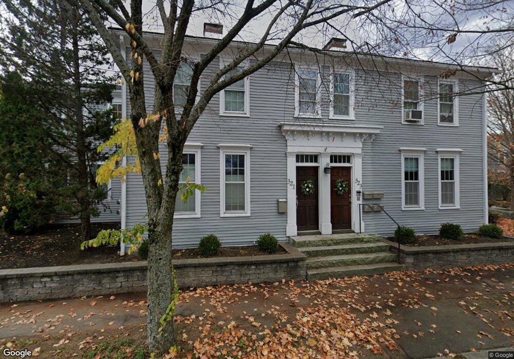
323 High St Unit 2 Newburyport, MA 01950
Estimated Value: $493,432 - $547,000
1
Bed
1
Bath
970
Sq Ft
$542/Sq Ft
Est. Value
About This Home
This home is located at 323 High St Unit 2, Newburyport, MA 01950 and is currently estimated at $525,858, approximately $542 per square foot. 323 High St Unit 2 is a home located in Essex County with nearby schools including Francis T. Bresnahan Elementary School, Edward G. Molin Elementary School, and Rupert A. Nock Middle School.
Ownership History
Date
Name
Owned For
Owner Type
Purchase Details
Closed on
Jan 31, 2018
Sold by
Cappello Brian
Bought by
Nakel Inge
Current Estimated Value
Home Financials for this Owner
Home Financials are based on the most recent Mortgage that was taken out on this home.
Original Mortgage
$261,250
Outstanding Balance
$220,977
Interest Rate
3.94%
Mortgage Type
New Conventional
Estimated Equity
$304,881
Purchase Details
Closed on
Mar 16, 2007
Sold by
Mellett Tasha
Bought by
Cappello Brian
Home Financials for this Owner
Home Financials are based on the most recent Mortgage that was taken out on this home.
Original Mortgage
$228,000
Interest Rate
6.4%
Mortgage Type
Purchase Money Mortgage
Create a Home Valuation Report for This Property
The Home Valuation Report is an in-depth analysis detailing your home's value as well as a comparison with similar homes in the area
Home Values in the Area
Average Home Value in this Area
Purchase History
| Date | Buyer | Sale Price | Title Company |
|---|---|---|---|
| Nakel Inge | $275,000 | -- | |
| Cappello Brian | $285,000 | -- |
Source: Public Records
Mortgage History
| Date | Status | Borrower | Loan Amount |
|---|---|---|---|
| Open | Nakel Inge | $261,250 | |
| Previous Owner | Cappello Brian | $218,174 | |
| Previous Owner | Cappello Brian | $228,000 |
Source: Public Records
Tax History Compared to Growth
Tax History
| Year | Tax Paid | Tax Assessment Tax Assessment Total Assessment is a certain percentage of the fair market value that is determined by local assessors to be the total taxable value of land and additions on the property. | Land | Improvement |
|---|---|---|---|---|
| 2025 | $4,140 | $432,200 | $0 | $432,200 |
| 2024 | $4,041 | $405,300 | $0 | $405,300 |
| 2023 | $3,623 | $332,700 | $0 | $332,700 |
| 2022 | $3,489 | $290,500 | $0 | $290,500 |
| 2021 | $3,462 | $273,900 | $0 | $273,900 |
| 2020 | $3,448 | $268,500 | $0 | $268,500 |
| 2019 | $3,747 | $286,500 | $0 | $286,500 |
| 2018 | $3,686 | $278,000 | $0 | $278,000 |
| 2017 | $3,574 | $265,700 | $0 | $265,700 |
| 2016 | $3,362 | $251,100 | $0 | $251,100 |
| 2015 | $3,203 | $240,100 | $0 | $240,100 |
Source: Public Records
Map
Nearby Homes
- 287 1/2 High St
- 19 Jefferson St
- 42 Myrtle Ave
- 17 Alberta Ave
- 6 Storey Ave
- 1 Jefferson St
- 492 Merrimac St
- 288 Merrimac St
- 138 Low St
- 110 Low St
- 13 Broad St
- 510 Merrimac St Unit 512
- 232 Low St Unit 7
- 266 Merrimac St Unit F
- 217 Merrimac St Unit 1
- 8 Hart Rd
- 27 Warren St Unit 1
- 61 Spofford St
- 572 Merrimac St
- 158 Merrimac St Unit 3
- 323 High St Unit 1
- 321 High St
- 321 High St Unit 1
- 319 High St
- 325 High St
- 325 High St Unit Lot D
- 4 Twomey Dr
- 317 High St
- 329 High St
- 346A High St Unit A
- 346A High St
- 346A High St
- 346 High St Unit 346A
- 346 High St
- 346 High St Unit 1
- 346 High St Unit A
- 315 High St Unit 1
- 315 High St Unit 315
- 313 High St Unit 1
- 313 High St Unit 315