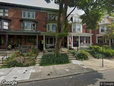
323 N West End Ave Lancaster, PA 17603
College Park NeighborhoodEstimated Value: $408,228 - $485,000
4
Beds
3
Baths
3,112
Sq Ft
$146/Sq Ft
Est. Value
About This Home
This home is located at 323 N West End Ave, Lancaster, PA 17603 and is currently estimated at $454,807, approximately $146 per square foot. 323 N West End Ave is a home located in Lancaster County with nearby schools including Thomas Wharton Elementary School, Reynolds Middle School, and McCaskey High School.
Ownership History
Date
Name
Owned For
Owner Type
Purchase Details
Closed on
Sep 18, 2006
Sold by
Hopkins Thomas J and Hopkins Frances L
Bought by
Hopkins Patrick S and Hopkins Amy B
Current Estimated Value
Home Financials for this Owner
Home Financials are based on the most recent Mortgage that was taken out on this home.
Original Mortgage
$150,000
Interest Rate
6.71%
Mortgage Type
Purchase Money Mortgage
Create a Home Valuation Report for This Property
The Home Valuation Report is an in-depth analysis detailing your home's value as well as a comparison with similar homes in the area
Home Values in the Area
Average Home Value in this Area
Purchase History
| Date | Buyer | Sale Price | Title Company |
|---|---|---|---|
| Hopkins Patrick S | $175,000 | Lancaster Title Abstracting |
Source: Public Records
Mortgage History
| Date | Status | Borrower | Loan Amount |
|---|---|---|---|
| Closed | Hopkins Patrick S | $61,000 | |
| Closed | Hopkins Patrick S | $150,000 | |
| Closed | Hopkins Thomas J | $150,000 |
Source: Public Records
Tax History Compared to Growth
Tax History
| Year | Tax Paid | Tax Assessment Tax Assessment Total Assessment is a certain percentage of the fair market value that is determined by local assessors to be the total taxable value of land and additions on the property. | Land | Improvement |
|---|---|---|---|---|
| 2024 | $9,912 | $250,500 | $46,800 | $203,700 |
| 2023 | $9,745 | $250,500 | $46,800 | $203,700 |
| 2022 | $9,340 | $250,500 | $46,800 | $203,700 |
| 2021 | $9,139 | $250,500 | $46,800 | $203,700 |
| 2020 | $9,139 | $250,500 | $46,800 | $203,700 |
| 2019 | $9,003 | $250,500 | $46,800 | $203,700 |
| 2018 | $4,906 | $250,500 | $46,800 | $203,700 |
| 2017 | $6,453 | $140,500 | $31,600 | $108,900 |
| 2016 | $6,394 | $140,500 | $31,600 | $108,900 |
| 2015 | $2,495 | $140,500 | $31,600 | $108,900 |
| 2014 | $5,153 | $140,500 | $31,600 | $108,900 |
Source: Public Records
Map
Nearby Homes
- 841 W Walnut St
- 825 W Walnut St
- 920 Marietta Ave
- 227 Elm St
- 315 Nevin St
- 772 Marietta Ave
- 336 N Pine St
- 917 Columbia Ave Unit 413
- 917 Columbia Ave Unit 726
- 1020 Marietta Ave
- 123 College Ave
- 758 Marietta Ave
- 121 College Ave
- 748 1/2 Marietta Ave
- 125 Nevin St
- 545 N Pine St
- 15 Ruby St
- 615 Lake St
- 409 Lancaster Ave
- 623 Marietta Ave
- 323 N West End Ave
- 325 N West End Ave
- 321 N West End Ave
- 327 N West End Ave
- 311 N West End Ave
- 329 N West End Ave
- 309 N West End Ave
- 307 N West End Ave Unit 1
- 331 N West End Ave
- 305 N West End Ave
- 303 N West End Ave
- 335 N West End Ave
- 301 N West End Ave
- 839 W Walnut St
- 339 N West End Ave
- 837 W Walnut St
- 341 N West End Ave
- 835 W Walnut St
- 835 W Walnut St
- 310 N End Ave