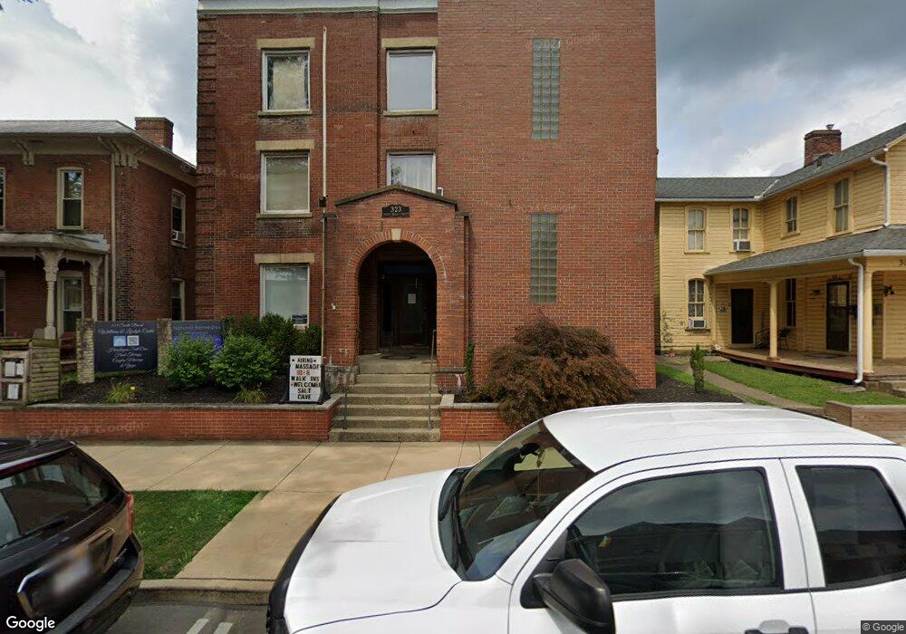
323 S Broad St Lancaster, OH 43130
Estimated Value: $450,315
Studio
3
Baths
10,604
Sq Ft
$42/Sq Ft
Est. Value
About This Home
This home is located at 323 S Broad St, Lancaster, OH 43130 and is currently estimated at $450,315, approximately $42 per square foot. 323 S Broad St is a home located in Fairfield County with nearby schools including Thomas Ewing Junior High School, Lancaster High School, and St Mary Elementary School.
Ownership History
Date
Name
Owned For
Owner Type
Purchase Details
Closed on
May 21, 2020
Sold by
Unlimited Healthcare Services Inc
Bought by
Broad St Property Llc
Current Estimated Value
Home Financials for this Owner
Home Financials are based on the most recent Mortgage that was taken out on this home.
Original Mortgage
$140,000
Outstanding Balance
$122,967
Interest Rate
3.3%
Mortgage Type
Future Advance Clause Open End Mortgage
Estimated Equity
$327,348
Purchase Details
Closed on
Sep 3, 2002
Sold by
B A J H Inc
Bought by
Mahlerwein Tiffany R
Home Financials for this Owner
Home Financials are based on the most recent Mortgage that was taken out on this home.
Original Mortgage
$92,000
Interest Rate
6.56%
Mortgage Type
Commercial
Purchase Details
Closed on
Jul 26, 1993
Sold by
Jessup Robert K
Bought by
Jessup Robert K
Purchase Details
Closed on
May 7, 1993
Sold by
Jessup Robert K
Bought by
Jessup Robert K
Create a Home Valuation Report for This Property
The Home Valuation Report is an in-depth analysis detailing your home's value as well as a comparison with similar homes in the area
Home Values in the Area
Average Home Value in this Area
Purchase History
| Date | Buyer | Sale Price | Title Company |
|---|---|---|---|
| Broad St Property Llc | $280,000 | None Available | |
| Mahlerwein Tiffany R | $230,000 | -- | |
| Jessup Robert K | $100,000 | -- | |
| Jessup Robert K | $10,000 | -- |
Source: Public Records
Mortgage History
| Date | Status | Borrower | Loan Amount |
|---|---|---|---|
| Open | Broad St Property Llc | $140,000 | |
| Previous Owner | Mahlerwein Tiffany R | $92,000 |
Source: Public Records
Tax History
| Year | Tax Paid | Tax Assessment Tax Assessment Total Assessment is a certain percentage of the fair market value that is determined by local assessors to be the total taxable value of land and additions on the property. | Land | Improvement |
|---|---|---|---|---|
| 2025 | $8,670 | $144,020 | $16,670 | $127,350 |
| 2024 | $8,670 | $96,440 | $13,690 | $82,750 |
| 2023 | $4,905 | $96,440 | $13,690 | $82,750 |
| 2022 | $4,946 | $96,440 | $13,690 | $82,750 |
| 2021 | $5,086 | $96,440 | $13,690 | $82,750 |
| 2020 | $5,114 | $96,440 | $13,690 | $82,750 |
| 2019 | $4,722 | $96,440 | $13,690 | $82,750 |
| 2018 | $4,593 | $96,440 | $13,690 | $82,750 |
| 2017 | $4,582 | $96,090 | $13,690 | $82,400 |
| 2016 | $4,427 | $96,090 | $13,690 | $82,400 |
| 2015 | $5,872 | $126,210 | $13,690 | $112,520 |
| 2014 | $5,612 | $126,210 | $13,690 | $112,520 |
| 2013 | $5,612 | $126,210 | $13,690 | $112,520 |
Source: Public Records
Map
Nearby Homes
- 0 N Columbus St
- 335 Whiley Ave
- 154 E Main St
- 342 E Chestnut St
- 233 Lewis Ave
- 414 E Walnut St
- 249 N Pearl Ave
- 0 Slocum Ave
- 515 E Chestnut St
- 153 King St
- 233 Union St
- 810 4th St
- 534 E Wheeling St
- 301 Witte St
- 515 N Columbus St
- 526 N Columbus St
- 157 Cedar Hill Rd
- 547 E Mulberry St
- 120 Talmadge Ave
- 600 N High St
- 319 S Broad St
- 316 S Broad St
- 330 S Broad St
- 112 W Walnut St
- 324 S Broad St
- 301 S Broad St
- 320 S Broad St
- 356 S Columbus St
- 350 S Columbus St
- 348 S Columbus St
- 417 S Broad St
- 409 S Broad St
- 400 S Columbus St
- 400 S Broad St
- 344 S Columbus St
- 352 S Columbus St
- 110 E Walnut St
- 110 & 114 E Walnut St
- 124 W Walnut St
- 116 E Winding St
Your Personal Tour Guide
Ask me questions while you tour the home.