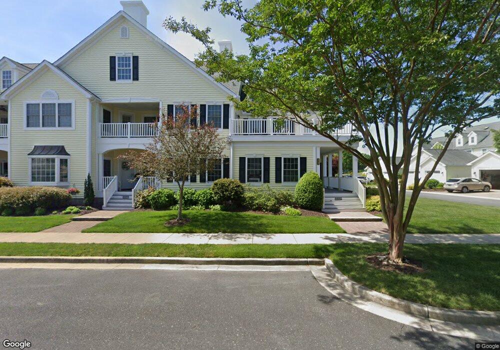
32347 Apron Way Millsboro, DE 19966
Estimated Value: $326,000 - $533,903
4
Beds
--
Bath
2,530
Sq Ft
$175/Sq Ft
Est. Value
About This Home
This home is located at 32347 Apron Way, Millsboro, DE 19966 and is currently estimated at $441,976, approximately $174 per square foot. 32347 Apron Way is a home located in Sussex County with nearby schools including Long Neck Elementary School, Millsboro Middle School, and Sussex Central High School.
Ownership History
Date
Name
Owned For
Owner Type
Purchase Details
Closed on
Jan 3, 2025
Sold by
Peabody-Bane Arline E and Arline E Peabody-Bane Revocable Trust
Bought by
Ditmars Robert D and Ditmars Patricia H
Current Estimated Value
Purchase Details
Closed on
Jan 5, 2024
Sold by
Bane Arline Peabody
Bought by
Arline E Peabody-Bane Revocable Trust and Peabody
Create a Home Valuation Report for This Property
The Home Valuation Report is an in-depth analysis detailing your home's value as well as a comparison with similar homes in the area
Home Values in the Area
Average Home Value in this Area
Purchase History
| Date | Buyer | Sale Price | Title Company |
|---|---|---|---|
| Ditmars Robert D | $440,000 | None Listed On Document | |
| Ditmars Robert D | $440,000 | None Listed On Document | |
| Arline E Peabody-Bane Revocable Trust | -- | None Listed On Document |
Source: Public Records
Tax History Compared to Growth
Tax History
| Year | Tax Paid | Tax Assessment Tax Assessment Total Assessment is a certain percentage of the fair market value that is determined by local assessors to be the total taxable value of land and additions on the property. | Land | Improvement |
|---|---|---|---|---|
| 2025 | $748 | $35,250 | $0 | $35,250 |
| 2024 | $1,484 | $35,250 | $0 | $35,250 |
| 2023 | $1,482 | $35,250 | $0 | $35,250 |
| 2022 | $1,459 | $35,250 | $0 | $35,250 |
| 2021 | $1,415 | $35,250 | $0 | $35,250 |
| 2020 | $1,351 | $35,250 | $0 | $35,250 |
| 2019 | $1,345 | $35,250 | $0 | $35,250 |
| 2018 | $1,358 | $35,600 | $0 | $0 |
| 2017 | $981 | $35,600 | $0 | $0 |
| 2016 | $749 | $35,600 | $0 | $0 |
| 2015 | $766 | $35,600 | $0 | $0 |
| 2014 | $747 | $35,600 | $0 | $0 |
Source: Public Records
Map
Nearby Homes
- 24934 Pot Bunker Way Unit 3716
- 32377 Back Nine Way Unit 3747
- 24960 Pot Bunker Way
- 32431 Back Nine Way Unit 3761
- 32447 Back Nine Way Unit 3765
- 24965 Crooked Stick Way Unit 4343
- 32667 Back Nine Way Unit 3857
- 32675 Back Nine Way Unit 3858
- 32701 Back Nine Way
- Lot 1 Canal Drive Extended
- 205 Long Neck Cir
- 32554 Long Spoon Way Unit 3141
- 32575 Long Iron Way Unit 3214
- 169 White Pine Dr
- 32530 Approach Way Unit 3252
- 32602 Long Iron Way
- 32575 Friendship Dr
- 36628 4038 Dew Way
- 24644 Dogwood Ln
- 24322 Canal Dr
- 32344 Apron Way Unit 3720
- 32346 Apron Way Unit 3719
- 32342 Apron Way Unit 3721
- 32338 Apron Way Unit 3723
- 24910 Pot Bunker Way Unit 3731
- 24916 Pot Bunker Way Unit 3729
- 24928 Pot Bunker Way Unit 3718
- 24930 Pot Bunker Way Unit 3717
- 24936 Pot Bunker Way Unit 3715
- 24940 Pot Bunker Way Unit 3714
- 24940 Pot Bunker Way
- 32397 Back Nine Way Unit 3739
- 32397 Back Nine Way Unit 3752
- 32393 Back Nine Way Unit 3751
- 32399 Back Nine Way Unit 3753
- 32389 Back Nine Way
- 32409 Back Nine Way
- 32409 Back Nine Way Unit 3754
- 32415 Back Nine Way
- 32415 Back Nine Way Unit 3756