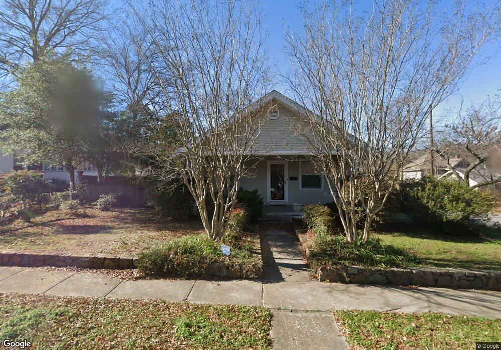
324 N Woodrow St Little Rock, AR 72205
Hillcrest NeighborhoodEstimated Value: $281,000 - $395,000
2
Beds
2
Baths
1,542
Sq Ft
$229/Sq Ft
Est. Value
About This Home
This home is located at 324 N Woodrow St, Little Rock, AR 72205 and is currently estimated at $352,802, approximately $228 per square foot. 324 N Woodrow St is a home located in Pulaski County with nearby schools including Pulaski Heights Elementary School, Pulaski Heights Middle School, and Central High School.
Ownership History
Date
Name
Owned For
Owner Type
Purchase Details
Closed on
Apr 6, 2021
Sold by
Mathews Angela and Mathews Bobby
Bought by
Ab Property Holdings Llc
Current Estimated Value
Purchase Details
Closed on
Jun 4, 2010
Sold by
Mccaskill James C
Bought by
Boyd Angela
Home Financials for this Owner
Home Financials are based on the most recent Mortgage that was taken out on this home.
Original Mortgage
$148,000
Interest Rate
5.02%
Mortgage Type
New Conventional
Purchase Details
Closed on
Dec 16, 2002
Sold by
Hitt Steven W
Bought by
Mccaskill James C
Home Financials for this Owner
Home Financials are based on the most recent Mortgage that was taken out on this home.
Original Mortgage
$125,764
Interest Rate
6.05%
Purchase Details
Closed on
Jul 31, 1997
Sold by
Hosto Bryan E and Barrett Julia S
Bought by
Stone Thomas S and Stone Cynthia R
Home Financials for this Owner
Home Financials are based on the most recent Mortgage that was taken out on this home.
Original Mortgage
$115,600
Interest Rate
7.59%
Mortgage Type
Purchase Money Mortgage
Create a Home Valuation Report for This Property
The Home Valuation Report is an in-depth analysis detailing your home's value as well as a comparison with similar homes in the area
Home Values in the Area
Average Home Value in this Area
Purchase History
| Date | Buyer | Sale Price | Title Company |
|---|---|---|---|
| Ab Property Holdings Llc | -- | Attorneys Title Group Pllc | |
| Boyd Angela | $185,000 | The Title Company | |
| Mccaskill James C | $155,000 | -- | |
| Stone Thomas S | $136,000 | Beach Abstract & Guaranty Co |
Source: Public Records
Mortgage History
| Date | Status | Borrower | Loan Amount |
|---|---|---|---|
| Previous Owner | Boyd Angela | $148,000 | |
| Previous Owner | Mccaskill James C | $125,764 | |
| Previous Owner | Stone Thomas S | $115,600 |
Source: Public Records
Tax History Compared to Growth
Tax History
| Year | Tax Paid | Tax Assessment Tax Assessment Total Assessment is a certain percentage of the fair market value that is determined by local assessors to be the total taxable value of land and additions on the property. | Land | Improvement |
|---|---|---|---|---|
| 2025 | $4,614 | $65,909 | $25,000 | $40,909 |
| 2024 | $4,614 | $65,909 | $25,000 | $40,909 |
| 2023 | $4,614 | $65,909 | $25,000 | $40,909 |
| 2022 | $4,614 | $65,909 | $25,000 | $40,909 |
| 2021 | $4,078 | $57,840 | $22,700 | $35,140 |
| 2020 | $3,674 | $57,840 | $22,700 | $35,140 |
| 2019 | $3,668 | $57,840 | $22,700 | $35,140 |
| 2018 | $3,517 | $57,840 | $22,700 | $35,140 |
| 2017 | $3,341 | $57,840 | $22,700 | $35,140 |
| 2016 | $3,165 | $50,220 | $13,300 | $36,920 |
| 2015 | $3,210 | $49,954 | $13,300 | $36,654 |
| 2014 | $3,210 | $45,794 | $13,300 | $32,494 |
Source: Public Records
Map
Nearby Homes
- 1204 Kavanaugh Blvd
- 301 N Woodrow St
- 313 Charles St
- 1116 Kavanaugh Blvd
- 1109 Kavanaugh Blvd
- 121 N Woodrow St
- 203 Midland St
- 111 Midland St
- 102 Midland St
- 306 S Woodrow St
- 505 N Valentine St
- 305 Booker St
- 3409 Hill Rd
- 400 S Booker St
- 921 Midland St
- 216 Rice St
- 206 Linwood Ct
- 312 Valmar St
- 2717 W Capitol Ave
- 201 Dennison St
- 312 N Woodrow St
- 1220 Kavanaugh Blvd
- 1212 Kavanaugh Blvd
- 0 Berry St Unit N Street 20009896
- 112 Berry St Unit 1
- 108 Berry St
- 321 N Woodrow St
- 315 N Woodrow St
- 106 Berry St
- 116 Berry St
- 116 Berry St Unit N
- 102 Berry St
- 300 N Woodrow St
- 311 N Woodrow St
- 0 Berry S Unit Street
- 116 Berry S Unit St
- 1202 Kavanaugh Blvd
- 120 Berry St
- 1308 Kavanaugh Blvd
- 303 N Woodrow St