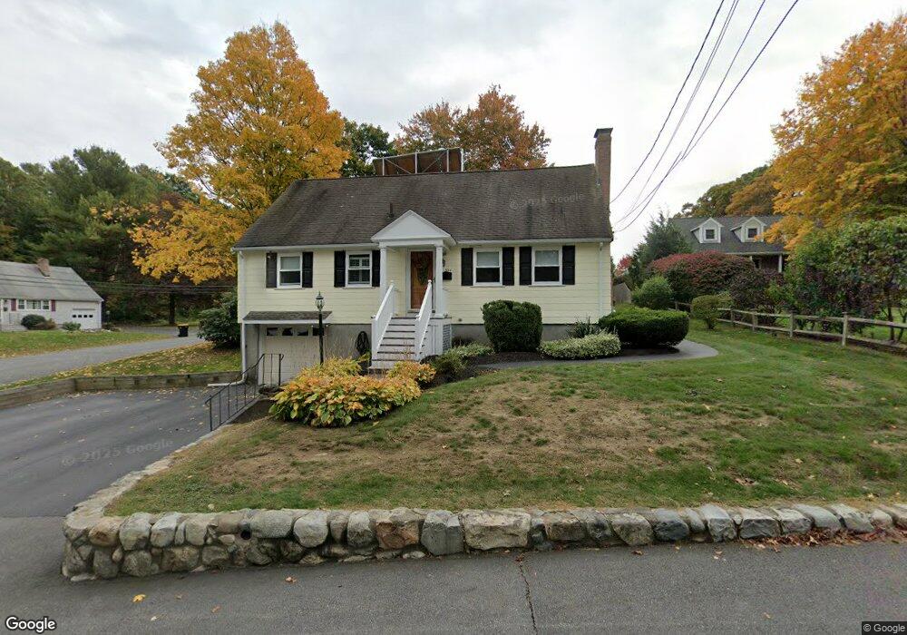
324 Potter Rd Framingham, MA 01701
Saxonville NeighborhoodEstimated Value: $607,000 - $621,000
4
Beds
2
Baths
1,729
Sq Ft
$355/Sq Ft
Est. Value
About This Home
This home is located at 324 Potter Rd, Framingham, MA 01701 and is currently estimated at $613,430, approximately $354 per square foot. 324 Potter Rd is a home located in Middlesex County with nearby schools including Framingham High School and MetroWest Jewish Day School.
Ownership History
Date
Name
Owned For
Owner Type
Purchase Details
Closed on
Oct 24, 2019
Sold by
324 Potter Road Rt and Spiri
Bought by
Spiri Barbara A and Spiri Elizabeth M
Current Estimated Value
Purchase Details
Closed on
May 2, 2014
Sold by
Spiri Barbara A
Bought by
324 Potter Road Rt and Spiri
Create a Home Valuation Report for This Property
The Home Valuation Report is an in-depth analysis detailing your home's value as well as a comparison with similar homes in the area
Home Values in the Area
Average Home Value in this Area
Purchase History
| Date | Buyer | Sale Price | Title Company |
|---|---|---|---|
| Spiri Barbara A | $358,000 | -- | |
| Spiri Barbara A | $358,000 | -- | |
| 324 Potter Road Rt | -- | -- | |
| Spiri Barbara A | -- | -- | |
| 324 Potter Road Rt | -- | -- | |
| 324 Potter Road Rt | -- | -- | |
| Spiri Barbara A | -- | -- |
Source: Public Records
Tax History Compared to Growth
Tax History
| Year | Tax Paid | Tax Assessment Tax Assessment Total Assessment is a certain percentage of the fair market value that is determined by local assessors to be the total taxable value of land and additions on the property. | Land | Improvement |
|---|---|---|---|---|
| 2025 | $5,814 | $486,900 | $271,100 | $215,800 |
| 2024 | $5,570 | $447,000 | $242,200 | $204,800 |
| 2023 | $5,260 | $401,800 | $216,100 | $185,700 |
| 2022 | $4,994 | $363,500 | $196,100 | $167,400 |
| 2021 | $4,847 | $345,000 | $188,500 | $156,500 |
| 2020 | $4,851 | $323,800 | $171,300 | $152,500 |
| 2019 | $4,731 | $307,600 | $171,300 | $136,300 |
| 2018 | $4,664 | $285,800 | $164,900 | $120,900 |
| 2017 | $4,450 | $266,300 | $160,100 | $106,200 |
| 2016 | $4,319 | $248,500 | $160,100 | $88,400 |
| 2015 | $4,362 | $244,800 | $160,700 | $84,100 |
Source: Public Records
Map
Nearby Homes
- 30 Edith Rd
- 84 Hopestill Brown Rd
- 14 Francine Rd
- 0 Wagonwheel Rd
- 8 Clara Rd
- 14 Eisenhower Rd
- 27 Sloane Dr
- 63 Landham Rd
- 24 Pinewood Dr
- 81 Nicholas Rd Unit B
- 19 Park Ave
- 82 Joseph Rd
- 53 Davidson Rd
- 71 Nicholas Rd Unit H
- 163 Water St
- 40 Gregory Rd
- 91 Eaton Rd W
- 19 Nob Hill Dr
- 41 James St
- 32 Eaton Rd W