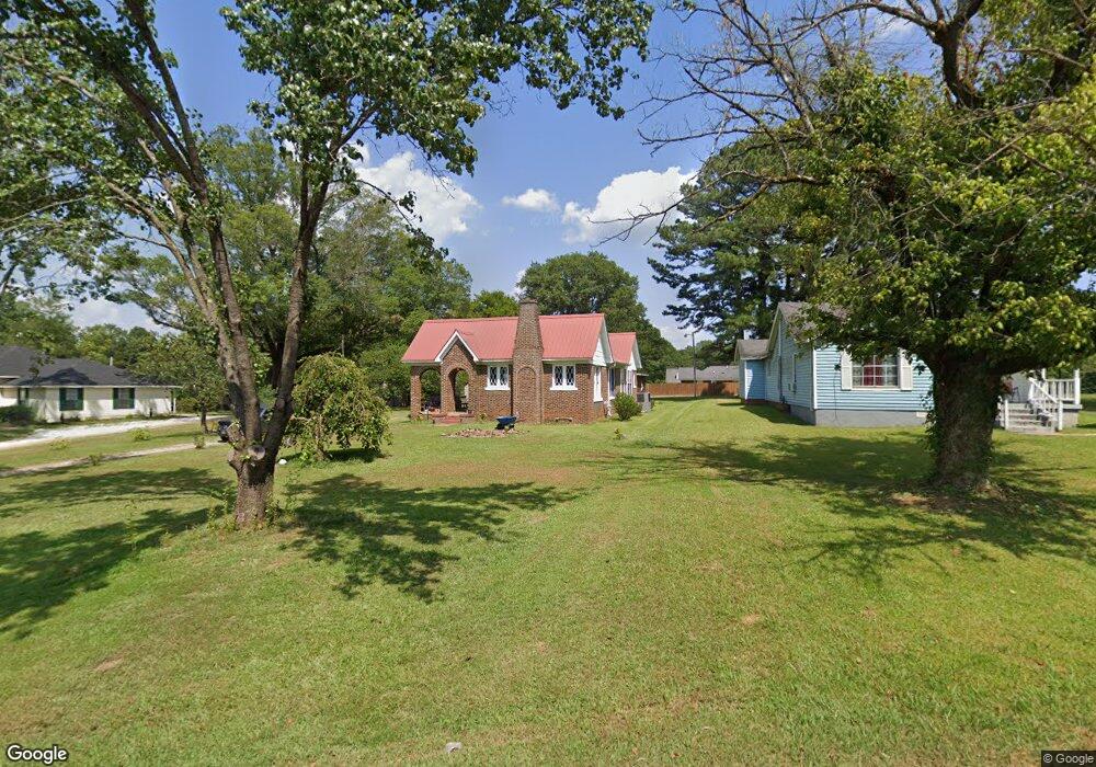
324 Substation Rd New Albany, MI 38652
Estimated Value: $116,000 - $171,000
2
Beds
1
Bath
1,434
Sq Ft
$104/Sq Ft
Est. Value
About This Home
This home is located at 324 Substation Rd, New Albany, MI 38652 and is currently estimated at $149,731, approximately $104 per square foot. 324 Substation Rd is a home located in Union County with nearby schools including New Albany Elementary School, New Albany/S.Tippah/Union County Alternative School, and New Albany Middle School.
Ownership History
Date
Name
Owned For
Owner Type
Purchase Details
Closed on
Dec 13, 2018
Sold by
Porter Ted Trussell
Bought by
Dean Provence Endowment For Excellence
Current Estimated Value
Purchase Details
Closed on
Sep 27, 2017
Sold by
Jpmorgan Chase Bank National Associatio
Bought by
Maxey David R
Home Financials for this Owner
Home Financials are based on the most recent Mortgage that was taken out on this home.
Original Mortgage
$55,574
Interest Rate
3.95%
Mortgage Type
Unknown
Purchase Details
Closed on
Aug 27, 2008
Sold by
Carroll Mary Alexander and Carroll Johnny
Bought by
Rogers Zack and Rogers Emily
Create a Home Valuation Report for This Property
The Home Valuation Report is an in-depth analysis detailing your home's value as well as a comparison with similar homes in the area
Home Values in the Area
Average Home Value in this Area
Purchase History
| Date | Buyer | Sale Price | Title Company |
|---|---|---|---|
| Dean Provence Endowment For Excellence | -- | None Available | |
| Maxey David R | -- | None Available | |
| Rogers Zack | -- | -- |
Source: Public Records
Mortgage History
| Date | Status | Borrower | Loan Amount |
|---|---|---|---|
| Previous Owner | Maxey David R | $55,574 |
Source: Public Records
Tax History Compared to Growth
Tax History
| Year | Tax Paid | Tax Assessment Tax Assessment Total Assessment is a certain percentage of the fair market value that is determined by local assessors to be the total taxable value of land and additions on the property. | Land | Improvement |
|---|---|---|---|---|
| 2025 | $674 | $6,550 | $0 | $0 |
| 2024 | $674 | $6,550 | $0 | $0 |
| 2023 | $676 | $6,550 | $0 | $0 |
| 2022 | $550 | $5,315 | $0 | $0 |
| 2021 | $506 | $5,066 | $0 | $0 |
| 2020 | $506 | $5,066 | $0 | $0 |
| 2019 | $506 | $5,066 | $0 | $0 |
| 2018 | $1,008 | $7,191 | $0 | $0 |
| 2017 | $979 | $7,191 | $0 | $0 |
| 2016 | $947 | $7,191 | $0 | $0 |
| 2015 | -- | $4,794 | $0 | $0 |
| 2014 | -- | $4,383 | $0 | $0 |
Source: Public Records
Map
Nearby Homes
- Lot 82 Sarah Grace Ln
- 0 Cr 371 Unit 22-3931
- Lot 18 Sarah Grace Ln
- Lot 84 Sara Grace Ln
- Lot 81 Sarah Grace Ln
- 410 Pineridge Dr
- 917 N Acre Dr
- 504 Hobson St
- 0 Bryan Lot 11 St Unit 22-1105
- 0 North St
- 0 Bryan Lot 4 St Unit 22-1103
- 0 Bryan Lot 6 St Unit 22-1104
- Lot 3 Bryan St
- 0 Bryan St
- 313 Garfield St
- 409 Broad St
- 400 Alabama St
- 211 E Main St
- 203 Alabama St
- 0 Denmill Rd
- 324 Sub Station Rd
- 324 Sub Station Rd
- 324 Sub-Station Rd
- 322 Sub Station Rd
- 714 Highland Cir
- 320 Sub Station Rd
- 319 Sub Station Rd
- 323 Substation Rd
- 323 Sub Station Rd
- 711 Highland Cir
- 711 Highland Dr
- 319 Sub Station Rd
- 104 Cotton Patch Dr
- 320 Sub Station Rd
- 319 Substation Rd
- 320 Substation Rd
- 711 Highland Cr
- 100 Cotton Patch St
- 900 Garrison St
- 318 Sub Station Rd