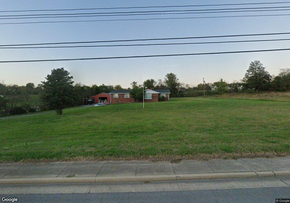
3241 Lebanon Rd Lebanon, TN 37087
Estimated Value: $444,000 - $628,000
--
Bed
2
Baths
2,126
Sq Ft
$256/Sq Ft
Est. Value
About This Home
This home is located at 3241 Lebanon Rd, Lebanon, TN 37087 and is currently estimated at $544,745, approximately $256 per square foot. 3241 Lebanon Rd is a home located in Wilson County with nearby schools including Coles Ferry Elementary School, Walter J. Baird Middle School, and Lebanon High School.
Ownership History
Date
Name
Owned For
Owner Type
Purchase Details
Closed on
Sep 14, 2012
Sold by
Federal National Mortgage Association
Bought by
Millerand Matthew D
Current Estimated Value
Home Financials for this Owner
Home Financials are based on the most recent Mortgage that was taken out on this home.
Original Mortgage
$132,405
Outstanding Balance
$92,093
Interest Rate
3.68%
Mortgage Type
Commercial
Estimated Equity
$452,652
Purchase Details
Closed on
Mar 15, 2012
Sold by
Campbell Barbara M
Bought by
Federal National Mtg Associati
Purchase Details
Closed on
Aug 1, 2002
Sold by
Robinson Newton W and Robinson Ida O
Bought by
Cambell Barbara M
Home Financials for this Owner
Home Financials are based on the most recent Mortgage that was taken out on this home.
Original Mortgage
$153,784
Interest Rate
6.52%
Purchase Details
Closed on
Jan 9, 1964
Bought by
Robinson Houston Sr & Odean A
Create a Home Valuation Report for This Property
The Home Valuation Report is an in-depth analysis detailing your home's value as well as a comparison with similar homes in the area
Home Values in the Area
Average Home Value in this Area
Purchase History
| Date | Buyer | Sale Price | Title Company |
|---|---|---|---|
| Millerand Matthew D | $136,500 | -- | |
| Federal National Mtg Associati | $181,653 | -- | |
| Cambell Barbara M | $155,000 | -- | |
| Robinson Houston Sr & Odean A | -- | -- |
Source: Public Records
Mortgage History
| Date | Status | Borrower | Loan Amount |
|---|---|---|---|
| Open | Millerand Matthew D | $132,405 | |
| Previous Owner | Robinson Houston Sr & Odean A | $153,784 |
Source: Public Records
Tax History Compared to Growth
Tax History
| Year | Tax Paid | Tax Assessment Tax Assessment Total Assessment is a certain percentage of the fair market value that is determined by local assessors to be the total taxable value of land and additions on the property. | Land | Improvement |
|---|---|---|---|---|
| 2024 | $2,115 | $95,850 | $27,375 | $68,475 |
| 2022 | $2,772 | $95,850 | $27,375 | $68,475 |
| 2021 | $2,655 | $95,850 | $27,375 | $68,475 |
| 2020 | $1,956 | $91,800 | $27,375 | $64,425 |
| 2019 | $446 | $52,050 | $16,650 | $35,400 |
| 2018 | $1,826 | $52,050 | $16,650 | $35,400 |
| 2017 | $1,826 | $52,050 | $16,650 | $35,400 |
| 2016 | $1,826 | $52,050 | $16,650 | $35,400 |
| 2015 | $1,888 | $52,050 | $16,650 | $35,400 |
| 2014 | $1,718 | $47,344 | $0 | $0 |
Source: Public Records
Map
Nearby Homes
- 108 Southfork Dr
- 0 Palmer Rd
- 523 Medwyk Dr
- 119 Fister Dr
- 1063 River Oaks Blvd
- 2019 Arlington Rd
- 2008 Hedgelawn Dr
- 0 Horn Springs Rd Unit RTC2822257
- 0 Horn Springs Rd Unit RTC2822266
- 0 Horn Springs Rd Unit RTC2780684
- 311 Five Oaks Blvd
- 3 Horn Springs Rd
- 1930 Arlington Rd
- 1920 Hampton Dr
- The McGinnis Plan at Stratford Station
- The Langford Plan at Stratford Station
- The Palmer Plan at Stratford Station
- The Braselton II Plan at Stratford Station
- The Harrington Plan at Stratford Station
- The Peachtree Plan at Stratford Station
- 3230 Lebanon Rd
- 100 Southfork Dr
- 3240 Lebanon Rd
- 104 Southfork Dr
- 0 Highway 70 E
- 101 Southfork Dr
- 106 Southfork Dr
- 105 Southfork Dr
- 101 Jarod Way
- 2217 Ewing Dr
- 3075 Lebanon Rd
- 2213 Ewing Dr
- 2303 Tintern Rd
- 2406 Kaycee Ct
- 2401 Kaycee Ct
- 2405 Kaycee Ct
- 2409 Kaycee Ct
- 2221 Ewing Dr
- 2209 Ewing Dr
- 106 Jarod Way