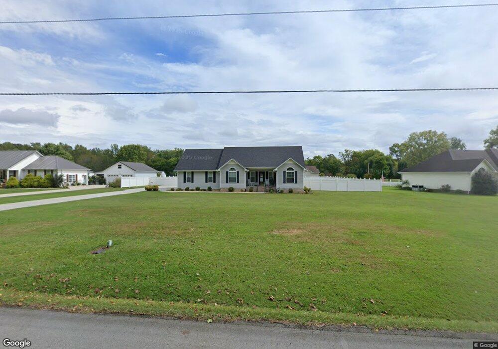
3243 Wayside Rd Manchester, TN 37355
Estimated Value: $278,461 - $334,000
--
Bed
2
Baths
1,650
Sq Ft
$189/Sq Ft
Est. Value
About This Home
This home is located at 3243 Wayside Rd, Manchester, TN 37355 and is currently estimated at $311,115, approximately $188 per square foot. 3243 Wayside Rd is a home located in Coffee County with nearby schools including East Coffee Elementary School, Coffee County Middle School, and Coffee County Central High School.
Ownership History
Date
Name
Owned For
Owner Type
Purchase Details
Closed on
Apr 30, 2002
Sold by
Freeze Ronnie and Freeze Dorothy
Bought by
Moore Harold D and Moore Phyllis J
Current Estimated Value
Home Financials for this Owner
Home Financials are based on the most recent Mortgage that was taken out on this home.
Original Mortgage
$115,000
Outstanding Balance
$49,413
Interest Rate
7.18%
Mortgage Type
VA
Estimated Equity
$261,702
Create a Home Valuation Report for This Property
The Home Valuation Report is an in-depth analysis detailing your home's value as well as a comparison with similar homes in the area
Home Values in the Area
Average Home Value in this Area
Purchase History
| Date | Buyer | Sale Price | Title Company |
|---|---|---|---|
| Moore Harold D | $115,000 | -- |
Source: Public Records
Mortgage History
| Date | Status | Borrower | Loan Amount |
|---|---|---|---|
| Open | Moore Harold D | $115,000 |
Source: Public Records
Tax History Compared to Growth
Tax History
| Year | Tax Paid | Tax Assessment Tax Assessment Total Assessment is a certain percentage of the fair market value that is determined by local assessors to be the total taxable value of land and additions on the property. | Land | Improvement |
|---|---|---|---|---|
| 2024 | $1,087 | $46,650 | $4,150 | $42,500 |
| 2023 | $1,087 | $46,650 | $0 | $0 |
| 2022 | $1,087 | $46,650 | $4,150 | $42,500 |
| 2021 | $1,031 | $35,150 | $3,425 | $31,725 |
| 2020 | $1,031 | $35,150 | $3,425 | $31,725 |
| 2019 | $1,031 | $35,150 | $3,425 | $31,725 |
| 2018 | $1,031 | $35,150 | $3,425 | $31,725 |
| 2017 | $1,070 | $32,800 | $3,825 | $28,975 |
| 2016 | $1,070 | $32,800 | $3,825 | $28,975 |
| 2015 | $1,070 | $32,800 | $3,825 | $28,975 |
| 2014 | $1,070 | $32,793 | $0 | $0 |
Source: Public Records
Map
Nearby Homes
- 670 Old McMinnville Hwy
- 4282 McMinnville Hwy Unit 4270
- 781 Circle Dr
- 837 Circle Dr
- 2635 Pete Sain Rd
- 1270 Taylor Rd
- 3313 McMinnville Hwy
- 363 Willow Brook Dr
- 300 Willow Brook Dr
- 499 Ridgewood Dr
- 0 Pete Sain Rd
- 166 Keele Rd
- 667 Pete Sain Rd
- 2315 Ragsdale Rd
- 106 Grandview Dr
- 74 Grandview Dr
- 442 Crouch Rd
- 304 W Lynn Dr
- 621 Brandon Rd
- 532 Summitville Rd
- 459 Old McMinnville Hwy
- 3215 Wayside Rd
- 3250 Wayside Rd
- 489 Old McMinnville Hwy Unit 489
- 3280 Wayside Rd
- 3181 Wayside Rd
- 454 Old McMinnville Hwy Unit 454
- 523 Old McMinnville Hwy Unit 523
- 405 Old McMinnville Hwy
- 510 Old McMinnville Hwy Unit 510
- 3244 Wayside Rd
- 3151 Wayside Rd
- 3109 Wayside Rd
- 323 Old McMinnville Hwy
- 3090 Wayside Rd
- 621 Old McMinnville Hwy Unit 621
- 604 Old McMinnville Hwy
- 3046 Wayside Rd
- 4789 McMinnville Hwy
- 4887 McMinnville Hwy Unit 4887