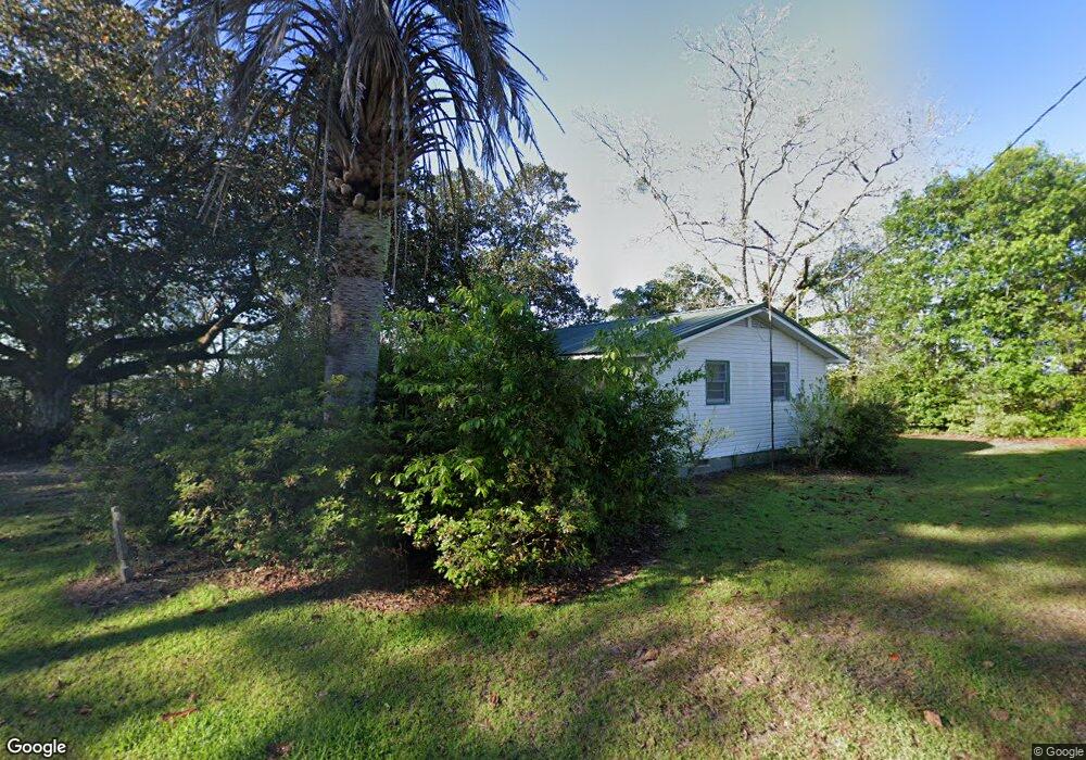
3244 Hiers Rd Barney, GA 31625
Estimated Value: $120,261 - $156,000
--
Bed
1
Bath
1,128
Sq Ft
$124/Sq Ft
Est. Value
About This Home
This home is located at 3244 Hiers Rd, Barney, GA 31625 and is currently estimated at $139,815, approximately $123 per square foot. 3244 Hiers Rd is a home located in Brooks County with nearby schools including North Brooks Elementary School.
Ownership History
Date
Name
Owned For
Owner Type
Purchase Details
Closed on
Feb 19, 2021
Sold by
Uher Living Trust
Bought by
Hiers Timothy F
Current Estimated Value
Purchase Details
Closed on
Sep 22, 2015
Sold by
Uher Mary Nell Bethea
Bought by
Uher Liv Trust
Purchase Details
Closed on
May 8, 2015
Sold by
Uher Mary Nell Bethea
Bought by
Sapp James Clenton
Home Financials for this Owner
Home Financials are based on the most recent Mortgage that was taken out on this home.
Original Mortgage
$114,500
Interest Rate
3.75%
Mortgage Type
New Conventional
Purchase Details
Closed on
Apr 14, 2011
Sold by
Uher Mary Nell Bethea and Uher Robert
Bought by
Conservation Use Covenant Recording
Purchase Details
Closed on
Dec 31, 2010
Sold by
Uher Mary Nell
Bought by
Uher Robert F
Purchase Details
Closed on
May 3, 1999
Sold by
Uher Mary Nell Bethea W and Uher Le
Bought by
Uher Mary Nell Bethea
Purchase Details
Closed on
Feb 15, 1995
Sold by
Bethea Myrtle Morrison
Bought by
Uher Mary Nell Bethea W and Uher Le
Create a Home Valuation Report for This Property
The Home Valuation Report is an in-depth analysis detailing your home's value as well as a comparison with similar homes in the area
Home Values in the Area
Average Home Value in this Area
Purchase History
| Date | Buyer | Sale Price | Title Company |
|---|---|---|---|
| Hiers Timothy F | $65,000 | -- | |
| Uher Liv Trust | -- | -- | |
| Sapp James Clenton | $152,843 | -- | |
| Conservation Use Covenant Recording | -- | -- | |
| Uher Robert F | -- | -- | |
| Uher Mary Nell Bethea | -- | -- | |
| Uher Mary Nell Bethea W | -- | -- | |
| Bethea Myrtle Morrison | -- | -- |
Source: Public Records
Mortgage History
| Date | Status | Borrower | Loan Amount |
|---|---|---|---|
| Previous Owner | Sapp James Clenton | $114,500 |
Source: Public Records
Tax History Compared to Growth
Tax History
| Year | Tax Paid | Tax Assessment Tax Assessment Total Assessment is a certain percentage of the fair market value that is determined by local assessors to be the total taxable value of land and additions on the property. | Land | Improvement |
|---|---|---|---|---|
| 2024 | $1,431 | $41,028 | $10,720 | $30,308 |
| 2023 | $1,333 | $37,188 | $10,720 | $26,468 |
| 2022 | $1,113 | $30,028 | $10,240 | $19,788 |
| 2021 | $1,158 | $29,468 | $10,000 | $19,468 |
| 2020 | $823 | $29,628 | $10,000 | $19,628 |
| 2019 | $1,090 | $28,668 | $10,240 | $18,428 |
| 2018 | $802 | $27,468 | $8,720 | $18,748 |
| 2017 | $1,011 | $26,748 | $8,720 | $18,028 |
| 2016 | $1,053 | $27,028 | $8,720 | $18,308 |
| 2015 | -- | $103,988 | $81,760 | $22,228 |
| 2014 | -- | $104,072 | $81,600 | $22,472 |
| 2013 | -- | $104,072 | $81,600 | $22,472 |
Source: Public Records
Map
Nearby Homes
- 916 Robinson Rd
- 9283 Tallokas Rd Unit 54/13
- 9283 Tallokas Rd
- 0 Burton Rd Unit 23760976
- 0 Burton Rd Unit 23669194
- 0 Southerland Ave
- 410 Railroad St
- 11439 Adel Hwy
- 165 Fletcher St
- 168 Azalea St
- 85 Hitch St
- 313 Langford St
- 8774 Antioch Rd
- 1440 Peach Rd
- 2275 Old Coffee Rd
- 5808 Georgia 133
- 693 Old Quitman Annex Rd
- 8739 Folsom Rd
- 421 Best Cir
- 1136 Nesbitt Rd
- 842 Mitchell Cir
- 573 Mitchell Cir
- 1052 Mitchell Cir
- 1183 Mitchell Cir
- 1360 Mitchell Cir
- 1315 Mitchell Cir
- 14395 Moultrie Hwy
- 14355 Moultrie Hwy
- 14815 Moultrie Hwy
- 14815 Moultrie Hwy
- 14796 Moultrie Hwy
- 1168 Hiers Rd
- 1218 Hiers Rd
- 1532 Hiers Rd
- 1566 Hiers Rd
- 1355 Hiers Rd
- 1485 Hiers Rd
- 0000 Hwy 122 (284ac @$3500 Ac)