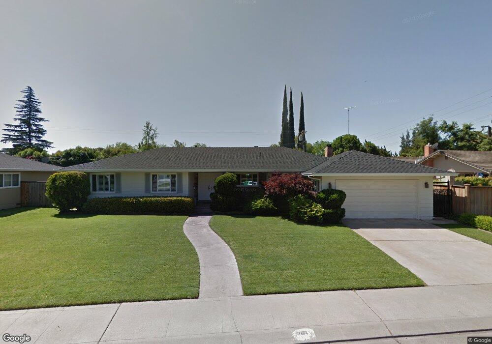
3244 Sheridan Way Unit 34 Stockton, CA 95219
Lincoln Village West NeighborhoodEstimated Value: $365,000 - $489,000
3
Beds
2
Baths
1,565
Sq Ft
$290/Sq Ft
Est. Value
About This Home
This home is located at 3244 Sheridan Way Unit 34, Stockton, CA 95219 and is currently estimated at $453,537, approximately $289 per square foot. 3244 Sheridan Way Unit 34 is a home located in San Joaquin County with nearby schools including Tully C. Knoles School, Sierra Middle School, and Lincoln High School.
Ownership History
Date
Name
Owned For
Owner Type
Purchase Details
Closed on
Feb 19, 2009
Sold by
Sohm Stephen D
Bought by
Sohm Stephen D and Sohm Julie L
Current Estimated Value
Home Financials for this Owner
Home Financials are based on the most recent Mortgage that was taken out on this home.
Original Mortgage
$50,000
Interest Rate
4.91%
Mortgage Type
New Conventional
Purchase Details
Closed on
Nov 12, 1998
Sold by
Sohm Frederick L and Sohm Judy D
Bought by
Sohm Stephen D
Create a Home Valuation Report for This Property
The Home Valuation Report is an in-depth analysis detailing your home's value as well as a comparison with similar homes in the area
Home Values in the Area
Average Home Value in this Area
Purchase History
| Date | Buyer | Sale Price | Title Company |
|---|---|---|---|
| Sohm Stephen D | -- | First American Title Company | |
| Sohm Stephen D | $53,000 | -- |
Source: Public Records
Mortgage History
| Date | Status | Borrower | Loan Amount |
|---|---|---|---|
| Previous Owner | Sohm Stephen D | $50,000 |
Source: Public Records
Tax History Compared to Growth
Tax History
| Year | Tax Paid | Tax Assessment Tax Assessment Total Assessment is a certain percentage of the fair market value that is determined by local assessors to be the total taxable value of land and additions on the property. | Land | Improvement |
|---|---|---|---|---|
| 2025 | $4,885 | $224,982 | $72,553 | $152,429 |
| 2024 | $4,736 | $220,572 | $71,131 | $149,441 |
| 2023 | $4,654 | $216,248 | $69,737 | $146,511 |
| 2022 | $4,306 | $212,009 | $68,370 | $143,639 |
| 2021 | $4,232 | $207,853 | $67,030 | $140,823 |
| 2020 | $4,198 | $205,723 | $66,343 | $139,380 |
| 2019 | $4,159 | $201,691 | $65,043 | $136,648 |
| 2018 | $4,068 | $197,737 | $63,768 | $133,969 |
| 2017 | $4,020 | $193,861 | $62,518 | $131,343 |
| 2016 | $3,581 | $190,060 | $61,292 | $128,768 |
| 2015 | $3,791 | $187,205 | $60,371 | $126,834 |
| 2014 | $3,682 | $183,539 | $59,189 | $124,350 |
Source: Public Records
Map
Nearby Homes
- 3216 Polk Way
- 3115 Polk Way
- 6406 Grigsby Place
- 3533 Harpers Ferry Dr
- 3102 W Swain Rd
- 6123 Cumberland Place
- 6078 Carolina Cir
- 2921 Rutledge Ct
- 2935 Prentiss Ct Unit 1844
- 6827 Shiloh Ct
- 6415 Plymouth Rd
- 2922 Prentiss Ct
- 6845 Shiloh Ct
- 3708 N Merrimac Cir
- 2914 Prentiss Ct
- 5833 Morgan Place Unit 60
- 6724 Plymouth Rd Unit 90
- 6724 Plymouth Rd Unit 54
- 5815 Morgan Place Unit 18
- 3720 W Benjamin Holt Dr Unit 10
- 3226 Sheridan Way
- 6528 Herndon Place
- 3243 Rutledge Way
- 3229 Rutledge Way
- 3255 Rutledge Way
- 3218 Sheridan Way Unit 34
- 3241 Sheridan Way
- 3217 Rutledge Way
- 6610 Herndon Place Unit 34
- 3229 Sheridan Way
- 3206 Sheridan Way
- 6519 Herndon Place
- 3205 Rutledge Way
- 3217 Sheridan Way
- 6535 Herndon Place
- 3242 Rutledge Way
- 6507 Herndon Place
- 3226 Rutledge Way
- 3254 Rutledge Way
- 6605 Herndon Place