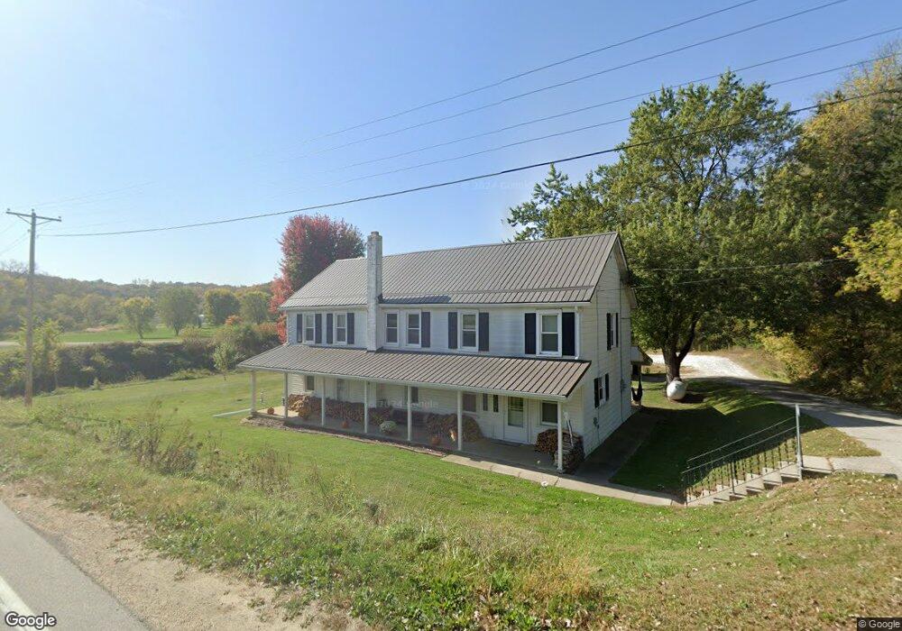
32471 Littleport Rd Edgewood, IA 52042
Estimated Value: $164,400 - $401,000
5
Beds
1
Bath
2,304
Sq Ft
$99/Sq Ft
Est. Value
About This Home
This home is located at 32471 Littleport Rd, Edgewood, IA 52042 and is currently estimated at $227,350, approximately $98 per square foot. 32471 Littleport Rd is a home located in Clayton County with nearby schools including Central Elementary School and Central Middle School/High School.
Ownership History
Date
Name
Owned For
Owner Type
Purchase Details
Closed on
May 11, 2007
Sold by
Schroeder Toby and Schroeder Tracy
Bought by
Brink Jason
Current Estimated Value
Purchase Details
Closed on
Mar 27, 2007
Sold by
Thurn Arleen M
Bought by
Schroeder Toby and Schroeder Tracy
Create a Home Valuation Report for This Property
The Home Valuation Report is an in-depth analysis detailing your home's value as well as a comparison with similar homes in the area
Home Values in the Area
Average Home Value in this Area
Purchase History
| Date | Buyer | Sale Price | Title Company |
|---|---|---|---|
| Brink Jason | $270,500 | Amrican Title & Escrow | |
| Schroeder Toby | $225,000 | None Available |
Source: Public Records
Tax History Compared to Growth
Tax History
| Year | Tax Paid | Tax Assessment Tax Assessment Total Assessment is a certain percentage of the fair market value that is determined by local assessors to be the total taxable value of land and additions on the property. | Land | Improvement |
|---|---|---|---|---|
| 2025 | $1,372 | $146,463 | $17,423 | $129,040 |
| 2024 | $1,330 | $121,756 | $15,150 | $106,606 |
| 2023 | $1,198 | $121,756 | $15,150 | $106,606 |
| 2022 | $1,156 | $95,076 | $15,200 | $79,876 |
| 2021 | $1,140 | $95,076 | $15,200 | $79,876 |
| 2020 | $1,140 | $90,969 | $15,200 | $75,769 |
| 2019 | $1,072 | $90,969 | $15,200 | $75,769 |
| 2018 | $1,072 | $83,813 | $15,200 | $68,613 |
| 2017 | $1,052 | $83,813 | $15,200 | $68,613 |
| 2015 | $530 | $50,458 | $7,290 | $43,168 |
| 2014 | $524 | $46,463 | $5,454 | $41,009 |
Source: Public Records
Map
Nearby Homes
- 0 Grandview Rd
- 27766 Highway 13
- 0 Trail Unit 731028
- Impala Rd
- 27455 Harbor Rd
- 209 2nd St SW
- 117 S Main St
- 301 N 1st St
- 0 E Bridge St
- 302 N 3rd St
- 305 Peterson St
- 702 N Main St
- 707 N Main St
- 710 Woodland Dr NW
- 407 W Newton St
- 306 & 400 N Chestnut St
- 302 E Harrison St
- 209 Woods Edge Dr
- 247 Franzen Ridge Rd
- 249 Franzen Ridge Rd
- 32388 Littleport Rd
- 32385 Littleport Rd
- 32409 Littleport Rd
- 21970 325th St
- 322 Nd St
- 22080 325th St
- 22097 325th St
- 32623 Elm Rd
- 32437 Dinan Rd
- 22183 322nd St
- 32407 Dinan Rd
- 32137 Littleport Rd
- 32758 Elm Rd
- 32790 Elm Rd
- 21500 Dinan Rd
- 33088 Littleport Rd
- 31735 Littleport Rd
- 22673 322nd St
- 21976 Harvest Rd
- 21976 Harvest Rd