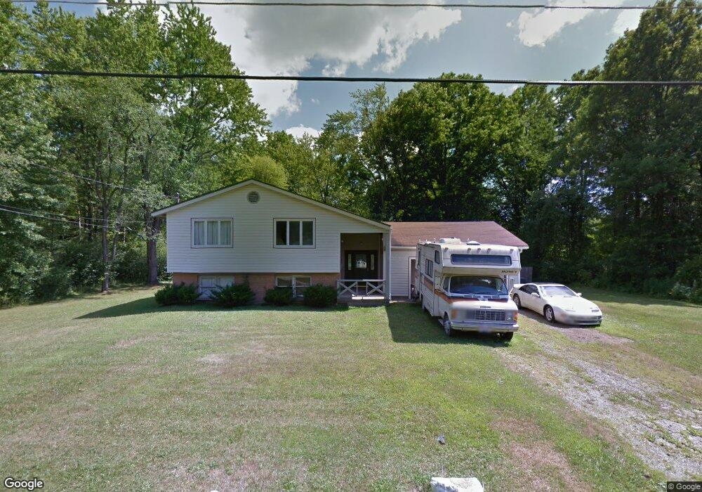
3249 Seifert Ave Youngstown, OH 44505
McGuffey Heights NeighborhoodEstimated Value: $83,561 - $105,000
4
Beds
2
Baths
1,872
Sq Ft
$49/Sq Ft
Est. Value
About This Home
This home is located at 3249 Seifert Ave, Youngstown, OH 44505 and is currently estimated at $92,640, approximately $49 per square foot. 3249 Seifert Ave is a home located in Mahoning County with nearby schools including M.L. King Elementary School, Williamson Elementary School, and East High School.
Ownership History
Date
Name
Owned For
Owner Type
Purchase Details
Closed on
May 1, 2014
Sold by
Fredericks Jon Michael and Fredericks John Michael
Bought by
Jones Betty J
Current Estimated Value
Purchase Details
Closed on
May 21, 2003
Sold by
Ucfc Loan Trust 1996-A1
Bought by
Laramie Cindy and Fredericks Ray
Purchase Details
Closed on
Dec 6, 2002
Sold by
Jones Frank and Jones Betty J
Bought by
Bankers Trust Co Of California
Purchase Details
Closed on
Jul 21, 1993
Bought by
Sec Of Hsng & Urban Dev
Create a Home Valuation Report for This Property
The Home Valuation Report is an in-depth analysis detailing your home's value as well as a comparison with similar homes in the area
Home Values in the Area
Average Home Value in this Area
Purchase History
| Date | Buyer | Sale Price | Title Company |
|---|---|---|---|
| Jones Betty J | $10,000 | Attorney | |
| Laramie Cindy | $10,000 | Accutitle Agency Inc | |
| Bankers Trust Co Of California | $2,200 | -- | |
| Sec Of Hsng & Urban Dev | -- | -- |
Source: Public Records
Tax History Compared to Growth
Tax History
| Year | Tax Paid | Tax Assessment Tax Assessment Total Assessment is a certain percentage of the fair market value that is determined by local assessors to be the total taxable value of land and additions on the property. | Land | Improvement |
|---|---|---|---|---|
| 2024 | $223 | $14,430 | $230 | $14,200 |
| 2023 | $251 | $14,430 | $230 | $14,200 |
| 2022 | $144 | $11,060 | $200 | $10,860 |
| 2021 | $144 | $11,060 | $200 | $10,860 |
| 2020 | $145 | $11,060 | $200 | $10,860 |
| 2019 | $107 | $10,230 | $180 | $10,050 |
| 2018 | $108 | $10,230 | $180 | $10,050 |
| 2017 | $105 | $10,230 | $180 | $10,050 |
| 2016 | $756 | $11,400 | $180 | $11,220 |
| 2015 | $740 | $11,400 | $180 | $11,220 |
| 2014 | -- | $11,400 | $180 | $11,220 |
| 2013 | $726 | $11,400 | $180 | $11,220 |
Source: Public Records
Map
Nearby Homes
- 2051 Blair Ave
- 2831 Benford Ln
- 2951 Megan Cir
- 2954 Megan Cir
- V/L Jacobs Rd
- 1720 Jacobs Rd
- 1214 Brighton St
- 665 Wendemere Dr
- 663 Meadowland Dr
- 531 Meadowland Dr
- 366 Westview Ave
- 1003 Liberty Rd
- 279 Parish Ave
- 269 Westview Ave
- 229 Jacobs Rd
- 254 Christian Ave
- 3317 Beechwood Dr
- 5843 Fairlawn Ave
- 1325 Miami Ave
- 902 Miami St
- 3242 Nelson Ave
- 3230 Nelson Ave
- 3207 Seifert Ave
- 3218 Nelson Ave
- 3210 Nelson Ave
- 3249 Nelson Ave
- 3318 Nelson Ave
- 0 Nelson Ave
- 3227 Nelson Ave
- 3231 Nelson Ave
- 3246 Orrin Ave
- 3244 Orrin Ave
- 3260 Orrin Ave
- 3234 Orrin Ave
- 3310 Orrin Ave
- 3206 Orrin Ave
- 3241 Orrin Ave
- 3237 Orrin Ave
- 3227 Orrin Ave
- 3355 Nelson Ave