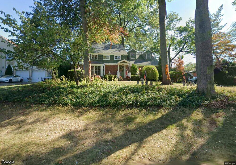
325 Chain o Hills Rd Colonia, NJ 07067
Estimated Value: $665,000 - $874,000
--
Bed
--
Bath
1,531
Sq Ft
$472/Sq Ft
Est. Value
About This Home
This home is located at 325 Chain o Hills Rd, Colonia, NJ 07067 and is currently estimated at $723,067, approximately $472 per square foot. 325 Chain o Hills Rd is a home located in Middlesex County with nearby schools including Robert Mascenik School #26, Iselin Middle School, and John F. Kennedy Memorial High School.
Ownership History
Date
Name
Owned For
Owner Type
Purchase Details
Closed on
May 9, 2004
Sold by
Deminski Kerry
Bought by
Nahrebne Nancy
Current Estimated Value
Home Financials for this Owner
Home Financials are based on the most recent Mortgage that was taken out on this home.
Original Mortgage
$240,000
Outstanding Balance
$116,390
Interest Rate
5.99%
Estimated Equity
$606,677
Purchase Details
Closed on
Dec 17, 1998
Sold by
Matsumoto Shinji
Bought by
Deminski Kerry and Deminski Carol
Home Financials for this Owner
Home Financials are based on the most recent Mortgage that was taken out on this home.
Original Mortgage
$237,500
Interest Rate
6.7%
Purchase Details
Closed on
May 7, 1994
Sold by
Dowiak Allan
Bought by
Matsumoto Shinji and Matsumoto Dorothy
Home Financials for this Owner
Home Financials are based on the most recent Mortgage that was taken out on this home.
Original Mortgage
$199,000
Interest Rate
8.51%
Create a Home Valuation Report for This Property
The Home Valuation Report is an in-depth analysis detailing your home's value as well as a comparison with similar homes in the area
Home Values in the Area
Average Home Value in this Area
Purchase History
| Date | Buyer | Sale Price | Title Company |
|---|---|---|---|
| Nahrebne Nancy | $389,900 | -- | |
| Deminski Kerry | $250,000 | -- | |
| Matsumoto Shinji | $249,000 | -- |
Source: Public Records
Mortgage History
| Date | Status | Borrower | Loan Amount |
|---|---|---|---|
| Open | Nahrebne Nancy | $240,000 | |
| Previous Owner | Deminski Kerry | $237,500 | |
| Previous Owner | Matsumoto Shinji | $199,000 |
Source: Public Records
Tax History Compared to Growth
Tax History
| Year | Tax Paid | Tax Assessment Tax Assessment Total Assessment is a certain percentage of the fair market value that is determined by local assessors to be the total taxable value of land and additions on the property. | Land | Improvement |
|---|---|---|---|---|
| 2025 | $14,913 | $121,900 | $32,100 | $89,800 |
| 2024 | $14,290 | $121,900 | $32,100 | $89,800 |
| 2023 | $14,290 | $121,900 | $32,100 | $89,800 |
| 2022 | $13,923 | $121,900 | $32,100 | $89,800 |
| 2021 | $13,804 | $121,900 | $32,100 | $89,800 |
| 2020 | $13,382 | $121,900 | $32,100 | $89,800 |
| 2019 | $13,222 | $121,900 | $32,100 | $89,800 |
| 2018 | $12,800 | $121,900 | $32,100 | $89,800 |
| 2017 | $12,567 | $121,900 | $32,100 | $89,800 |
| 2016 | $12,465 | $121,900 | $32,100 | $89,800 |
| 2015 | $12,255 | $121,900 | $32,100 | $89,800 |
| 2014 | $11,993 | $121,900 | $32,100 | $89,800 |
Source: Public Records
Map
Nearby Homes
- 47 Glendale Rd
- 101 W Hill Rd
- 145 Dover Rd
- 127 S Cliff Rd
- 68 Grand Ave
- 15 Grand Ave
- 124 Lincoln Ave
- 479 Chain O' Hills Rd
- 109 S Harrison Ave
- 105 Grand Ave
- 93 N Washington Ave
- 75 S Mckinley Ave
- 44 N Washington Ave
- 220 Elizabeth Ave
- 77 Union St
- 990 Rebecca Place
- 119 Bedford Ave
- 10 Benedict Way
- 188 Bloomfield Ave
- 135 Bond St
- 325 Chain O' Hills Rd
- 331 Chain o Hills Rd
- 331 Chain O' Hills Rd
- 319 Chain o Hills Rd
- 313 Chain o Hills Rd
- 337 Chain o Hills Rd
- 34 W Hill Rd
- 36 W Hill Rd
- 40 W Hill Rd
- 28 W Hill Rd
- 309 Chain O' Hills Rd
- 345 Chain o Hills Rd
- 22 W Hill Rd
- 16 W Hill Rd
- 44 W Hill Rd
- 12 W Hill Rd
- 305 Chain o Hills Rd
- 48 W Hill Rd
- 35 W Hill Rd
- 29 W Hill Rd