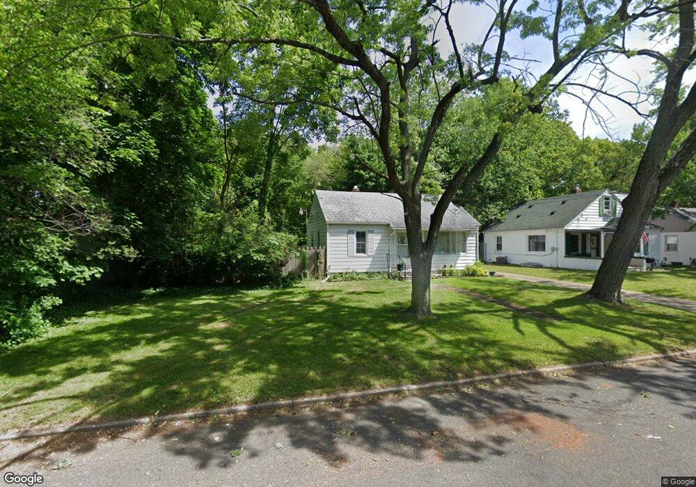
325 Cornell Dr Battle Creek, MI 49017
Northeast Battle Creek NeighborhoodEstimated Value: $114,000 - $120,634
2
Beds
1
Bath
720
Sq Ft
$162/Sq Ft
Est. Value
About This Home
This home is located at 325 Cornell Dr, Battle Creek, MI 49017 and is currently estimated at $116,659, approximately $162 per square foot. 325 Cornell Dr is a home located in Calhoun County with nearby schools including Verona Elementary School, Northwestern Middle School, and Battle Creek Central High School.
Ownership History
Date
Name
Owned For
Owner Type
Purchase Details
Closed on
Nov 22, 2010
Sold by
Paulino Isiriel Nmn
Bought by
Paulino Liz Eslendy
Current Estimated Value
Purchase Details
Closed on
May 7, 2004
Sold by
Paulino Isiriel and Paulino Liz
Bought by
Paulino Isiriel and Paulino Liz
Purchase Details
Closed on
Apr 13, 2004
Sold by
Us Bank Na
Bought by
Paulino Isiriel
Purchase Details
Closed on
Jul 2, 2003
Bought by
U.S. Bank National Assoc
Purchase Details
Closed on
Dec 20, 2002
Sold by
Jackson Larry A
Bought by
Equicredit Corporation
Purchase Details
Closed on
Mar 15, 1999
Bought by
Jackson
Purchase Details
Closed on
Jul 26, 1996
Bought by
Lapekas and Ivany
Create a Home Valuation Report for This Property
The Home Valuation Report is an in-depth analysis detailing your home's value as well as a comparison with similar homes in the area
Home Values in the Area
Average Home Value in this Area
Purchase History
| Date | Buyer | Sale Price | Title Company |
|---|---|---|---|
| Paulino Liz Eslendy | -- | None Available | |
| Paulino Isiriel | -- | Fatic | |
| Paulino Isiriel | $54,500 | Fatic | |
| U.S. Bank National Assoc | -- | -- | |
| Equicredit Corporation | $56,000 | -- | |
| Jackson | $45,100 | -- | |
| Lapekas | $45,000 | -- |
Source: Public Records
Tax History Compared to Growth
Tax History
| Year | Tax Paid | Tax Assessment Tax Assessment Total Assessment is a certain percentage of the fair market value that is determined by local assessors to be the total taxable value of land and additions on the property. | Land | Improvement |
|---|---|---|---|---|
| 2025 | -- | $42,000 | $0 | $0 |
| 2024 | $830 | $37,551 | $0 | $0 |
| 2023 | $949 | $31,863 | $0 | $0 |
| 2022 | $750 | $29,560 | $0 | $0 |
| 2021 | $895 | $24,690 | $0 | $0 |
| 2020 | $842 | $24,869 | $0 | $0 |
| 2019 | $839 | $23,166 | $0 | $0 |
| 2018 | $839 | $20,750 | $2,236 | $18,514 |
| 2017 | $813 | $20,984 | $0 | $0 |
| 2016 | $812 | $20,790 | $0 | $0 |
| 2015 | $1,054 | $17,535 | $4,094 | $13,441 |
| 2014 | $1,054 | $22,882 | $4,094 | $18,788 |
Source: Public Records
Map
Nearby Homes
- 276 Mckinley Ave N
- 274 Central St
- 261 Emmett St E
- 195 Union St N
- 292 Hunter St
- 21 Bryant St
- 176 Union St N
- 174 East Ave N
- 495 Emmett St E
- 162 Orchard Ave
- 31 Oxford St
- 561 Garrison Rd
- 40 Oxford St
- 90 N Broad St
- 731 Roosevelt Ave E
- 955 Capital Ave NE
- 20 Piper Ave
- 179 Bryant St
- 78 Central St
- 170 Sherman Rd
- 329 Cornell Dr
- 333 Cornell Dr
- 319 Cornell Dr
- 315 Cornell Dr
- 337 Cornell Dr
- 311 Cornell Dr
- 326 Cornell Dr
- 322 Cornell Dr
- 330 Cornell Dr
- 341 Cornell Dr
- 314 Cornell Dr
- 310 Cornell Dr
- 303 Cornell Dr
- 338 Cornell Dr
- 345 Cornell Dr
- 342 Cornell Dr
- 302 Cornell Dr
- 327 Pleasantview Dr
- 323 Pleasantview Dr
- 346 Cornell Dr