325 Division St South Elgin, IL 60177
Estimated Value: $260,000 - $335,000
5
Beds
2
Baths
1,287
Sq Ft
$241/Sq Ft
Est. Value
About This Home
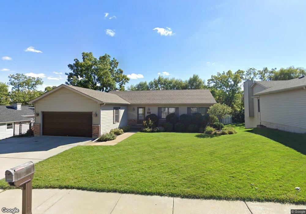
This home is located at 325 Division St, South Elgin, IL 60177 and is currently estimated at $309,815, approximately $240 per square foot. 325 Division St is a home located in Kane County with nearby schools including Willard Elementary School, Kenyon Woods Middle School, and South Elgin High School.
Ownership History
Date
Name
Owned For
Owner Type
Purchase Details
Closed on
Nov 27, 1996
Sold by
Miller Charles P
Bought by
Todd Daniel and Ehlers Kimberly S
Current Estimated Value
Home Financials for this Owner
Home Financials are based on the most recent Mortgage that was taken out on this home.
Original Mortgage
$128,850
Outstanding Balance
$13,346
Interest Rate
7.91%
Estimated Equity
$296,469
Create a Home Valuation Report for This Property
The Home Valuation Report is an in-depth analysis detailing your home's value as well as a comparison with similar homes in the area
Home Values in the Area
Average Home Value in this Area
Purchase History
| Date | Buyer | Sale Price | Title Company |
|---|---|---|---|
| Todd Daniel | $143,500 | Chicago Title Insurance Co |
Source: Public Records
Mortgage History
| Date | Status | Borrower | Loan Amount |
|---|---|---|---|
| Open | Todd Daniel | $128,850 |
Source: Public Records
Tax History Compared to Growth
Tax History
| Year | Tax Paid | Tax Assessment Tax Assessment Total Assessment is a certain percentage of the fair market value that is determined by local assessors to be the total taxable value of land and additions on the property. | Land | Improvement |
|---|---|---|---|---|
| 2024 | $5,579 | $86,693 | $19,391 | $67,302 |
| 2023 | $5,229 | $78,320 | $17,518 | $60,802 |
| 2022 | $5,199 | $71,414 | $15,973 | $55,441 |
| 2021 | $4,857 | $66,767 | $14,934 | $51,833 |
| 2020 | $4,683 | $63,740 | $14,257 | $49,483 |
| 2019 | $4,480 | $60,717 | $13,581 | $47,136 |
| 2018 | $4,354 | $57,199 | $12,794 | $44,405 |
| 2017 | $4,101 | $54,074 | $12,095 | $41,979 |
| 2016 | $3,855 | $50,166 | $11,221 | $38,945 |
| 2015 | -- | $45,982 | $10,285 | $35,697 |
| 2014 | -- | $45,414 | $10,158 | $35,256 |
| 2013 | -- | $46,612 | $10,426 | $36,186 |
Source: Public Records
Map
Nearby Homes
- 120 Melrose Ct
- 194 S Collins St
- 1071 Moraine Dr
- 1078 Moraine Dr
- 1066 Moraine Dr
- 1017 Atterberg Rd
- 1015 Atterberg Rd
- 300 N South Elgin Blvd
- 1063 Manchester Ct Unit 1
- 3 Brandywine Ct
- 339 Hartman Ct
- 399 Fulton St Unit 2
- 303 Ann St
- 1502 Kinwood Rd
- 207 Bexley St
- 1506 Kinwood Rd
- 205 Bexley St
- 1510 Kinwood Rd
- 121 Pinehill St
- 203 Bexley St
- 345 Division St
- 365 Division St
- 300 Division St
- 320 Division St
- 297 Division St
- 375 Division St
- 340 Division St
- 296 Division St
- 277 Quarry St
- 534 N Walnut St
- 620 N La Fox St
- 755 N Walnut St
- 535 N Walnut St
- 328 Kossuth St
- 768 N Walnut St
- 506 N Walnut St
- 396 Kossuth St
- 1881 Harwood Ave
- 1889 Harwood Ave
- 1890 Harwood Ave