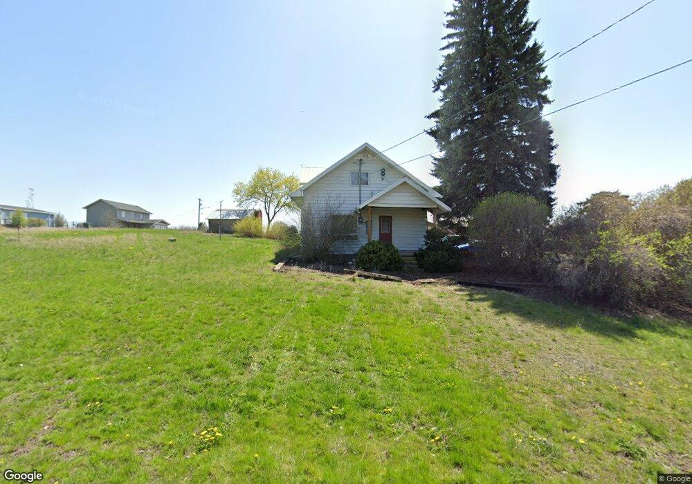
325 E 5th St Spangle, WA 99031
Estimated Value: $291,435 - $384,000
3
Beds
2
Baths
1,574
Sq Ft
$207/Sq Ft
Est. Value
About This Home
This home is located at 325 E 5th St, Spangle, WA 99031 and is currently estimated at $325,609, approximately $206 per square foot. 325 E 5th St is a home with nearby schools including Liberty Elementary/Junior High School, Liberty High School, and Upper Columbia Academy - Elementary School.
Ownership History
Date
Name
Owned For
Owner Type
Purchase Details
Closed on
Jul 19, 2016
Sold by
Baird Timothy and Baird Angela
Bought by
Baird Josh M
Current Estimated Value
Home Financials for this Owner
Home Financials are based on the most recent Mortgage that was taken out on this home.
Original Mortgage
$93,000
Outstanding Balance
$74,290
Interest Rate
3.6%
Mortgage Type
New Conventional
Estimated Equity
$251,319
Purchase Details
Closed on
Oct 26, 2006
Sold by
Parker Peggy J and Johnson Peggy J
Bought by
Baird Timothy and Baird Angela
Home Financials for this Owner
Home Financials are based on the most recent Mortgage that was taken out on this home.
Original Mortgage
$60,000
Interest Rate
6.39%
Mortgage Type
Seller Take Back
Purchase Details
Closed on
Sep 16, 2002
Sold by
Cunningham Velma
Bought by
Johnson Peggy J
Create a Home Valuation Report for This Property
The Home Valuation Report is an in-depth analysis detailing your home's value as well as a comparison with similar homes in the area
Purchase History
| Date | Buyer | Sale Price | Title Company |
|---|---|---|---|
| Baird Josh M | $145,308 | First American Title Ins Co | |
| Baird Timothy | $60,000 | Transnation Title | |
| Johnson Peggy J | -- | -- |
Source: Public Records
Mortgage History
| Date | Status | Borrower | Loan Amount |
|---|---|---|---|
| Open | Baird Josh M | $93,000 | |
| Previous Owner | Baird Timothy | $60,000 |
Source: Public Records
Tax History
| Year | Tax Paid | Tax Assessment Tax Assessment Total Assessment is a certain percentage of the fair market value that is determined by local assessors to be the total taxable value of land and additions on the property. | Land | Improvement |
|---|---|---|---|---|
| 2025 | $2,330 | $229,600 | $45,000 | $184,600 |
| 2024 | $2,330 | $241,700 | $52,500 | $189,200 |
| 2023 | $1,817 | $219,600 | $52,500 | $167,100 |
| 2022 | $1,885 | $215,400 | $48,300 | $167,100 |
| 2021 | $1,937 | $158,350 | $36,750 | $121,600 |
| 2020 | $1,949 | $153,070 | $35,070 | $118,000 |
| 2019 | $1,748 | $140,180 | $31,080 | $109,100 |
| 2018 | $1,765 | $121,390 | $22,890 | $98,500 |
| 2017 | $1,390 | $96,580 | $14,280 | $82,300 |
| 2016 | $1,325 | $98,880 | $14,280 | $84,600 |
| 2015 | $1,346 | $95,880 | $15,780 | $80,100 |
| 2014 | -- | $93,480 | $15,780 | $77,700 |
| 2013 | -- | $0 | $0 | $0 |
Source: Public Records
Map
Nearby Homes
- 365 N Pine St
- 205 E 1st St
- Lot 2 Nka Cheney Spangle Rd Unit Parcel 32085.9041
- 3013 E Watt Rd
- 1112 E Jennings Rd
- XXX E Cornwall Rd
- 102 E Cameron Rd
- 1403 W Jennings Rd
- 20xxx S Parker Rd
- 22711 S Gateway Ln
- 6919 E Spangle Waverly Rd
- 497 E Stutler Rd
- 0 Unassigned Address Rd Unit SAR202513397
- 18206 S Hanson Pond Ln
- 19212 S Aspen Meadows Dr
- 177XX S Smythe Rd
- nka Unassigned Address Rd
- 15010 S Stentz Rd
- 17901 S Aspen Meadows Dr
- 16771 S Sherman Rd
Your Personal Tour Guide
Ask me questions while you tour the home.