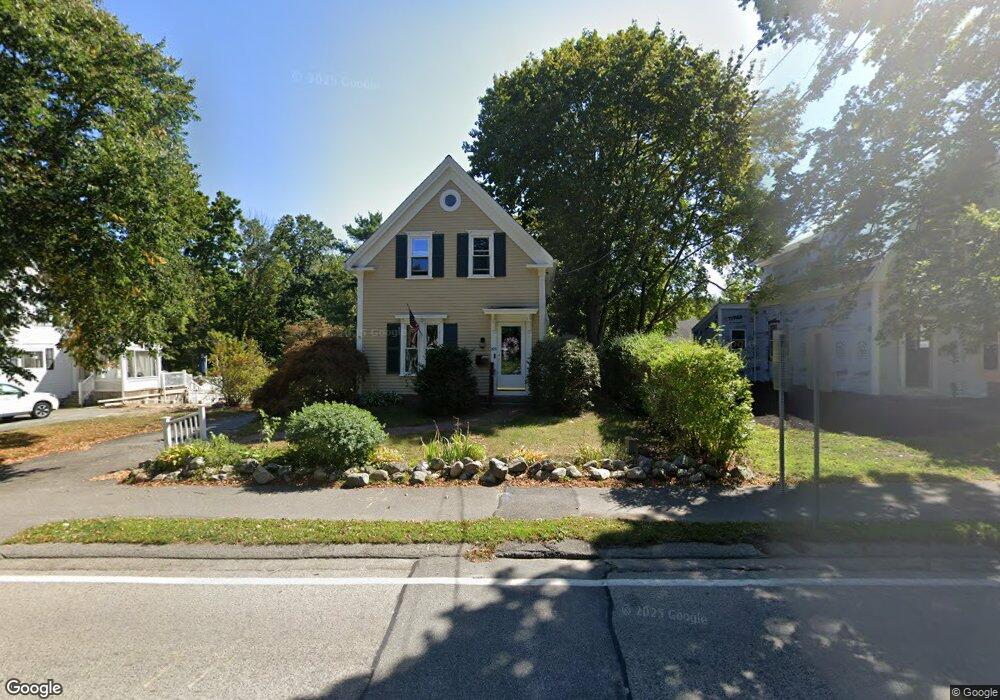
325 Gannett Rd Scituate, MA 02066
Estimated Value: $781,880 - $1,023,000
4
Beds
2
Baths
1,995
Sq Ft
$463/Sq Ft
Est. Value
About This Home
This home is located at 325 Gannett Rd, Scituate, MA 02066 and is currently estimated at $922,720, approximately $462 per square foot. 325 Gannett Rd is a home located in Plymouth County with nearby schools including Hatherly Elementary School, Lester J. Gates Middle School, and Scituate High School.
Ownership History
Date
Name
Owned For
Owner Type
Purchase Details
Closed on
Dec 6, 1990
Sold by
Hopkins Michael S
Bought by
Connelly Paul J
Current Estimated Value
Purchase Details
Closed on
Mar 27, 1987
Sold by
Amara John J
Bought by
Hopkins Michael S
Create a Home Valuation Report for This Property
The Home Valuation Report is an in-depth analysis detailing your home's value as well as a comparison with similar homes in the area
Home Values in the Area
Average Home Value in this Area
Purchase History
| Date | Buyer | Sale Price | Title Company |
|---|---|---|---|
| Connelly Paul J | $163,000 | -- | |
| Hopkins Michael S | $205,000 | -- |
Source: Public Records
Mortgage History
| Date | Status | Borrower | Loan Amount |
|---|---|---|---|
| Open | Hopkins Michael S | $328,000 | |
| Closed | Hopkins Michael S | $60,000 | |
| Closed | Hopkins Michael S | $250,000 |
Source: Public Records
Tax History Compared to Growth
Tax History
| Year | Tax Paid | Tax Assessment Tax Assessment Total Assessment is a certain percentage of the fair market value that is determined by local assessors to be the total taxable value of land and additions on the property. | Land | Improvement |
|---|---|---|---|---|
| 2025 | $7,025 | $703,200 | $342,800 | $360,400 |
| 2024 | $6,944 | $670,300 | $311,600 | $358,700 |
| 2023 | $6,984 | $623,600 | $300,000 | $323,600 |
| 2022 | $6,984 | $553,400 | $281,900 | $271,500 |
| 2021 | $6,689 | $501,800 | $268,500 | $233,300 |
| 2020 | $6,487 | $480,500 | $258,100 | $222,400 |
| 2019 | $6,401 | $465,900 | $253,100 | $212,800 |
| 2018 | $6,229 | $446,500 | $255,200 | $191,300 |
| 2017 | $6,142 | $435,900 | $244,600 | $191,300 |
| 2016 | $5,759 | $407,300 | $223,300 | $184,000 |
| 2015 | $5,197 | $396,700 | $212,700 | $184,000 |
Source: Public Records
Map
Nearby Homes
- 26 Mordecai Lincoln Rd
- 817 Country Way
- 16 3 Ring Rd
- 392 S Main St
- 84 Booth Hill Rd
- 11 Forest Ln
- 9 Forest Ln Unit 9
- 7 Border St
- 112 Hollett St
- 8 Trudys Ln
- 40 Brewster Rd
- 309 S Main St
- 9 Kyle Path
- 70 Black Horse Ln
- 68 Black Horse Ln
- 29 Country Club Cir
- 212 S Main St
- 98 Black Horse Ln
- 100 Pond St Unit 10
- 14 Aberdeen Dr
- 323 Gannett Rd
- 317 Gannett Rd
- 334 Gannett Rd
- 335 Gannett Rd
- 326 Gannett Rd
- 337 Gannett Rd
- 340 Gannett Rd
- 330 Gannett Rd
- 330 Gannett Rd Unit 1
- 330 Gannett Rd Unit n/a
- 14 Village Ln
- 26 Wade St Unit 2
- 26 Wade St
- 24 Wade St
- 320 Gannett Rd
- 320 Gannett Rd Unit 1
- 10 Village Ln
- 999 Main Thoroughfare
- 18 Village Ln
- 16 Wade St