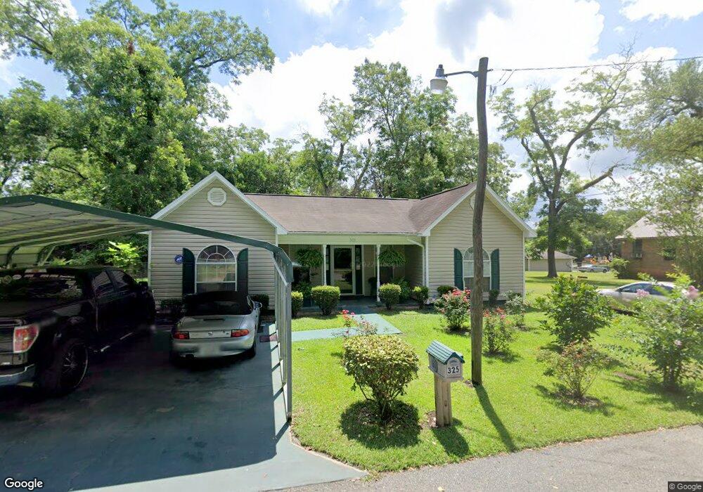
325 Kent St Quincy, FL 32351
Estimated Value: $176,000 - $223,000
3
Beds
2
Baths
1,368
Sq Ft
$147/Sq Ft
Est. Value
About This Home
This home is located at 325 Kent St, Quincy, FL 32351 and is currently estimated at $201,647, approximately $147 per square foot. 325 Kent St is a home located in Gadsden County.
Ownership History
Date
Name
Owned For
Owner Type
Purchase Details
Closed on
Mar 13, 2001
Sold by
Mas Unlimited Inc
Bought by
Brown Emma Smith
Current Estimated Value
Home Financials for this Owner
Home Financials are based on the most recent Mortgage that was taken out on this home.
Original Mortgage
$6,340
Outstanding Balance
$2,263
Interest Rate
7.09%
Mortgage Type
Seller Take Back
Estimated Equity
$199,384
Purchase Details
Closed on
Oct 26, 2000
Sold by
Jackson Pryor Patsy
Bought by
Mas Unlimited Inc
Home Financials for this Owner
Home Financials are based on the most recent Mortgage that was taken out on this home.
Original Mortgage
$62,000
Interest Rate
7.91%
Create a Home Valuation Report for This Property
The Home Valuation Report is an in-depth analysis detailing your home's value as well as a comparison with similar homes in the area
Home Values in the Area
Average Home Value in this Area
Purchase History
| Date | Buyer | Sale Price | Title Company |
|---|---|---|---|
| Brown Emma Smith | $84,000 | Stewart Title | |
| Mas Unlimited Inc | $7,000 | Capital City Title Tallahass |
Source: Public Records
Mortgage History
| Date | Status | Borrower | Loan Amount |
|---|---|---|---|
| Open | Brown Emma Smith | $6,340 | |
| Previous Owner | Mas Unlimited Inc | $62,000 |
Source: Public Records
Tax History
| Year | Tax Paid | Tax Assessment Tax Assessment Total Assessment is a certain percentage of the fair market value that is determined by local assessors to be the total taxable value of land and additions on the property. | Land | Improvement |
|---|---|---|---|---|
| 2025 | $2,063 | $125,480 | -- | -- |
| 2024 | $1,928 | $124,087 | -- | -- |
| 2023 | $1,748 | $117,736 | $0 | $0 |
| 2022 | $1,617 | $112,712 | $0 | $0 |
| 2021 | $1,326 | $87,280 | $0 | $0 |
| 2020 | $1,185 | $84,647 | $8,000 | $76,647 |
| 2019 | $1,294 | $85,541 | $8,000 | $77,541 |
| 2018 | $1,302 | $85,041 | $0 | $0 |
| 2017 | $1,277 | $85,041 | $0 | $0 |
| 2016 | $1,752 | $85,936 | $0 | $0 |
| 2015 | $921 | $86,102 | $0 | $0 |
| 2014 | $945 | $86,989 | $0 | $0 |
Source: Public Records
Map
Nearby Homes
- 918 7th St
- 303 S 10th St
- 3-12-2N-4W-1100-0000 Station St
- 3 S Slappey St
- 0 N Pat Thomas Pkwy Unit 10783375
- 1513 Live Oak St
- XXXX W Jefferson St
- 610 6th St
- 422 Thomas St
- 519 Thomas St
- 1614 Martin Luther King Blvd
- 516 Thomas St
- 618 W Washington St
- 1636 Martin Luther King Blvd
- 200 N Key St
- 118 N Ward St
- 31 N Cone St
- 1738 Martin Luther King Blvd
- 502 N 11th St
- 1314 Osceola St
Your Personal Tour Guide
Ask me questions while you tour the home.