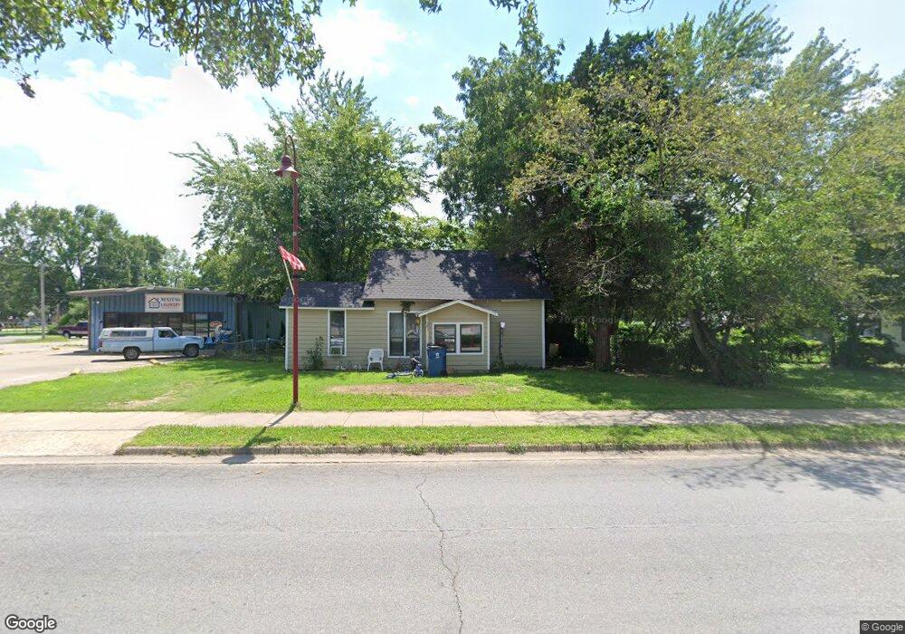
325 W Main St Gentry, AR 72734
Estimated Value: $173,061 - $230,000
2
Beds
1
Bath
1,223
Sq Ft
$165/Sq Ft
Est. Value
About This Home
This home is located at 325 W Main St, Gentry, AR 72734 and is currently estimated at $202,020, approximately $165 per square foot. 325 W Main St is a home located in Benton County with nearby schools including Gentry Intermediate School, Gentry Primary School, and Gentry Middle School.
Ownership History
Date
Name
Owned For
Owner Type
Purchase Details
Closed on
Sep 14, 2001
Bought by
Jech Et Al 4P
Current Estimated Value
Purchase Details
Closed on
Jan 4, 1999
Bought by
Krein and Krein Krein
Purchase Details
Closed on
Jul 18, 1997
Bought by
Fuller
Purchase Details
Closed on
Jun 19, 1997
Bought by
Fuller Joint Rev Trust
Purchase Details
Closed on
Apr 22, 1994
Bought by
Fuller
Purchase Details
Closed on
Feb 7, 1991
Bought by
Fuller
Purchase Details
Closed on
Sep 1, 1989
Bought by
Cox
Purchase Details
Closed on
Apr 14, 1988
Bought by
Swisher
Purchase Details
Closed on
May 1, 1987
Bought by
Calkins
Create a Home Valuation Report for This Property
The Home Valuation Report is an in-depth analysis detailing your home's value as well as a comparison with similar homes in the area
Home Values in the Area
Average Home Value in this Area
Purchase History
| Date | Buyer | Sale Price | Title Company |
|---|---|---|---|
| Jech Et Al 4P | $600,000 | -- | |
| Krein | $135,000 | -- | |
| Fuller | -- | -- | |
| Fuller Tr | -- | -- | |
| Fuller Joint Rev Trust | -- | -- | |
| Fuller | -- | -- | |
| Fuller | $130,000 | -- | |
| Cox | $15,000 | -- | |
| Swisher | -- | -- | |
| Calkins | $12,000 | -- |
Source: Public Records
Tax History Compared to Growth
Tax History
| Year | Tax Paid | Tax Assessment Tax Assessment Total Assessment is a certain percentage of the fair market value that is determined by local assessors to be the total taxable value of land and additions on the property. | Land | Improvement |
|---|---|---|---|---|
| 2025 | $805 | $21,764 | $7,000 | $14,764 |
| 2024 | $730 | $21,764 | $7,000 | $14,764 |
| 2023 | $664 | $13,370 | $5,000 | $8,370 |
| 2022 | $646 | $13,370 | $5,000 | $8,370 |
| 2021 | $591 | $13,370 | $5,000 | $8,370 |
| 2020 | $540 | $9,240 | $1,800 | $7,440 |
| 2019 | $540 | $9,240 | $1,800 | $7,440 |
| 2018 | $540 | $9,240 | $1,800 | $7,440 |
| 2017 | $505 | $9,240 | $1,800 | $7,440 |
| 2016 | $505 | $9,240 | $1,800 | $7,440 |
| 2015 | $435 | $7,860 | $1,800 | $6,060 |
| 2014 | $435 | $7,860 | $1,800 | $6,060 |
Source: Public Records
Map
Nearby Homes
- 104 N Giles Ave
- 213 Whitten Ave
- 317 Whitten Ave
- TBD Lot 3 The Preserve
- 309 Whitten Ave
- 313 Whitten Ave
- 305 Whitten Ave
- 503 W Arkansas St
- 0 Arkansas 12
- 904 W Main St
- 604 S Smith Ave
- 399 Pioneer Ln
- 302 W Fulton St
- 0 Orchard
- 104 White Oak St
- 108 White Oak St
- 216 White Oak St
- 300 White Oak St
- 105 Whitten Ave
- 109 Whitten Ave
- 341 W Main St
- 16 S Little St
- 90 S Little St
- 14 S Little St
- 8 S Little St
- 104 S Little Ave
- 105 S Byers Ave
- 0 S Little St
- 315 W Main St
- 401 W Main St
- 285 S Byers Ave
- 321 S Byers Ave
- 325 S Byers Ave
- 25 S Little St
- 202 W Main St
- 0 S Little Ave
- 0 S Little Ave
- 413 W Main St
- 112 S Little Ave
- 103 S Little Ave