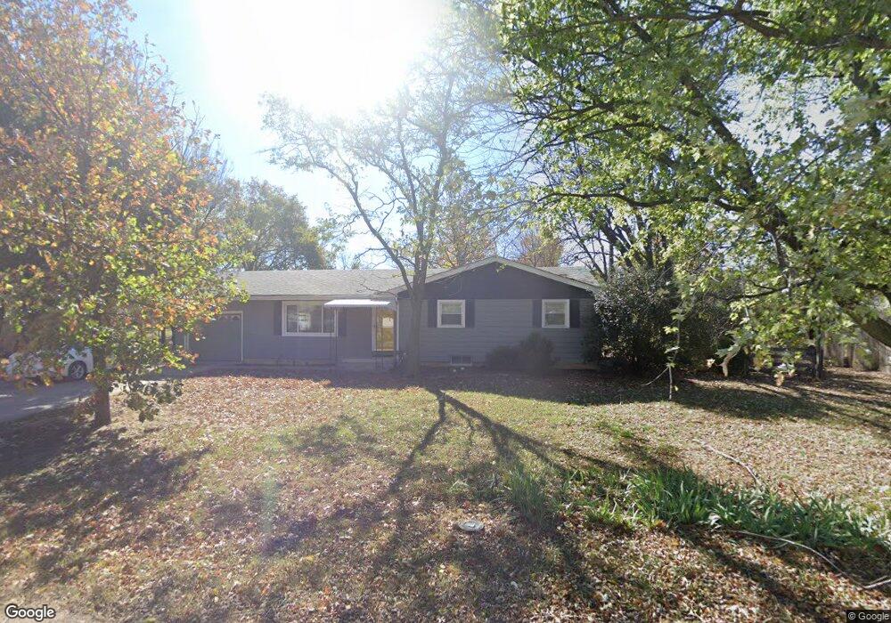
325 W Virginia Rd Andover, KS 67002
Estimated Value: $198,000 - $230,000
3
Beds
3
Baths
1,204
Sq Ft
$176/Sq Ft
Est. Value
About This Home
This home is located at 325 W Virginia Rd, Andover, KS 67002 and is currently estimated at $212,312, approximately $176 per square foot. 325 W Virginia Rd is a home located in Butler County with nearby schools including Cottonwood Elementary School, Andover Middle School, and Andover High School.
Ownership History
Date
Name
Owned For
Owner Type
Purchase Details
Closed on
Jul 13, 2018
Sold by
Nelson James M and Nelson Kayla F
Bought by
Bryant Evelyne M
Current Estimated Value
Home Financials for this Owner
Home Financials are based on the most recent Mortgage that was taken out on this home.
Original Mortgage
$135,315
Outstanding Balance
$117,025
Interest Rate
4.5%
Mortgage Type
New Conventional
Estimated Equity
$95,287
Purchase Details
Closed on
Apr 25, 2014
Sold by
Jean C Jean C
Bought by
Nelson James M and Nelson Kayla F
Create a Home Valuation Report for This Property
The Home Valuation Report is an in-depth analysis detailing your home's value as well as a comparison with similar homes in the area
Home Values in the Area
Average Home Value in this Area
Purchase History
| Date | Buyer | Sale Price | Title Company |
|---|---|---|---|
| Bryant Evelyne M | -- | Security 1St Title | |
| Bryant Evelyne M | $169,144 | Security First Title | |
| Nelson James M | -- | Kansas Secured Title |
Source: Public Records
Mortgage History
| Date | Status | Borrower | Loan Amount |
|---|---|---|---|
| Open | Bryant Evelyne M | $135,315 |
Source: Public Records
Tax History Compared to Growth
Tax History
| Year | Tax Paid | Tax Assessment Tax Assessment Total Assessment is a certain percentage of the fair market value that is determined by local assessors to be the total taxable value of land and additions on the property. | Land | Improvement |
|---|---|---|---|---|
| 2025 | $30 | $20,849 | $5,254 | $15,595 |
| 2024 | $30 | $20,643 | $2,636 | $18,007 |
| 2023 | $2,946 | $19,898 | $2,636 | $17,262 |
| 2022 | $2,931 | $18,481 | $2,636 | $15,845 |
| 2021 | $2,604 | $15,686 | $2,636 | $13,050 |
| 2020 | $2,579 | $16,043 | $2,636 | $13,407 |
| 2019 | $2,604 | $16,043 | $2,636 | $13,407 |
| 2018 | $2,216 | $13,754 | $2,636 | $11,118 |
| 2017 | $1,790 | $11,167 | $2,107 | $9,060 |
Source: Public Records
Map
Nearby Homes
- 606 N Lakeside Dr
- 318 Countryside Ct S
- 924 Maplewood Ct
- 241 Koob Ln
- 328 W 1st St
- 601 Brentwood Place
- 602 Brentwood Place
- 620 N Somerset Ct
- 118 Chapel Dr
- 305 Oakmont Ct
- 109 S Putter Dr
- 1009 E Rosemont Ct
- 918 E Lakecrest Dr
- 2243 S San Marino Cir
- 2231 S San Marino Cir
- 2227 S San Marino Cir
- 2235 S San Marino Cir
- 2239 S San Marino Cir
- 844 N Speyside Cir
- 818 N Mccloud Cir
- 315 W Virginia Rd
- 600 N Broadview Ln
- 324 W Virginia Rd
- 630 N Broadview Ln
- 546 N Broadview Ln
- 605 Joye St
- 601 Joye St
- 314 W Virginia Rd
- 543 Joye St
- 601 N Broadview Ln
- 621 N Broadview Ln
- 304 W Virginia Rd
- 632 N Broadview Ln
- 530 N Broadview Ln
- 539 N Broadview Ln
- 612 Joye St
- 604 Joye St
- 631 N Broadview Ln
- 544 Joye St
- 209 W Virginia Rd