Estimated Value: $418,000 - $479,000
3
Beds
3
Baths
2,148
Sq Ft
$203/Sq Ft
Est. Value
About This Home
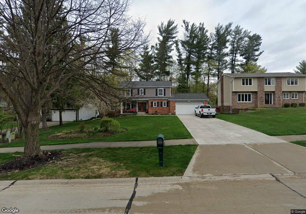
This home is located at 32557 Springside Ln, Solon, OH 44139 and is currently estimated at $436,174, approximately $203 per square foot. 32557 Springside Ln is a home located in Cuyahoga County with nearby schools including Dorothy E Lewis Elementary School, Orchard Middle School, and Solon Middle School.
Ownership History
Date
Name
Owned For
Owner Type
Purchase Details
Closed on
May 6, 1998
Sold by
Baden Steven L and Baden Stephanie
Bought by
Sharkus David R and Sharkus Suzanne E
Current Estimated Value
Home Financials for this Owner
Home Financials are based on the most recent Mortgage that was taken out on this home.
Original Mortgage
$142,500
Outstanding Balance
$28,208
Interest Rate
7.25%
Estimated Equity
$407,966
Purchase Details
Closed on
Nov 30, 1988
Sold by
Rantanen Thomas F
Bought by
Baden Steven L
Purchase Details
Closed on
Jul 20, 1981
Bought by
Rantanen Thomas F
Purchase Details
Closed on
Dec 16, 1980
Bought by
Broadview Sav & Loan Co
Purchase Details
Closed on
Jan 1, 1978
Bought by
Country Craft Dev Inc
Create a Home Valuation Report for This Property
The Home Valuation Report is an in-depth analysis detailing your home's value as well as a comparison with similar homes in the area
Home Values in the Area
Average Home Value in this Area
Purchase History
| Date | Buyer | Sale Price | Title Company |
|---|---|---|---|
| Sharkus David R | $214,500 | -- | |
| Baden Steven L | $159,000 | -- | |
| Rantanen Thomas F | $118,000 | -- | |
| Broadview Sav & Loan Co | -- | -- | |
| Country Craft Dev Inc | -- | -- |
Source: Public Records
Mortgage History
| Date | Status | Borrower | Loan Amount |
|---|---|---|---|
| Open | Sharkus David R | $142,500 |
Source: Public Records
Tax History Compared to Growth
Tax History
| Year | Tax Paid | Tax Assessment Tax Assessment Total Assessment is a certain percentage of the fair market value that is determined by local assessors to be the total taxable value of land and additions on the property. | Land | Improvement |
|---|---|---|---|---|
| 2024 | $7,090 | $129,570 | $24,780 | $104,790 |
| 2023 | $6,719 | $100,420 | $19,360 | $81,060 |
| 2022 | $6,704 | $100,420 | $19,360 | $81,060 |
| 2021 | $6,628 | $100,420 | $19,360 | $81,060 |
| 2020 | $6,649 | $92,120 | $17,750 | $74,380 |
| 2019 | $6,440 | $263,200 | $50,700 | $212,500 |
| 2018 | $5,811 | $92,120 | $17,750 | $74,380 |
| 2017 | $5,912 | $89,320 | $17,640 | $71,680 |
| 2016 | $5,857 | $89,320 | $17,640 | $71,680 |
| 2015 | $5,623 | $89,320 | $17,640 | $71,680 |
| 2014 | $5,623 | $82,710 | $16,350 | $66,360 |
Source: Public Records
Map
Nearby Homes
- 32775 Ledge Hill Dr
- 32650 Stony Brook Ln
- 5575 Hummingbird Cir
- 5721 Som Center Rd Unit 25
- 5929 Som Center Rd
- 112 Meadow Ln
- 34600 Mcafee Dr
- 5241 Som Center Rd
- 30705 Cannon Rd
- 32560 Wintergreen Dr
- 5158 Lansdowne Dr
- 5151 Som Center Rd
- 35690 Solon Rd
- 5009 Lansdowne Dr
- 35906 Solon Rd
- V/L (1.32 Acres) Aurora Rd
- 36265 Timberlane Dr
- 33645 Baldwin Rd
- 29470 W Woodall Dr
- S/L 12 Neptune Oval
- 32517 Springside Ln
- 32597 Springside Ln
- 32610 Timothy Cir
- 32477 Springside Ln
- 32627 Springside Ln
- 32582 Springside Ln
- 0 Springside Ln
- 32542 Springside Ln
- 32622 Springside Ln
- 32590 Timothy Cir
- 32437 Springside Ln
- 32657 Springside Ln
- 32652 Springside Ln
- 32397 Springside Ln
- 32570 Timothy Cir
- 32462 Springside Ln
- 32687 Springside Ln
- 32682 Springside Ln
- 32700 Ledge Hill Dr
- 32625 Timothy Cir