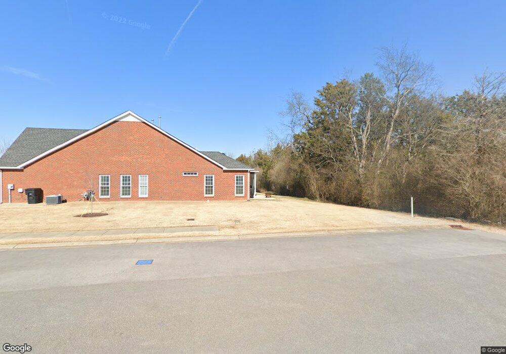
3258 Mershon Dr Unit 3260 Murfreesboro, TN 37128
Estimated Value: $385,455 - $400,000
--
Bed
2
Baths
1,666
Sq Ft
$236/Sq Ft
Est. Value
About This Home
This home is located at 3258 Mershon Dr Unit 3260, Murfreesboro, TN 37128 and is currently estimated at $393,864, approximately $236 per square foot. 3258 Mershon Dr Unit 3260 is a home located in Rutherford County with nearby schools including Scales Elementary School, Rockvale Middle School, and Rockvale High School.
Ownership History
Date
Name
Owned For
Owner Type
Purchase Details
Closed on
Jul 22, 2019
Sold by
Brown Douglas L and Brown Emily B
Bought by
Brown Lucy and Brown Stan
Current Estimated Value
Purchase Details
Closed on
Dec 31, 2015
Sold by
Brown Douglas L Emily B
Bought by
Brown Douglas L Emily Rlt and Brown Douglas L & Emily B (Tr)
Home Financials for this Owner
Home Financials are based on the most recent Mortgage that was taken out on this home.
Original Mortgage
$177,600
Interest Rate
3.96%
Mortgage Type
New Conventional
Create a Home Valuation Report for This Property
The Home Valuation Report is an in-depth analysis detailing your home's value as well as a comparison with similar homes in the area
Home Values in the Area
Average Home Value in this Area
Purchase History
| Date | Buyer | Sale Price | Title Company |
|---|---|---|---|
| Brown Lucy | $250,000 | Memorial Title Llc | |
| Brown Douglas L Emily Rlt | -- | -- | |
| Brown Douglas L Emily S | $231,050 | -- |
Source: Public Records
Mortgage History
| Date | Status | Borrower | Loan Amount |
|---|---|---|---|
| Previous Owner | Brown Douglas L Emily S | $177,600 |
Source: Public Records
Tax History Compared to Growth
Tax History
| Year | Tax Paid | Tax Assessment Tax Assessment Total Assessment is a certain percentage of the fair market value that is determined by local assessors to be the total taxable value of land and additions on the property. | Land | Improvement |
|---|---|---|---|---|
| 2025 | $2,393 | $84,600 | $11,250 | $73,350 |
| 2024 | $2,393 | $84,600 | $11,250 | $73,350 |
| 2023 | $1,587 | $84,600 | $11,250 | $73,350 |
| 2022 | $1,367 | $84,600 | $11,250 | $73,350 |
| 2021 | $1,331 | $59,950 | $8,750 | $51,200 |
| 2020 | $1,331 | $59,950 | $8,750 | $51,200 |
| 2019 | $1,331 | $59,950 | $8,750 | $51,200 |
Source: Public Records
Map
Nearby Homes
- 2339 Shafer Dr
- 3217 Mapleside Ln
- 3116 Mapleside Ln
- 3429 Deerview Dr
- 1315 Elevation ABC Plan at Evergreen Farms
- 3409 Nightshade Dr
- 2003 Tabasco Way
- 2738 Maylon Dr
- 3525 Nightshade Dr
- 1823 Joben Dr
- 2018 Debonair Ln
- 2017 Victory Gallop Ln
- 1919 Debonair Ln
- 1944 Colyn Ave
- 1943 Odessa Ave
- 2012 Victory Gallop Ln
- 1428 Ovaldale Dr
- 1819 Allwood Ave
- 1417 Ovaldale Dr
- 3508 Donerail Cir
- 3313 Mershon Dr Unit 3315
- 3261 Mershon Dr
- 3321 Mershon Dr
- 3259 Mershon Dr Unit 3261
- 3317 Berryside Dr Unit 3319
- 3325 Mershon Dr
- 3316 Berryside Dr
- 3318 Berryside Dr
- 3327 Mershon Dr
- 3324 Mershon Dr
- 3323 Berryside Dr
- 3322 Berryside Dr
- 3326 Mershon Dr
- 3331 Mershon Dr
- 3325 Berryside Dr
- 3330 Mershon Dr
- 3333 Mershon Dr
- 3332 Mershon Dr
- 3328 Berryside Dr
- 3337 Mershon Dr