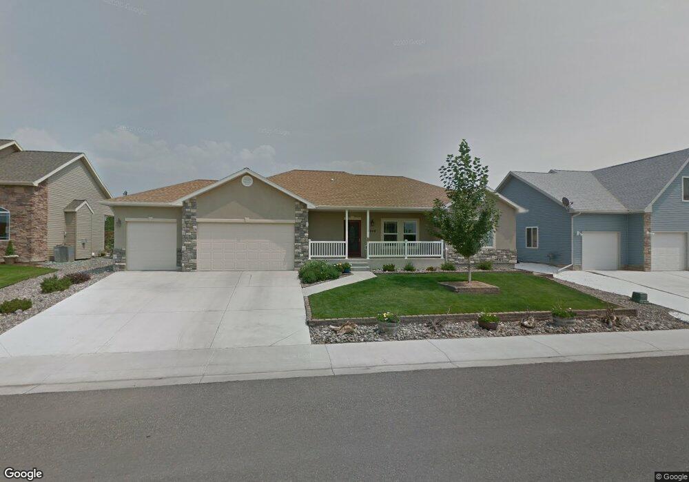
3258 Wheat Grass Dr Montrose, CO 81401
Estimated Value: $483,000 - $503,000
3
Beds
2
Baths
1,606
Sq Ft
$306/Sq Ft
Est. Value
About This Home
This home is located at 3258 Wheat Grass Dr, Montrose, CO 81401 and is currently estimated at $490,904, approximately $305 per square foot. 3258 Wheat Grass Dr is a home located in Montrose County with nearby schools including Johnson Elementary School, Centennial Middle School, and Montrose High School.
Ownership History
Date
Name
Owned For
Owner Type
Purchase Details
Closed on
Aug 5, 2016
Sold by
Ewing Bobby C and Ewing Joanne M
Bought by
Ericson Family Trust
Current Estimated Value
Purchase Details
Closed on
Apr 30, 2008
Sold by
Little Cimarron Llc
Bought by
Ewing Bobby C and Ewing Joanne M
Home Financials for this Owner
Home Financials are based on the most recent Mortgage that was taken out on this home.
Original Mortgage
$175,000
Interest Rate
5.84%
Mortgage Type
New Conventional
Create a Home Valuation Report for This Property
The Home Valuation Report is an in-depth analysis detailing your home's value as well as a comparison with similar homes in the area
Home Values in the Area
Average Home Value in this Area
Purchase History
| Date | Buyer | Sale Price | Title Company |
|---|---|---|---|
| Ericson Family Trust | $240,000 | None Available | |
| Ewing Bobby C | $257,033 | Security Title |
Source: Public Records
Mortgage History
| Date | Status | Borrower | Loan Amount |
|---|---|---|---|
| Previous Owner | Ewing Bobby C | $175,000 |
Source: Public Records
Tax History Compared to Growth
Tax History
| Year | Tax Paid | Tax Assessment Tax Assessment Total Assessment is a certain percentage of the fair market value that is determined by local assessors to be the total taxable value of land and additions on the property. | Land | Improvement |
|---|---|---|---|---|
| 2024 | $2,035 | $28,230 | $3,560 | $24,670 |
| 2023 | $2,035 | $33,100 | $4,170 | $28,930 |
| 2022 | $1,612 | $23,100 | $3,130 | $19,970 |
| 2021 | $1,661 | $23,770 | $3,220 | $20,550 |
| 2020 | $1,445 | $21,250 | $2,870 | $18,380 |
| 2019 | $1,454 | $21,250 | $2,870 | $18,380 |
| 2018 | $1,305 | $18,580 | $1,990 | $16,590 |
| 2017 | $1,294 | $18,580 | $1,990 | $16,590 |
| 2016 | $1,158 | $16,900 | $2,010 | $14,890 |
| 2015 | $1,138 | $16,900 | $2,010 | $14,890 |
| 2014 | $1,006 | $15,980 | $2,010 | $13,970 |
Source: Public Records
Map
Nearby Homes
- 1708 American Way
- 1764 Freedom Way
- TBD Freedom Way
- 3208 Wheat Grass Dr
- 3208 Ravens Crest Dr
- 1833 Estates Dr Unit A
- 1530 American Way
- 1624 Election Way
- 2224 American Way
- 3315 Pinewood St
- 3415 Kestrel Loop
- 2132 Patriot Ct
- Lot 7 Pinewood St
- 3435 Kestrel Loop
- 2308 Mead Ln
- 1818 Senate St
- 2348 Mead Ln
- 3161 Silver Fox Dr
- 1987 Sara E Ln
- 1439 Big Pines Dr
- 3266 Wheat Grass Dr
- 3255 Wheat Grass Dr
- 3263 Wheat Grass Dr
- 3274 Wheat Grass Dr
- 3245 Wheat Grass Dr
- 0 Wheat Grass Dr Unit 769103
- 0 Wheat Grass Dr Unit 755806
- 0 Wheat Grass Dr Unit 748598
- 0 Wheat Grass Dr Unit 654374
- 0 Wheat Grass Dr Unit 654352
- 0 Wheat Grass Dr Unit 667052
- 0 Wheat Grass Dr Unit 730218
- 0 Wheat Grass Dr Unit 597158
- 0 Wheat Grass Dr Unit 599086
- 0 Wheat Grass Dr Unit 602097
- 0 Wheat Grass Dr Unit 601821
- 0 Wheat Grass Dr Unit 601929
- 0 Wheat Grass Dr Unit 611474
- 0 Wheat Grass Dr Unit 609643
- 0 Wheat Grass Dr Unit 610014