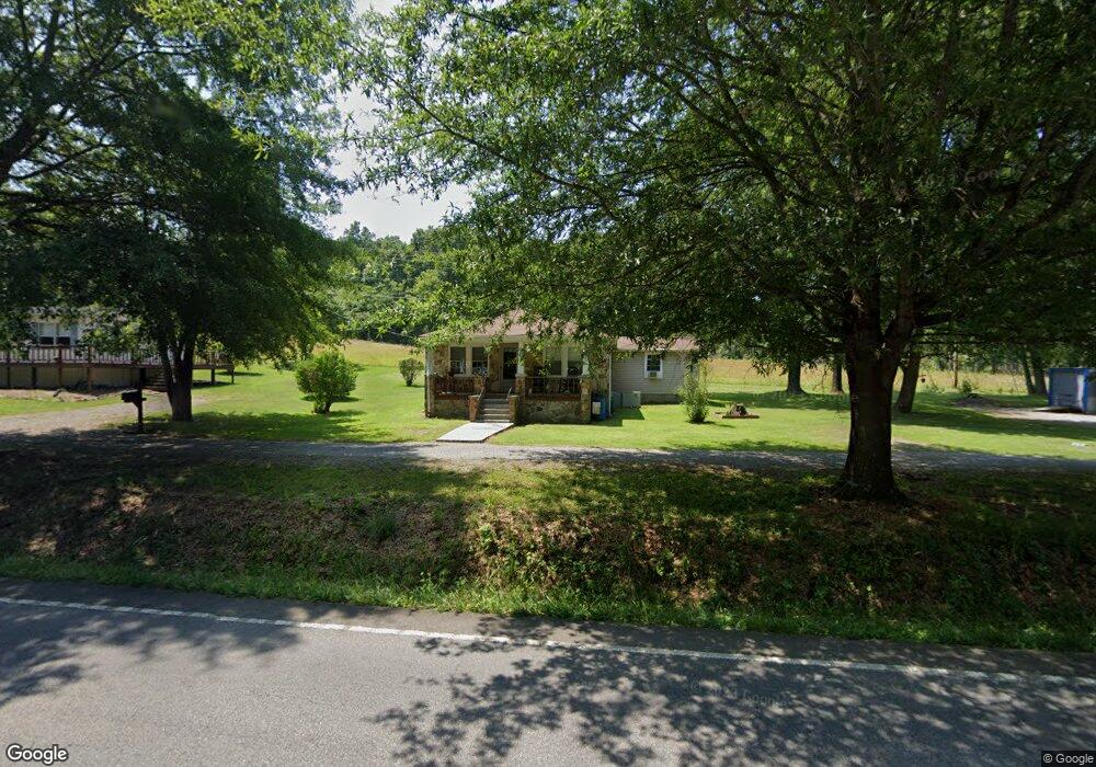
3259 S Main St Tennessee Ridge, TN 37178
Estimated Value: $96,000 - $168,000
--
Bed
1
Bath
1,144
Sq Ft
$116/Sq Ft
Est. Value
About This Home
This home is located at 3259 S Main St, Tennessee Ridge, TN 37178 and is currently estimated at $132,904, approximately $116 per square foot. 3259 S Main St is a home located in Houston County.
Ownership History
Date
Name
Owned For
Owner Type
Purchase Details
Closed on
Jan 11, 2019
Sold by
Baggett Clifton R
Bought by
Baggett Kristy L and C/O Baggett Clifton R
Current Estimated Value
Purchase Details
Closed on
Jun 18, 2001
Bought by
Baggett Clifton R and Baggett Susan
Purchase Details
Closed on
Feb 21, 2000
Bought by
Baggett Dale
Purchase Details
Closed on
Sep 1, 1994
Bought by
Baggett Dale
Purchase Details
Closed on
Jul 11, 1988
Purchase Details
Closed on
May 20, 1947
Bought by
Robbins Pearl Mrs
Create a Home Valuation Report for This Property
The Home Valuation Report is an in-depth analysis detailing your home's value as well as a comparison with similar homes in the area
Home Values in the Area
Average Home Value in this Area
Purchase History
| Date | Buyer | Sale Price | Title Company |
|---|---|---|---|
| Baggett Kristy L | -- | -- | |
| Baggett Kristy L | -- | -- | |
| Baggett Clifton R | $10,000 | -- | |
| Baggett Dale | -- | -- | |
| Baggett Dale | $10,000 | -- | |
| -- | -- | -- | |
| Robbins Pearl Mrs | -- | -- |
Source: Public Records
Tax History Compared to Growth
Tax History
| Year | Tax Paid | Tax Assessment Tax Assessment Total Assessment is a certain percentage of the fair market value that is determined by local assessors to be the total taxable value of land and additions on the property. | Land | Improvement |
|---|---|---|---|---|
| 2024 | -- | $33,275 | $3,175 | $30,100 |
| 2023 | $747 | $33,275 | $3,175 | $30,100 |
| 2022 | $691 | $19,325 | $2,175 | $17,150 |
| 2021 | $681 | $19,325 | $2,175 | $17,150 |
| 2020 | $645 | $19,325 | $2,175 | $17,150 |
| 2019 | $645 | $16,175 | $1,925 | $14,250 |
| 2018 | $637 | $16,175 | $1,925 | $14,250 |
| 2017 | $637 | $16,175 | $1,925 | $14,250 |
| 2016 | $637 | $16,175 | $1,925 | $14,250 |
| 2015 | $637 | $16,175 | $1,925 | $14,250 |
| 2014 | -- | $16,166 | $0 | $0 |
Source: Public Records
Map
Nearby Homes
- 1950 Old Stewart Rd
- 0 Carl Taylor Rd
- 110 Peachtree St
- 0 Taylor St Unit RTC2764411
- 0 Taylor St Unit RTC2764420
- 0 Taylor St Unit RTC2764418
- 0 Taylor St Unit RTC2764423
- 0 Taylor St Unit RTC2764415
- 155 Rolling Hills Dr
- 0 Main St N Unit RTC2988796
- 0 Main St N Unit RTC3003416
- 0 Main St N Unit RTC2987692
- 0 Main St N Unit RTC2988794
- 0 Main St N Unit RTC2988130
- 0 Main St N Unit RTC2988128
- 0 Main St N Unit RTC2987687
- 0 Main St N Unit RTC2988129
- 0 Main St N Unit RTC2988126
- 0 Main St N Unit RTC2988125
- 0 Main St N Unit RTC3003418
- 3241 S Main St
- 3361 S Main St
- 3137 S Main St
- 3132 S Main St
- 3393 S Main St
- 310 Stevenson Cir
- 3478 S Main St
- 240 Stevenson Cir
- 1175 Old Stewart Rd
- 350 Stevenson Cir
- 355 Stevenson Cir
- 241 Stevenson Cir
- 3574 S Main St
- 2917 S Main St
- 2978 S Main St
- 185 Stevenson Cir
- 415 Stevenson Cir
- 220 Jan Cir
- 445 Stevenson Cir
- 359 Mule Ln