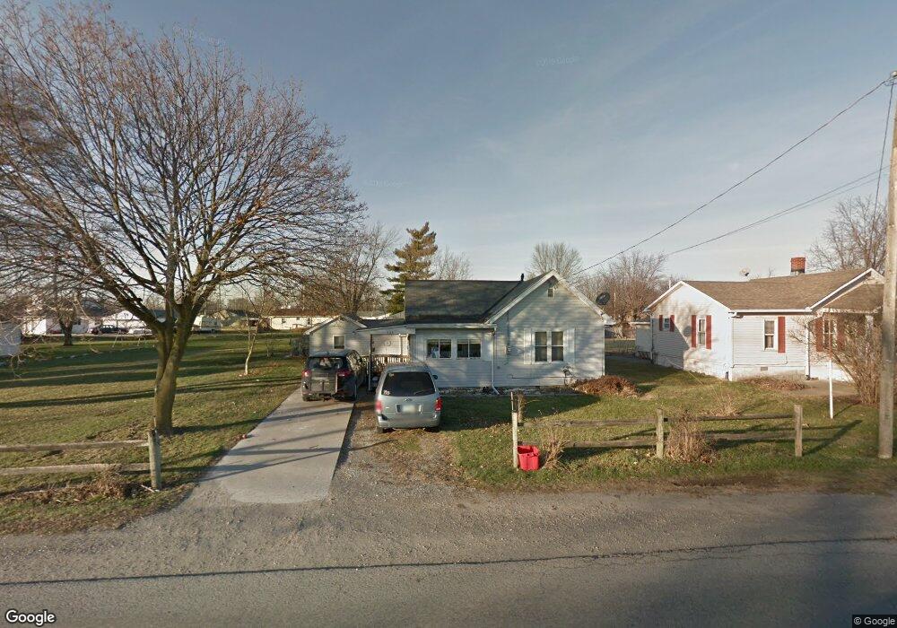
326 Letson Ave Kenton, OH 43326
Estimated Value: $69,000 - $119,322
2
Beds
1
Bath
1,020
Sq Ft
$99/Sq Ft
Est. Value
About This Home
This home is located at 326 Letson Ave, Kenton, OH 43326 and is currently estimated at $100,831, approximately $98 per square foot. 326 Letson Ave is a home located in Hardin County with nearby schools including Kenton Elementary School, Kenton Middle School, and Kenton High School.
Ownership History
Date
Name
Owned For
Owner Type
Purchase Details
Closed on
Oct 22, 2004
Bought by
Large James M and Large Rosemary
Current Estimated Value
Purchase Details
Closed on
May 2, 2003
Bought by
Large Rosemary L Trustee
Purchase Details
Closed on
Oct 8, 1997
Bought by
Large James M and Large Rosem
Purchase Details
Closed on
Apr 18, 1997
Bought by
Manns Tony and Manns Ramona
Purchase Details
Closed on
Jan 21, 1997
Bought by
Manns J B
Purchase Details
Closed on
Nov 13, 1989
Purchase Details
Closed on
Sep 1, 1988
Create a Home Valuation Report for This Property
The Home Valuation Report is an in-depth analysis detailing your home's value as well as a comparison with similar homes in the area
Home Values in the Area
Average Home Value in this Area
Purchase History
| Date | Buyer | Sale Price | Title Company |
|---|---|---|---|
| Large James M | -- | -- | |
| Large Rosemary L Trustee | -- | -- | |
| Large James M | $38,000 | -- | |
| Manns Tony | $26,700 | -- | |
| Manns J B | $24,300 | -- | |
| -- | -- | -- | |
| -- | $24,000 | -- |
Source: Public Records
Tax History
| Year | Tax Paid | Tax Assessment Tax Assessment Total Assessment is a certain percentage of the fair market value that is determined by local assessors to be the total taxable value of land and additions on the property. | Land | Improvement |
|---|---|---|---|---|
| 2024 | $653 | $24,850 | $2,310 | $22,540 |
| 2023 | $682 | $24,850 | $2,310 | $22,540 |
| 2022 | $569 | $20,500 | $1,620 | $18,880 |
| 2021 | $571 | $20,500 | $1,620 | $18,880 |
| 2020 | $498 | $20,500 | $1,620 | $18,880 |
| 2019 | $325 | $16,670 | $1,540 | $15,130 |
| 2018 | $325 | $16,670 | $1,540 | $15,130 |
| 2017 | $171 | $16,670 | $1,540 | $15,130 |
| 2016 | $239 | $14,790 | $1,690 | $13,100 |
| 2015 | $530 | $14,790 | $1,690 | $13,100 |
| 2014 | $130 | $14,790 | $1,690 | $13,100 |
| 2013 | $162 | $16,240 | $1,690 | $14,550 |
Source: Public Records
Map
Nearby Homes
- 703 S Detroit St
- 639 S Main St
- 508 Decatur St
- 510 Decatur St
- 13450 State Route 292
- 354 S Barron St
- 226 S Wayne St
- 501 East St
- 920 Cooper St
- 121 S High St
- 820 King St
- 39 Grape St
- 219 W Carrol St
- 405 E Carroll St
- 405 E Carrol St Unit 405 1/2
- 79 Broadway St
- 89 Broadway St
- 233 N Main St
- 509 E North St
- 310 N Market St
- 332 Letson Ave
- 318 Letson Ave
- 14344 County Road 140
- 338 Letson Ave
- 316 Letson Ave
- 300 Letson Ave
- 1001 Steiner Ave
- 325 Gilbert St
- 335 Gilbert St
- 317 Gilbert St
- 315 Gilbert St
- 14323 County Road 140
- 309 Gilbert St
- 340 Gilbert St
- 1001 Steiner(p)
- 224 Letson Ave
- 303 Gilbert St
- 227 Gilbert St
- 220 Letson Ave
- 995 Steiner Ave
Your Personal Tour Guide
Ask me questions while you tour the home.