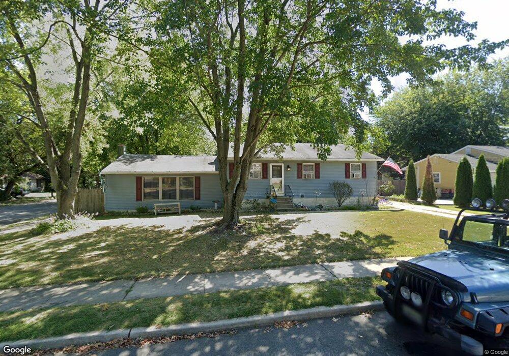
326 Roosevelt Blvd Thorofare, NJ 08086
West Deptford Township NeighborhoodEstimated Value: $281,677 - $341,000
--
Bed
--
Bath
1,633
Sq Ft
$197/Sq Ft
Est. Value
About This Home
This home is located at 326 Roosevelt Blvd, Thorofare, NJ 08086 and is currently estimated at $322,169, approximately $197 per square foot. 326 Roosevelt Blvd is a home located in Gloucester County with nearby schools including Red Bank Elementary School, Oakview Elementary School, and Green-Fields Elementary School.
Ownership History
Date
Name
Owned For
Owner Type
Purchase Details
Closed on
Jun 10, 2005
Sold by
Conaway Alexander M and Conaway Jennifer Lynn
Bought by
Martino Helena
Current Estimated Value
Home Financials for this Owner
Home Financials are based on the most recent Mortgage that was taken out on this home.
Original Mortgage
$140,000
Outstanding Balance
$73,182
Interest Rate
5.78%
Mortgage Type
New Conventional
Estimated Equity
$248,987
Purchase Details
Closed on
Mar 8, 2002
Sold by
Conaway Michael P and Conaway Patricia E
Bought by
Conaway Alexander M and Conaway Jennifer Lynn
Create a Home Valuation Report for This Property
The Home Valuation Report is an in-depth analysis detailing your home's value as well as a comparison with similar homes in the area
Home Values in the Area
Average Home Value in this Area
Purchase History
| Date | Buyer | Sale Price | Title Company |
|---|---|---|---|
| Martino Helena | $175,000 | Congress | |
| Conaway Alexander M | $121,000 | -- |
Source: Public Records
Mortgage History
| Date | Status | Borrower | Loan Amount |
|---|---|---|---|
| Open | Martino Helena | $140,000 |
Source: Public Records
Tax History Compared to Growth
Tax History
| Year | Tax Paid | Tax Assessment Tax Assessment Total Assessment is a certain percentage of the fair market value that is determined by local assessors to be the total taxable value of land and additions on the property. | Land | Improvement |
|---|---|---|---|---|
| 2025 | $5,895 | $168,800 | $54,800 | $114,000 |
| 2024 | $5,819 | $168,800 | $54,800 | $114,000 |
| 2023 | $5,819 | $168,800 | $54,800 | $114,000 |
| 2022 | $5,792 | $168,800 | $54,800 | $114,000 |
| 2021 | $5,771 | $168,800 | $54,800 | $114,000 |
| 2020 | $5,758 | $168,800 | $54,800 | $114,000 |
| 2019 | $5,597 | $168,800 | $54,800 | $114,000 |
| 2018 | $5,445 | $168,800 | $54,800 | $114,000 |
| 2017 | $5,319 | $168,800 | $54,800 | $114,000 |
| 2016 | $5,170 | $168,800 | $54,800 | $114,000 |
| 2015 | $4,926 | $168,800 | $54,800 | $114,000 |
| 2014 | $4,681 | $168,800 | $54,800 | $114,000 |
Source: Public Records
Map
Nearby Homes
- 266 Passaic Ave
- 107 Audubon Ave
- 121 Cape May Ave
- 112 N Drexel St
- 177 Frederic Ct Unit 177
- 400 Audubon Ave
- 10 Kennedy Ct
- 91 N American St
- 64 Tilden Rd
- 439 Crown Point Rd
- 44 N American St
- 433 Crown Point Rd
- 67 Pelican Place
- 1810 Fernwood Dr
- 21 S Columbia St
- 38 Pelican Place Unit 38
- 845 W Red Bank Ave
- 558 Prince St
- 344 S Girard St
- 2 Victorian Way
- 320 Roosevelt Blvd
- 309 Grant Ave
- 319 Passaic Ave
- 323 Roosevelt Blvd
- 300 Grant Ave
- 319 N Roosevelt Blvd
- 230 Grant Ave
- 319 Roosevelt Blvd
- 310 Grant Ave
- 315 Passaic Ave
- 315 Roosevelt Blvd
- 310 N Roosevelt Blvd
- 310 Roosevelt Blvd
- 221 Grant Ave
- 311 Passaic Ave
- 311 N Roosevelt Blvd
- 320 Middlesex Ave
- 431 Roosevelt Blvd
- 224 Grant Ave
- 311 Roosevelt Blvd