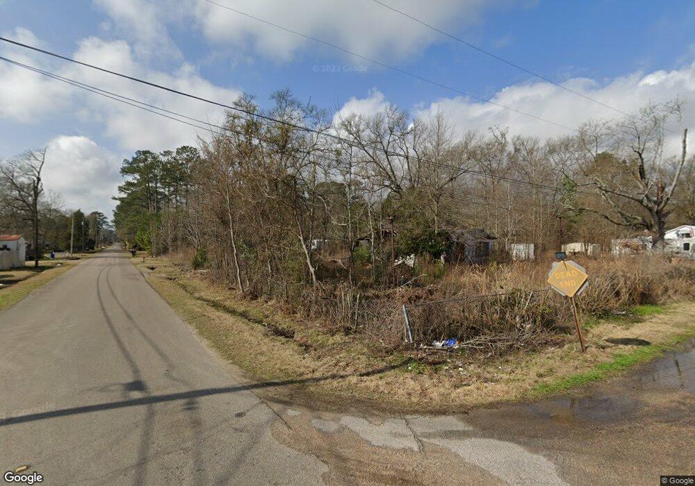
3262 Sheppard Dr Laurel, MS 39440
Estimated Value: $127,684 - $213,000
Studio
--
Bath
1,526
Sq Ft
$112/Sq Ft
Est. Value
About This Home
This home is located at 3262 Sheppard Dr, Laurel, MS 39440 and is currently estimated at $171,171, approximately $112 per square foot. 3262 Sheppard Dr is a home located in Jones County.
Ownership History
Date
Name
Owned For
Owner Type
Purchase Details
Closed on
Mar 20, 2014
Sold by
James Tarrell James Tarrell and Hinton Della Merlene
Bought by
Johnson Robert D
Current Estimated Value
Home Financials for this Owner
Home Financials are based on the most recent Mortgage that was taken out on this home.
Original Mortgage
$22,952
Interest Rate
4.36%
Mortgage Type
Purchase Money Mortgage
Purchase Details
Closed on
Feb 4, 2014
Sold by
James Tarrell James Tarrell
Bought by
Hinton James Tarrell and Hinton Della Marlene
Home Financials for this Owner
Home Financials are based on the most recent Mortgage that was taken out on this home.
Original Mortgage
$22,952
Interest Rate
4.36%
Mortgage Type
Purchase Money Mortgage
Create a Home Valuation Report for This Property
The Home Valuation Report is an in-depth analysis detailing your home's value as well as a comparison with similar homes in the area
Purchase History
| Date | Buyer | Sale Price | Title Company |
|---|---|---|---|
| Johnson Robert D | -- | -- | |
| Hinton James Tarrell | -- | -- |
Source: Public Records
Mortgage History
| Date | Status | Borrower | Loan Amount |
|---|---|---|---|
| Closed | Johnson Robert D | $22,952 |
Source: Public Records
Tax History Compared to Growth
Tax History
| Year | Tax Paid | Tax Assessment Tax Assessment Total Assessment is a certain percentage of the fair market value that is determined by local assessors to be the total taxable value of land and additions on the property. | Land | Improvement |
|---|---|---|---|---|
| 2025 | $1,097 | $9,111 | $0 | $0 |
| 2024 | $1,069 | $8,442 | $0 | $0 |
| 2023 | $1,069 | $8,442 | $0 | $0 |
| 2022 | $500 | $5,628 | $0 | $0 |
| 2021 | $503 | $5,628 | $0 | $0 |
| 2020 | $502 | $5,475 | $0 | $0 |
| 2019 | $483 | $5,265 | $0 | $0 |
| 2018 | $483 | $5,265 | $0 | $0 |
| 2017 | $482 | $5,265 | $0 | $0 |
| 2016 | $866 | $4,957 | $0 | $0 |
| 2015 | -- | $4,873 | $0 | $0 |
| 2014 | -- | $4,873 | $0 | $0 |
Source: Public Records
Map
Nearby Homes
- 211 Palmer Rd
- 9 Sanderson Rd
- 31 Sanderson Rd
- 144 Don Curt Blvd
- 0 Ellisville Blvd
- 0 Burnt Bridge Rd
- 908 Sunflower Dr
- 1131 Capitol St
- 1013 Wilson Ave
- 915 S 14th Ave
- 23 Sunset Rd
- 250 Dutton Ave
- 0 S 13th Ave
- 640 S Magnolia St
- 514 Paulding Rd
- 911 S 8th Ave
- 0 Corner of Congress St & 13th Ave Unit 31841
- 1500 W 1st St
- Meador Rd
- 104 N 14th Ave
- 3261 Sheppard Dr
- 3011 Indian Springs Rd
- 3235 Fant Dr
- 3240 Ellisville Blvd
- 3229 Fant Dr
- 3223 Fant Dr
- 3234 Fant Dr
- 3224 Sheppard Dr
- 3242 Fant Dr
- 5534 Highway 11 N
- 5534 U S 11
- 5534 Us-11
- 3240 Us Hwy 11
- 3226 Fant Dr
- 5530 Highway 11 N
- 3211 Indian Springs Rd
- 3265 Ellisville Blvd
- 3265 Ellisville Blvd
- 3271 Ellisville Blvd
- 3220 Fant Dr
