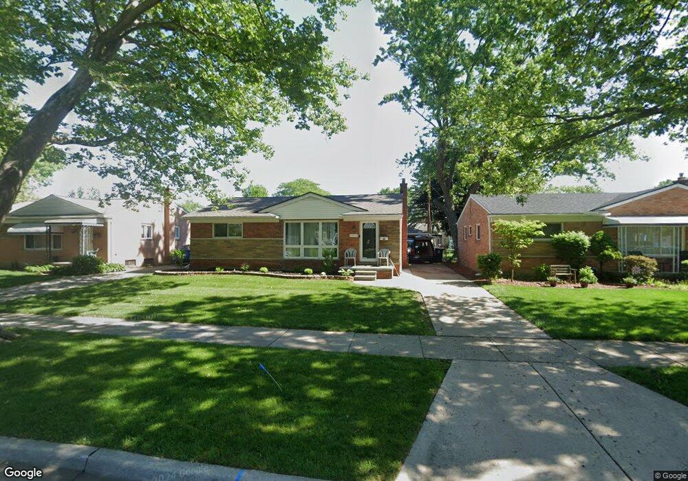
32634 Merritt Dr Westland, MI 48185
Estimated Value: $243,000 - $263,000
3
Beds
2
Baths
1,055
Sq Ft
$239/Sq Ft
Est. Value
About This Home
This home is located at 32634 Merritt Dr, Westland, MI 48185 and is currently estimated at $252,255, approximately $239 per square foot. 32634 Merritt Dr is a home located in Wayne County with nearby schools including Hayes Elementary School, Cooper Upper Elementary School, and Emerson Middle School.
Ownership History
Date
Name
Owned For
Owner Type
Purchase Details
Closed on
Oct 6, 2022
Sold by
Wayne County Treasurer
Bought by
Farah Rhonda
Current Estimated Value
Purchase Details
Closed on
Mar 17, 2010
Sold by
Necker Robert E
Bought by
Suntrust Bank
Purchase Details
Closed on
Feb 17, 2005
Sold by
Necker Robert E
Bought by
Necker Robert E
Purchase Details
Closed on
Sep 29, 1999
Sold by
Rackly Dorothy Racklyeft
Bought by
Necker Robert E
Create a Home Valuation Report for This Property
The Home Valuation Report is an in-depth analysis detailing your home's value as well as a comparison with similar homes in the area
Home Values in the Area
Average Home Value in this Area
Purchase History
| Date | Buyer | Sale Price | Title Company |
|---|---|---|---|
| Farah Rhonda | $190,000 | -- | |
| Suntrust Bank | $68,000 | None Available | |
| Necker Robert E | -- | Multiple | |
| Necker Robert E | $128,000 | -- |
Source: Public Records
Tax History Compared to Growth
Tax History
| Year | Tax Paid | Tax Assessment Tax Assessment Total Assessment is a certain percentage of the fair market value that is determined by local assessors to be the total taxable value of land and additions on the property. | Land | Improvement |
|---|---|---|---|---|
| 2025 | $3,847 | $106,300 | $0 | $0 |
| 2024 | $3,847 | $98,700 | $0 | $0 |
| 2023 | $3,875 | $89,500 | $0 | $0 |
| 2022 | $3,476 | $77,500 | $0 | $0 |
| 2021 | $3,887 | $73,900 | $0 | $0 |
| 2020 | $3,561 | $69,900 | $0 | $0 |
| 2019 | $3,420 | $67,600 | $0 | $0 |
| 2018 | $2,400 | $57,000 | $0 | $0 |
| 2017 | $2,505 | $53,100 | $0 | $0 |
| 2016 | $2,670 | $53,400 | $0 | $0 |
| 2015 | $3,900 | $49,490 | $0 | $0 |
| 2013 | $3,778 | $38,610 | $0 | $0 |
| 2012 | $2,547 | $38,730 | $0 | $0 |
Source: Public Records
Map
Nearby Homes
- 32451 Sandra Ln
- 32725 Joy Rd
- 33211 Anita Dr
- 32724 Hees St
- 32047 Anita Dr
- 33312 Lynx St
- 8332 Berwick Dr
- 32327 Washington St
- 33030 Cowan Rd
- 8824 Nevada St
- 7872 Ritz Ave
- 7436 Cochise St
- 31640 Ann Arbor Trail
- 8219 Roselawn St
- 7946 Moonwood Place
- 9243 Montana St
- 9212 Idaho St
- 32144 Warren Rd
- 32611 Vermont St
- 31273 Mackenzie Dr
- 32642 Merritt Dr
- 32626 Merritt Dr
- 32650 Merritt Dr
- 32618 Merritt Dr
- 32647 Mackenzie Dr
- 32639 Mackenzie Dr
- 32655 Mackenzie Dr
- 32631 Mackenzie Dr
- 32658 Merritt Dr
- 32610 Merritt Dr
- 32663 Mackenzie Dr
- 32665 Judy Dr
- 32621 Mackenzie Dr
- 32664 Judy Dr
- 32666 Merritt Dr
- 32584 Merritt Dr
- 32671 Mackenzie Dr
- 32611 Mackenzie Dr
- 32657 Merritt Dr
- 32659 Judy Dr