Estimated Value: $425,791 - $502,000
4
Beds
3
Baths
2,345
Sq Ft
$199/Sq Ft
Est. Value
About This Home
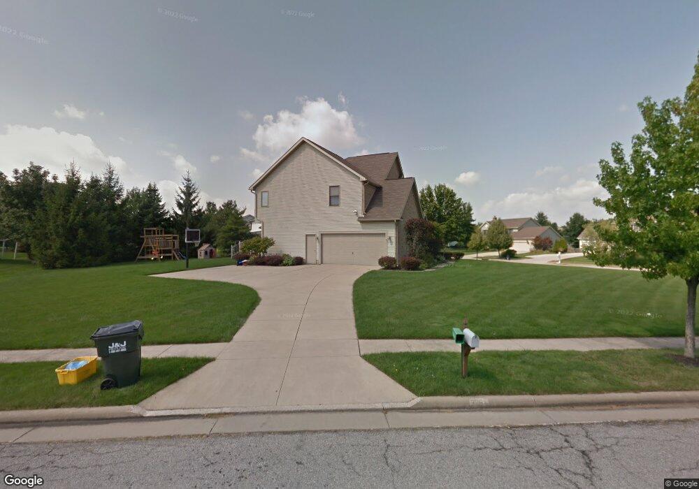
This home is located at 3264 Berwin Dr, Stow, OH 44224 and is currently estimated at $467,698, approximately $199 per square foot. 3264 Berwin Dr is a home located in Summit County with nearby schools including Stow-Munroe Falls High School and St Patrick Elementary School.
Ownership History
Date
Name
Owned For
Owner Type
Purchase Details
Closed on
Sep 17, 2010
Sold by
Andio Anthony R and Andio Gina A
Bought by
Woodside William Joseph and Woodside Erin K
Current Estimated Value
Home Financials for this Owner
Home Financials are based on the most recent Mortgage that was taken out on this home.
Original Mortgage
$245,890
Outstanding Balance
$160,796
Interest Rate
4.25%
Mortgage Type
FHA
Estimated Equity
$306,902
Purchase Details
Closed on
May 29, 1996
Sold by
Schalmo Homes Inc
Bought by
Andio Anthony R and Bernhart Gina A
Create a Home Valuation Report for This Property
The Home Valuation Report is an in-depth analysis detailing your home's value as well as a comparison with similar homes in the area
Home Values in the Area
Average Home Value in this Area
Purchase History
| Date | Buyer | Sale Price | Title Company |
|---|---|---|---|
| Woodside William Joseph | $250,500 | Guardian Title | |
| Andio Anthony R | $44,900 | -- |
Source: Public Records
Mortgage History
| Date | Status | Borrower | Loan Amount |
|---|---|---|---|
| Open | Woodside William Joseph | $245,890 |
Source: Public Records
Tax History
| Year | Tax Paid | Tax Assessment Tax Assessment Total Assessment is a certain percentage of the fair market value that is determined by local assessors to be the total taxable value of land and additions on the property. | Land | Improvement |
|---|---|---|---|---|
| 2024 | $7,401 | $131,485 | $24,346 | $107,139 |
| 2023 | $7,401 | $131,485 | $24,346 | $107,139 |
| 2022 | $6,889 | $108,063 | $19,957 | $88,106 |
| 2021 | $6,166 | $108,063 | $19,957 | $88,106 |
| 2020 | $6,060 | $108,070 | $19,960 | $88,110 |
| 2019 | $5,534 | $92,130 | $19,760 | $72,370 |
| 2018 | $5,443 | $92,130 | $19,760 | $72,370 |
| 2017 | $5,037 | $92,130 | $19,760 | $72,370 |
| 2016 | $5,184 | $82,770 | $19,760 | $63,010 |
| 2015 | $5,037 | $82,770 | $19,760 | $63,010 |
| 2014 | $5,063 | $83,130 | $19,760 | $63,370 |
| 2013 | $4,845 | $80,020 | $19,760 | $60,260 |
Source: Public Records
Map
Nearby Homes
- 2908 Wexford Blvd
- 76 Wanda Ct
- 3313 Crown Pointe Dr
- 4556 Fishcreek Rd
- 3753 Lake Run Blvd
- 4399-4403 Cherryhurst Dr
- 3767 Lake Run Blvd
- 2738 Stockman Ct
- 3874 Lake Run Blvd
- 1302 Carol Dr
- 2944 Heatherwood Ct
- 4916 Friar Rd Unit B
- 884 Highridge Ln
- 601 Silver Meadows Blvd
- 0 Pardee Rd
- 891 Stonewater Dr Unit 43
- 976 Kevin Dr
- 1189 Garth Dr
- 4078 Pardee Rd
- 4155 Burton Dr
Your Personal Tour Guide
Ask me questions while you tour the home.