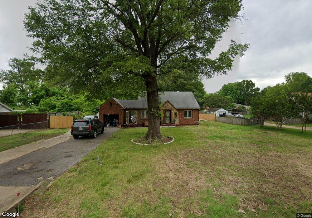
3266 W Rosita Cir Memphis, TN 38116
Whitehaven NeighborhoodEstimated Value: $120,820 - $160,000
2
Beds
1
Bath
2,510
Sq Ft
$55/Sq Ft
Est. Value
About This Home
This home is located at 3266 W Rosita Cir, Memphis, TN 38116 and is currently estimated at $137,455, approximately $54 per square foot. 3266 W Rosita Cir is a home located in Shelby County with nearby schools including Ford Road Elementary School, A. Maceo Walker Middle School, and Mitchell High School.
Ownership History
Date
Name
Owned For
Owner Type
Purchase Details
Closed on
Apr 3, 2008
Sold by
Triad Guaranty Insurance Corp
Bought by
Fsns Llc
Current Estimated Value
Purchase Details
Closed on
Feb 21, 2007
Sold by
Federal Home Loan Mortgage Corporation
Bought by
Triad Guaranty Insurance Corp
Purchase Details
Closed on
Sep 21, 2006
Sold by
Patterson Raymond L
Bought by
Federal Home Loan Mortgage Corporation
Purchase Details
Closed on
Aug 8, 2003
Sold by
Watson Pamela B
Bought by
Patterson Raymond L
Home Financials for this Owner
Home Financials are based on the most recent Mortgage that was taken out on this home.
Original Mortgage
$57,000
Interest Rate
5.42%
Mortgage Type
Purchase Money Mortgage
Purchase Details
Closed on
Jan 24, 2002
Sold by
Stovall Eddie Mae Rice
Bought by
Watson Pamela B
Create a Home Valuation Report for This Property
The Home Valuation Report is an in-depth analysis detailing your home's value as well as a comparison with similar homes in the area
Home Values in the Area
Average Home Value in this Area
Purchase History
| Date | Buyer | Sale Price | Title Company |
|---|---|---|---|
| Fsns Llc | $64,000 | Signature Title & Escrow Llc | |
| Triad Guaranty Insurance Corp | $84,000 | Realty Title & Escrow | |
| Federal Home Loan Mortgage Corporation | $64,078 | None Available | |
| Patterson Raymond L | $60,000 | First National Financial Tit | |
| Watson Pamela B | -- | Memphis Title |
Source: Public Records
Mortgage History
| Date | Status | Borrower | Loan Amount |
|---|---|---|---|
| Previous Owner | Patterson Raymond L | $57,000 |
Source: Public Records
Tax History Compared to Growth
Tax History
| Year | Tax Paid | Tax Assessment Tax Assessment Total Assessment is a certain percentage of the fair market value that is determined by local assessors to be the total taxable value of land and additions on the property. | Land | Improvement |
|---|---|---|---|---|
| 2025 | $799 | $28,225 | $3,825 | $24,400 |
| 2024 | $799 | $23,575 | $3,300 | $20,275 |
| 2023 | $1,436 | $23,575 | $3,300 | $20,275 |
| 2022 | $1,436 | $23,575 | $3,300 | $20,275 |
| 2021 | $1,453 | $23,575 | $3,300 | $20,275 |
| 2020 | $1,230 | $16,975 | $3,300 | $13,675 |
| 2019 | $1,230 | $16,975 | $3,300 | $13,675 |
| 2018 | $1,230 | $16,975 | $3,300 | $13,675 |
| 2017 | $698 | $16,975 | $3,300 | $13,675 |
| 2016 | $705 | $16,125 | $0 | $0 |
| 2014 | $705 | $16,125 | $0 | $0 |
Source: Public Records
Map
Nearby Homes
- 3264 Dogwood Ln
- 3279 Lakeview Rd
- 3402 Lakeview Rd
- 3320 Mccorkle Rd
- 745 Brakebill Ave
- 1268 Royal Oaks Cove
- 1277 Singing Trees Dr
- 55 E Brooks Rd
- 47 E Brooks Rd
- 41 E Brooks Rd
- 3652 Graves Rd
- 3700 Lakeview Rd
- 3693 Hermitage Dr
- 1328 Old Hickory Rd
- 899 Craft Rd
- 1358 Old Hickory Rd
- 3639 Huckleberry St
- 707 Craft Rd
- 1435 Blueberry Dr
- 1460 Lehr Dr
- 3256 W Rosita Cir
- 3276 W Rosita Cir
- 3286 W Rosita Cir
- 3267 E Rosita Cir
- 3275 E Rosita Cir
- 3259 E Rosita Cir
- 3230 W Rosita Cir
- 3265 W Rosita Cir
- 3275 W Rosita Cir
- 3257 W Rosita Cir
- 3285 E Rosita Cir
- 3296 W Rosita Cir
- 3235 E Rosita Cir
- 3285 W Rosita Cir
- 3297 E Rosita Cir
- 3245 W Rosita Cir
- 3295 W Rosita Cir
- 3306 W Rosita Cir
- 3231 W Rosita Cir
- 3307 E Rosita Cir