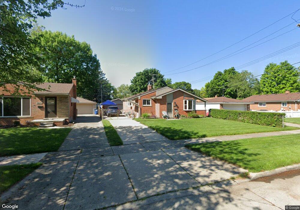
32681 Mackenzie Dr Westland, MI 48185
Estimated Value: $231,652 - $267,000
--
Bed
1
Bath
1,093
Sq Ft
$233/Sq Ft
Est. Value
About This Home
This home is located at 32681 Mackenzie Dr, Westland, MI 48185 and is currently estimated at $254,913, approximately $233 per square foot. 32681 Mackenzie Dr is a home located in Wayne County with nearby schools including Hayes Elementary School, Cooper Upper Elementary School, and Emerson Middle School.
Ownership History
Date
Name
Owned For
Owner Type
Purchase Details
Closed on
Oct 24, 2022
Sold by
Brodie Daniel W and Brodie Melissa A
Bought by
Daniel And Melissa Brodie Living Trust
Current Estimated Value
Purchase Details
Closed on
Jan 10, 2014
Sold by
Liv Brodie Richard C and Liv Richard C Brodie Revocable
Bought by
Brodie Daniel Winson and Brodie Melissa Anne
Home Financials for this Owner
Home Financials are based on the most recent Mortgage that was taken out on this home.
Original Mortgage
$52,000
Interest Rate
4.5%
Mortgage Type
New Conventional
Purchase Details
Closed on
Jul 20, 2011
Sold by
Brodie Richard C
Bought by
Liv Brodie Richard C and Liv Richard C Brodie Revocable
Purchase Details
Closed on
Jul 28, 2010
Sold by
Brodie Daniel W and Richard C Brodie Irrevocable T
Bought by
Brodie Richard C
Purchase Details
Closed on
Jul 28, 2009
Sold by
Brodie Daniel W and Richard C Brodie Irrevocable T
Bought by
Brodie Richard C
Purchase Details
Closed on
Sep 17, 2008
Sold by
Brodie Richard C
Bought by
Brodie Daniel W
Create a Home Valuation Report for This Property
The Home Valuation Report is an in-depth analysis detailing your home's value as well as a comparison with similar homes in the area
Home Values in the Area
Average Home Value in this Area
Purchase History
| Date | Buyer | Sale Price | Title Company |
|---|---|---|---|
| Daniel And Melissa Brodie Living Trust | -- | -- | |
| Brodie Daniel Winson | $65,000 | Title Source Inc | |
| Liv Brodie Richard C | -- | None Available | |
| Brodie Richard C | -- | None Available | |
| Brodie Richard C | -- | None Available | |
| Brodie Daniel W | -- | None Available | |
| Brodie Richard C | -- | None Available |
Source: Public Records
Mortgage History
| Date | Status | Borrower | Loan Amount |
|---|---|---|---|
| Previous Owner | Brodie Daniel Winson | $52,000 |
Source: Public Records
Tax History Compared to Growth
Tax History
| Year | Tax Paid | Tax Assessment Tax Assessment Total Assessment is a certain percentage of the fair market value that is determined by local assessors to be the total taxable value of land and additions on the property. | Land | Improvement |
|---|---|---|---|---|
| 2025 | $2,158 | $113,700 | $0 | $0 |
| 2024 | $2,158 | $105,600 | $0 | $0 |
| 2023 | $2,061 | $95,700 | $0 | $0 |
| 2022 | $2,400 | $83,000 | $0 | $0 |
| 2021 | $2,339 | $79,200 | $0 | $0 |
| 2020 | $2,314 | $75,000 | $0 | $0 |
| 2019 | $2,205 | $72,500 | $0 | $0 |
| 2018 | $1,740 | $61,500 | $0 | $0 |
| 2017 | $796 | $57,300 | $0 | $0 |
| 2016 | $2,100 | $57,700 | $0 | $0 |
| 2015 | $3,868 | $49,180 | $0 | $0 |
| 2013 | $3,747 | $38,290 | $0 | $0 |
| 2012 | $2,525 | $38,390 | $0 | $0 |
Source: Public Records
Map
Nearby Homes
- 32451 Sandra Ln
- 33211 Anita Dr
- 32725 Joy Rd
- 32724 Hees St
- 32047 Anita Dr
- 32327 Washington St
- 33312 Lynx St
- 8332 Berwick Dr
- 8824 Nevada St
- 33030 Cowan Rd
- 9243 Montana St
- 7872 Ritz Ave
- 7946 Moonwood Place
- 7436 Cochise St
- 31640 Ann Arbor Trail
- 8219 Roselawn St
- 32611 Vermont St
- 9212 Idaho St
- 9253 Idaho St
- 9085 Melrose St
- 32671 Mackenzie Dr
- 8342 Rae Dr
- 8328 Rae Dr
- 32663 Mackenzie Dr
- 32674 Merritt Dr
- 32666 Merritt Dr
- 32658 Merritt Dr
- 8314 Rae Dr
- 32655 Mackenzie Dr
- 32682 Mackenzie Dr
- 32650 Merritt Dr
- 8416 Rae Dr
- 32672 Mackenzie Dr
- 32662 Mackenzie Dr
- 32647 Mackenzie Dr
- 32642 Merritt Dr
- 32652 Mackenzie Dr
- 8430 Rae Dr
- 8343 Rae Dr
- 32639 Mackenzie Dr