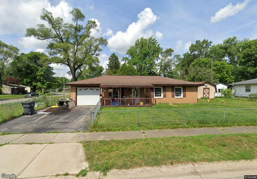
3269 Arnsby Rd Columbus, OH 43232
East Columbus-White Ash NeighborhoodEstimated Value: $184,145 - $218,000
3
Beds
1
Bath
936
Sq Ft
$213/Sq Ft
Est. Value
About This Home
This home is located at 3269 Arnsby Rd, Columbus, OH 43232 and is currently estimated at $199,286, approximately $212 per square foot. 3269 Arnsby Rd is a home located in Franklin County with nearby schools including Groveport Madison High School, A+ Arts Academy, and Eastland Preparatory Academy.
Ownership History
Date
Name
Owned For
Owner Type
Purchase Details
Closed on
Dec 4, 2000
Sold by
Banther James M and Banther Leta M
Bought by
Maynard William and Maynard Ettalee
Current Estimated Value
Purchase Details
Closed on
Jul 17, 1998
Sold by
Banther James M and Banther Leta M
Bought by
Maynard William and Maynard Ettalee
Home Financials for this Owner
Home Financials are based on the most recent Mortgage that was taken out on this home.
Original Mortgage
$39,374
Interest Rate
10%
Mortgage Type
Seller Take Back
Purchase Details
Closed on
Apr 18, 1983
Bought by
Banther James M and Banther Leta M
Create a Home Valuation Report for This Property
The Home Valuation Report is an in-depth analysis detailing your home's value as well as a comparison with similar homes in the area
Home Values in the Area
Average Home Value in this Area
Purchase History
| Date | Buyer | Sale Price | Title Company |
|---|---|---|---|
| Maynard William | $39,400 | -- | |
| Maynard William | $39,374 | -- | |
| Banther James M | -- | -- |
Source: Public Records
Mortgage History
| Date | Status | Borrower | Loan Amount |
|---|---|---|---|
| Closed | Maynard William | $39,374 |
Source: Public Records
Tax History
| Year | Tax Paid | Tax Assessment Tax Assessment Total Assessment is a certain percentage of the fair market value that is determined by local assessors to be the total taxable value of land and additions on the property. | Land | Improvement |
|---|---|---|---|---|
| 2025 | $2,769 | $55,930 | $16,590 | $39,340 |
| 2024 | $2,769 | $55,930 | $16,590 | $39,340 |
| 2023 | $2,751 | $55,930 | $16,590 | $39,340 |
| 2022 | $1,652 | $26,610 | $7,250 | $19,360 |
| 2021 | $1,694 | $26,610 | $7,250 | $19,360 |
| 2020 | $1,698 | $26,610 | $7,250 | $19,360 |
| 2019 | $1,667 | $22,960 | $6,300 | $16,660 |
| 2018 | $1,647 | $22,960 | $6,300 | $16,660 |
| 2017 | $1,653 | $22,960 | $6,300 | $16,660 |
| 2016 | $1,618 | $19,950 | $4,480 | $15,470 |
| 2015 | $1,617 | $19,950 | $4,480 | $15,470 |
| 2014 | $1,480 | $19,950 | $4,480 | $15,470 |
| 2013 | $148 | $26,915 | $4,970 | $21,945 |
Source: Public Records
Map
Nearby Homes
- 5152 Burdett Dr
- 3246 Latonia Rd
- 3333 Latonia Ct
- 3275 Faycrest Rd
- 5323 Sundale Place S
- 5143 Rutledge Dr N
- 5422 Everson Rd N
- 3455 Tremaine Rd
- 4878 Amber Crossing Dr
- 5397 Jack Russell Way
- 5522 Newport Ct
- 2949 Fleet Rd
- 2998 Osgood Rd E
- 5189 Zimmer Dr
- 4942 Talbert Dr
- 5290 Quincy Dr
- 5106 Harbor Blvd
- 5373 Spire Ln
- 3773 Clearwater Dr
- 4980 Harbor Blvd
- 5200 Burdett Dr
- 3261 Arnsby Rd
- 3272 Arnsby Rd
- 5194 Burdett Dr
- 3255 Arnsby Rd
- 3280 Arnsby Rd
- 3264 Arnsby Rd
- 3299 Arnsby Rd
- 3288 Arnsby Rd
- 5203 Burdett Dr
- 3244 Burdett Ct
- 3298 Arnsby Rd
- 3236 Burdett Ct
- 3247 Arnsby Rd
- 3252 Burdett Ct
- 5225 Dunloe Place
- 5195 Burdett Dr
- 5188 Burdett Dr
- 3228 Burdett Ct
- 3275 Dunloe Rd
Your Personal Tour Guide
Ask me questions while you tour the home.