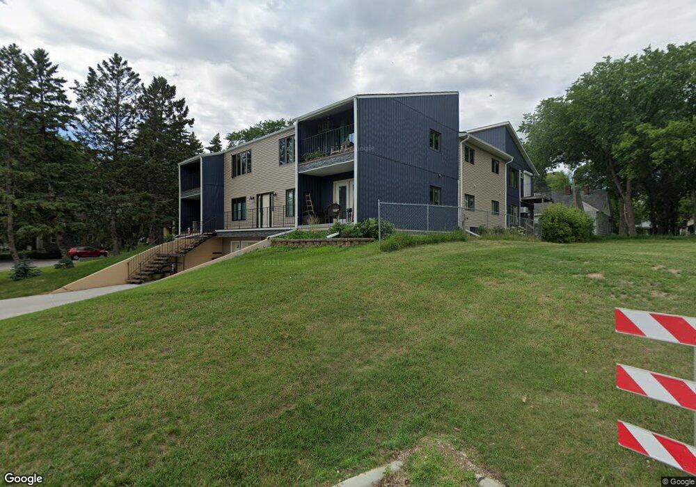
327 10th Ave S Unit 1 Fargo, ND 58103
Hawthorne NeighborhoodEstimated Value: $180,000 - $220,000
2
Beds
2
Baths
1,066
Sq Ft
$187/Sq Ft
Est. Value
About This Home
This home is located at 327 10th Ave S Unit 1, Fargo, ND 58103 and is currently estimated at $198,868, approximately $186 per square foot. 327 10th Ave S Unit 1 is a home located in Cass County with nearby schools including Clara Barton Elementary School, Ben Franklin Middle School, and South High School.
Ownership History
Date
Name
Owned For
Owner Type
Purchase Details
Closed on
Jan 30, 2020
Sold by
Woodard Dianna J
Bought by
Weitzel Jeffrey and Weitzel Sharon
Current Estimated Value
Home Financials for this Owner
Home Financials are based on the most recent Mortgage that was taken out on this home.
Original Mortgage
$99,200
Interest Rate
3.7%
Mortgage Type
Closed End Mortgage
Purchase Details
Closed on
Jul 1, 2014
Sold by
Wadeson Gloria M D
Bought by
Woodard Dianne J
Home Financials for this Owner
Home Financials are based on the most recent Mortgage that was taken out on this home.
Original Mortgage
$87,200
Interest Rate
4.12%
Mortgage Type
New Conventional
Create a Home Valuation Report for This Property
The Home Valuation Report is an in-depth analysis detailing your home's value as well as a comparison with similar homes in the area
Home Values in the Area
Average Home Value in this Area
Purchase History
| Date | Buyer | Sale Price | Title Company |
|---|---|---|---|
| Weitzel Jeffrey | -- | Title Co | |
| Woodard Dianne J | $109,000 | None Available |
Source: Public Records
Mortgage History
| Date | Status | Borrower | Loan Amount |
|---|---|---|---|
| Closed | Weitzel Jeffrey | $99,200 | |
| Previous Owner | Woodard Dianne J | $87,200 |
Source: Public Records
Tax History Compared to Growth
Tax History
| Year | Tax Paid | Tax Assessment Tax Assessment Total Assessment is a certain percentage of the fair market value that is determined by local assessors to be the total taxable value of land and additions on the property. | Land | Improvement |
|---|---|---|---|---|
| 2024 | $145 | $77,850 | $4,650 | $73,200 |
| 2023 | $145 | $67,700 | $4,650 | $63,050 |
| 2022 | $1,304 | $67,700 | $4,650 | $63,050 |
| 2021 | $1,756 | $60,450 | $4,650 | $55,800 |
| 2020 | $1,734 | $60,450 | $4,650 | $55,800 |
| 2019 | $1,344 | $51,050 | $2,700 | $48,350 |
| 2018 | $1,326 | $51,050 | $2,700 | $48,350 |
| 2017 | $1,273 | $49,550 | $2,700 | $46,850 |
| 2016 | $1,133 | $48,100 | $2,700 | $45,400 |
| 2015 | $1,119 | $44,500 | $1,850 | $42,650 |
| 2014 | $1,044 | $40,450 | $1,850 | $38,600 |
| 2013 | $1,044 | $40,450 | $1,850 | $38,600 |
Source: Public Records
Map
Nearby Homes
- 327 10th Ave S Unit 4
- 327 10th Ave S Unit 6
- 327 10th Ave S Unit 5
- 327 10th Ave S Unit 3
- 327 10th Ave S Unit 2
- 327 10th Ave S
- 327 10th Ave S Unit 1
- 327 10th Ave S Unit 2
- 333 10th Ave S
- 321 10th Ave S
- 303 10th Ave S
- 348 9th Ave S
- 354 9th Ave S
- 908 4th St S
- 340 9th Ave S
- 912 4th St S
- 362 9th Ave S
- 334 9th Ave S
- 326 10th Ave S Unit 2
- 326 10th Ave S Unit 8