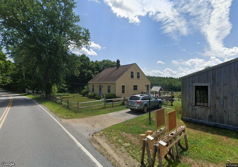
327 1st Crown Point Rd Strafford, NH 03884
Estimated Value: $380,516 - $496,000
3
Beds
1
Bath
1,580
Sq Ft
$282/Sq Ft
Est. Value
About This Home
This home is located at 327 1st Crown Point Rd, Strafford, NH 03884 and is currently estimated at $446,129, approximately $282 per square foot. 327 1st Crown Point Rd is a home located in Strafford County with nearby schools including Strafford School and Coe-Brown Northwood Academy.
Ownership History
Date
Name
Owned For
Owner Type
Purchase Details
Closed on
Jul 11, 2022
Sold by
Miller James R and Miller Emily S
Bought by
Miller Ft
Current Estimated Value
Purchase Details
Closed on
Oct 6, 2014
Sold by
Robert B & S H Dowst Ret
Bought by
Miller Emily S and Miller James R
Create a Home Valuation Report for This Property
The Home Valuation Report is an in-depth analysis detailing your home's value as well as a comparison with similar homes in the area
Home Values in the Area
Average Home Value in this Area
Purchase History
| Date | Buyer | Sale Price | Title Company |
|---|---|---|---|
| Miller Ft | -- | None Available | |
| Miller Ft | -- | None Available | |
| Miller Emily S | $203,000 | -- | |
| Miller Emily S | $203,000 | -- |
Source: Public Records
Mortgage History
| Date | Status | Borrower | Loan Amount |
|---|---|---|---|
| Closed | Miller Emily S | $0 |
Source: Public Records
Tax History Compared to Growth
Tax History
| Year | Tax Paid | Tax Assessment Tax Assessment Total Assessment is a certain percentage of the fair market value that is determined by local assessors to be the total taxable value of land and additions on the property. | Land | Improvement |
|---|---|---|---|---|
| 2024 | $4,622 | $233,900 | $67,700 | $166,200 |
| 2023 | $4,360 | $233,900 | $67,700 | $166,200 |
| 2022 | $4,007 | $233,900 | $67,700 | $166,200 |
| 2021 | $4,347 | $235,500 | $67,700 | $167,800 |
| 2020 | $4,425 | $172,500 | $64,800 | $107,700 |
| 2019 | $4,049 | $172,500 | $64,800 | $107,700 |
| 2018 | $4,076 | $172,500 | $64,800 | $107,700 |
| 2016 | $3,666 | $172,500 | $64,800 | $107,700 |
| 2015 | $3,675 | $168,500 | $79,200 | $89,300 |
| 2014 | $3,902 | $168,500 | $79,200 | $89,300 |
| 2013 | $3,822 | $168,500 | $79,200 | $89,300 |
| 2012 | $3,771 | $168,500 | $79,200 | $89,300 |
Source: Public Records
Map
Nearby Homes
- 948 Strafford Rd
- 345 Dry Hill Rd
- 38 Strafford Rd
- 243 Second Crown Point Rd
- 86 Long Shores Dr
- 00 Squire Rd
- 83 Sloper Rd
- 68 Berry River Rd
- 0 Long Shores Dr Unit 5057687
- 0 Sloper Rd Unit 6
- 30 Avalon Rd
- Map 220 Lot 16 Four Rod Rd
- 272 Walnut St
- 217-13 Washington St
- 212-0003-01 Washington St
- 207-002 Washington St
- 40 Dry Hill Rd Unit Lot 0250/0006/0000
- 185 Mahala Way
- 10 Blue Hills Dr
- 1226 First Crown Point Rd
- 327 1st Crown Point Rd
- 320 1st Crown Point Rd
- 340 1st Crown Point Rd
- 352 1st Crown Point Rd
- 296 1st Crown Point Rd
- 1041 1st Crown Point Rd
- 286 1st Crown Point Rd
- 391 1st Crown Point Rd
- 392 1st Crown Point Rd
- 403 1st Crown Point Rd
- 3 Crown Point Rd
- 249 1st Crown Point Rd
- 243 1st Crown Point Rd
- 6 Crown Point Rd
- 413 1st Crown Point Rd
- 6 Crown Point Rd
- 692 2nd Crown Point Rd
- 25 Crown Point Rd
- 227 1st Crown Point Rd
- 24 Crown Point Rd