Estimated Value: $192,034 - $214,000
3
Beds
1
Bath
1,232
Sq Ft
$165/Sq Ft
Est. Value
About This Home
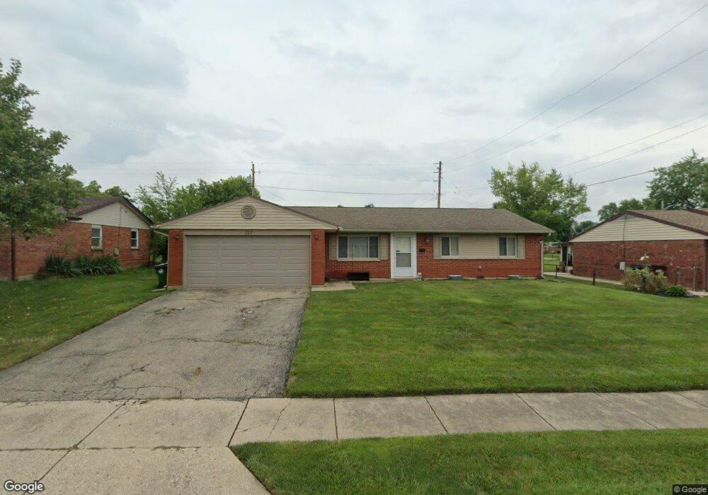
This home is located at 327 Oregon Dr, Xenia, OH 45385 and is currently estimated at $203,759, approximately $165 per square foot. 327 Oregon Dr is a home located in Greene County with nearby schools including Xenia High School and Summit Academy Community School for Alternative Learners - Xenia.
Ownership History
Date
Name
Owned For
Owner Type
Purchase Details
Closed on
Mar 28, 2007
Sold by
Slone David and Slone Myra
Bought by
Herbert Guy M and Herbert Tasha P
Current Estimated Value
Home Financials for this Owner
Home Financials are based on the most recent Mortgage that was taken out on this home.
Original Mortgage
$110,229
Outstanding Balance
$67,013
Interest Rate
6.25%
Mortgage Type
FHA
Estimated Equity
$136,746
Purchase Details
Closed on
Oct 20, 2006
Sold by
Fannie Mae
Bought by
Slone David
Purchase Details
Closed on
May 4, 2006
Sold by
Titus Keith A and Titus Susan A
Bought by
Fanniemae and Federal National Mortgage Association
Create a Home Valuation Report for This Property
The Home Valuation Report is an in-depth analysis detailing your home's value as well as a comparison with similar homes in the area
Home Values in the Area
Average Home Value in this Area
Purchase History
| Date | Buyer | Sale Price | Title Company |
|---|---|---|---|
| Herbert Guy M | $112,000 | Attorney | |
| Slone David | $75,000 | Title First Agency Inc | |
| Fanniemae | $80,000 | None Available |
Source: Public Records
Mortgage History
| Date | Status | Borrower | Loan Amount |
|---|---|---|---|
| Open | Herbert Guy M | $110,229 |
Source: Public Records
Tax History Compared to Growth
Tax History
| Year | Tax Paid | Tax Assessment Tax Assessment Total Assessment is a certain percentage of the fair market value that is determined by local assessors to be the total taxable value of land and additions on the property. | Land | Improvement |
|---|---|---|---|---|
| 2024 | $2,128 | $49,730 | $11,590 | $38,140 |
| 2023 | $2,128 | $49,730 | $11,590 | $38,140 |
| 2022 | $1,768 | $35,250 | $6,820 | $28,430 |
| 2021 | $1,792 | $35,250 | $6,820 | $28,430 |
| 2020 | $1,717 | $35,250 | $6,820 | $28,430 |
| 2019 | $1,499 | $28,970 | $6,580 | $22,390 |
| 2018 | $1,505 | $28,970 | $6,580 | $22,390 |
| 2017 | $1,462 | $28,970 | $6,580 | $22,390 |
| 2016 | $1,372 | $25,910 | $6,580 | $19,330 |
| 2015 | $1,375 | $25,910 | $6,580 | $19,330 |
| 2014 | $1,317 | $25,910 | $6,580 | $19,330 |
Source: Public Records
Map
Nearby Homes
- 2758 Wyoming Dr
- 219 Kansas Dr
- 414 Whisper Ln
- 161 Montana Dr
- 2142 Michigan Dr
- 2545 Harmony Dr
- 1653 Seneca Dr
- 1769 Gayhart Dr
- 1618 Navajo Dr
- 2257 Maryland Dr
- 1568 Cheyenne Dr
- 1829 Gayhart Dr
- 1778 Arapaho Dr
- 1908 Whitt St
- 1107 Arkansas Dr
- 1255 Colorado Dr
- 1866 Roxbury Dr
- 2345 Tennessee Dr
- 121 S Progress Dr
- 1144 Rockwell Dr