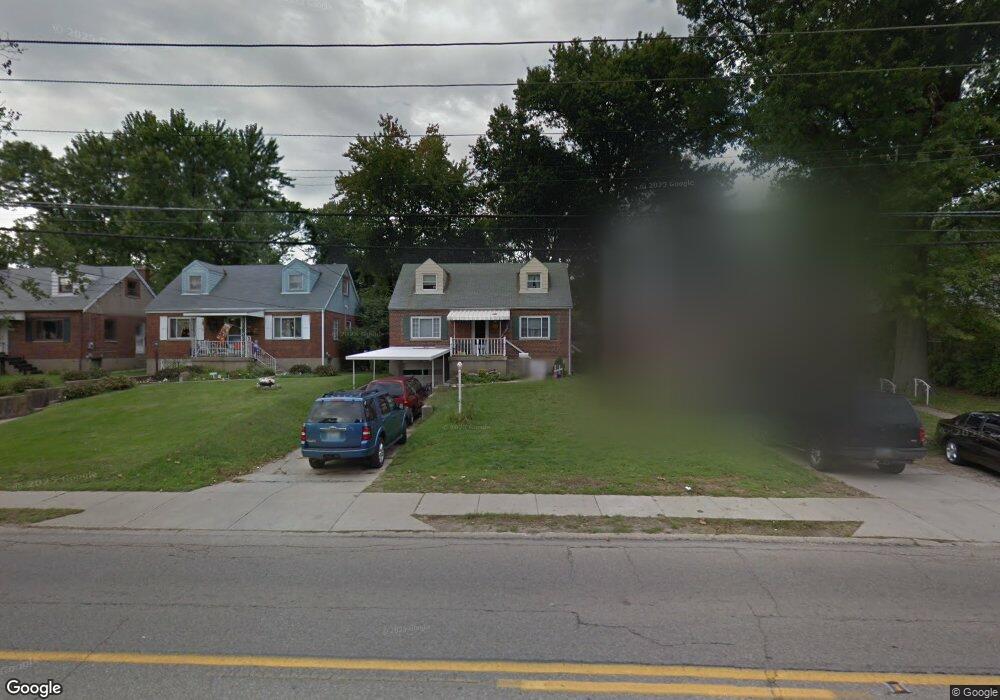
3272 W Galbraith Rd Cincinnati, OH 45239
Estimated Value: $179,000 - $204,377
4
Beds
1
Bath
1,258
Sq Ft
$154/Sq Ft
Est. Value
About This Home
This home is located at 3272 W Galbraith Rd, Cincinnati, OH 45239 and is currently estimated at $193,844, approximately $154 per square foot. 3272 W Galbraith Rd is a home located in Hamilton County with nearby schools including White Oak Middle School, Colerain High School, and Cincinnati Achievement Academy.
Ownership History
Date
Name
Owned For
Owner Type
Purchase Details
Closed on
Jan 30, 2001
Sold by
Frazier Sherri and Frazier Sherri L
Bought by
Mapes James C and Mapes Candace E
Current Estimated Value
Home Financials for this Owner
Home Financials are based on the most recent Mortgage that was taken out on this home.
Original Mortgage
$90,450
Outstanding Balance
$31,333
Interest Rate
7.22%
Mortgage Type
FHA
Estimated Equity
$162,511
Purchase Details
Closed on
Nov 13, 1998
Sold by
Miller John J and Miller Carol A
Bought by
Frazier Sherri L
Purchase Details
Closed on
Sep 16, 1997
Sold by
Brausch Steven J and Brausch Jill M
Bought by
Miller John J and Miller Carol A
Home Financials for this Owner
Home Financials are based on the most recent Mortgage that was taken out on this home.
Original Mortgage
$63,900
Interest Rate
7.55%
Create a Home Valuation Report for This Property
The Home Valuation Report is an in-depth analysis detailing your home's value as well as a comparison with similar homes in the area
Home Values in the Area
Average Home Value in this Area
Purchase History
| Date | Buyer | Sale Price | Title Company |
|---|---|---|---|
| Mapes James C | $91,900 | -- | |
| Frazier Sherri L | $87,000 | -- | |
| Miller John J | $79,900 | -- |
Source: Public Records
Mortgage History
| Date | Status | Borrower | Loan Amount |
|---|---|---|---|
| Open | Mapes James C | $90,450 | |
| Previous Owner | Miller John J | $63,900 |
Source: Public Records
Tax History
| Year | Tax Paid | Tax Assessment Tax Assessment Total Assessment is a certain percentage of the fair market value that is determined by local assessors to be the total taxable value of land and additions on the property. | Land | Improvement |
|---|---|---|---|---|
| 2025 | $2,733 | $47,453 | $10,612 | $36,841 |
| 2024 | $2,534 | $47,453 | $10,612 | $36,841 |
| 2023 | $2,549 | $47,453 | $10,612 | $36,841 |
| 2022 | $2,285 | $34,685 | $10,486 | $24,199 |
| 2021 | $2,265 | $34,685 | $10,486 | $24,199 |
| 2020 | $2,289 | $34,685 | $10,486 | $24,199 |
| 2019 | $1,979 | $27,972 | $8,456 | $19,516 |
| 2018 | $1,775 | $27,972 | $8,456 | $19,516 |
| 2017 | $1,682 | $27,972 | $8,456 | $19,516 |
| 2016 | $1,838 | $30,199 | $8,957 | $21,242 |
| 2015 | $1,856 | $30,199 | $8,957 | $21,242 |
| 2014 | $1,859 | $30,199 | $8,957 | $21,242 |
| 2013 | $1,770 | $30,199 | $8,957 | $21,242 |
Source: Public Records
Map
Nearby Homes
- 3269 Warfield Ave
- 3336 Nandale Dr
- 3408 Rocker Dr
- 3397 Nandale Dr
- 3329 Alexis Rd
- 2953 Commodore Ln
- 2807 W Galbraith Rd
- 8278 Lyness Dr
- 2750 W Galbraith Rd
- 3140 Banning Rd
- 3069 Sovereign Dr
- 8261 Cheviot Rd
- 3510 Banning Rd
- 2896 Regal Ln
- 2701 Hennge Dr
- 3691 W Galbraith Rd
- 3693 W Galbraith Rd
- 3633 Twinview Dr
- 6893 Newbridge Dr
- 3701 W Galbraith Rd
- 3268 W Galbraith Rd
- 3276 W Galbraith Rd
- 3264 W Galbraith Rd
- 3280 W Galbraith Rd
- 3273 Warfield Ave
- 3277 Warfield Ave
- 3260 W Galbraith Rd
- 3284 W Galbraith Rd
- 3281 Warfield Ave
- 3261 Warfield Ave
- 3256 W Galbraith Rd
- 3285 Warfield Ave
- 3308 W Galbraith Rd
- 3257 Warfield Ave
- 3252 W Galbraith Rd
- 3269 W Galbraith Rd
- 3285 W Galbraith Rd
- 156 Sandy Ridge
- 3253 Warfield Ave
- 3291 W Galbraith Rd
Your Personal Tour Guide
Ask me questions while you tour the home.